Sunday, February 25, 2018

Crater Lake Ski Circumnavigation 02.21-23-18

Finally posting again.

Almost every year Jennifer and Mirabelle head to Florida in February. And every year I try to plan something while they are gone. So far, I have been shut out by bad snow, warm temps and you name it. This year I bought new skis for the purpose of not being shut out. This year I came up with a destination that would have a higher probability for snow and reliable weather. This year I finally got out and did something bigger while they were away.

I often had long tour plans for this time period. But many involve dangerous terrain that would require someone joining me. Then this past year we went to Crater Lake where they had early snow. That is when I added another destination to my plans. I researched it a bit and most of the avalanche terrain could be avoided and this meant I could go solo.

So I called the ranger station just to make sure they don't have any requirements I was not meeting to get a back country permit. I checked all their boxes and headed down the following day hoping to get a permit so I could start early the day after my travel. As always, it is not easy driving the I5 corridor in the northwest. This time it was due to snow from Seattle to Salem. The Tumwater area was littered with wrecks and emergency vehicles. It was slow going. I called the ranger station from Chemult to let them know I wouldn't make it in by 4pm and that I would be there at 8am the following day to get a permit and start my trip. Then I set about finding a place to sleep for the night. Mostly because I am cheap, and perhaps partially because I like to suffer that place was my car in a snow park just outside the west side of the park.

I started Wednesday morning repacking for my trip and then driving into the park. I got the ranger station a bit before eight and then caught the ranger just before he was heading out to the weather station. I read their instruction book, and signed for my back country permit. I was pointed to the overnight parking and I was on my way. At the parking there was a couple who were also planning on the circumnavigation. I thought this would be good in case either of us ran into issues. But shortly starting up the Raven Trail to the lake, they appeared to back out and left me to break trail for 50km around the lake.

I got up to the lake and there was some spotty sun. The lake was visible and it was fun to see the lodge all wintered up. I took some photos and got moving as I had a later start than I had hoped. I west rim road and started to follow it. I hadn't see the others, or anybody for that matter since I left the Raven Trail. At first the going was easy. Trail had been broken in one of the previous days, but it had been snowing alot, so it was not that easy. The road is marked by sticks that the park service puts in for spring plowing, so it is not too difficult to follow as well.

As time went on I was slowed. I blamed my lack of acclimatization. But it could have been lack of conditioning, or sleeping in the car. There were endless snow drifts. I fell off one and was concerned that I would not dry out for the rest of the trip. Then the weather got less clear. And I slowed more. I feel like there was one part I just kept skiing over and over because everything looked the same. The sky matched the earth and even had trees. At one point I got a little off course when I could no longer follow the road. Fortunately by the time I back tracked to the last known place, it cleared enough that I could track where the road continued.

Seven hours after I had left the ranger station, I had finally reached the north junction. It was short of where I wanted to stop for the night. But it was snowing, and the wind was blowing hard. I headed a little further up into the trees where I would have some shelter from the wind.

I found a spot off the road that would work for my intended sleep system. Being a solo traveler, I had a lot to carry. (Especially because I opted for a bear canister.) A tent was not a very viable option for me. I opted for a snow trench. Since I figured there would be lots of fresh snow, I brought a tarp in case there was no solid snow to build a roof. This was good, as I would have had to dig deep to quarry good blocks for a roof. The tarp works well, but has the drawbacks of not being as insulating as a snow roof and allowing the condensed ice crystals to fall on you instead of attaching more firmly to a snow roof. I quickly dug a trench and set up shelter before setting about eating. It was difficult to keep everything dry as the snow just kept falling. On a positive note, it was quite cold, so the snow was also quite dry. After eating I got into my trench and realized it was not long enough. But I wanted to make it work. Eventually, I gave in, and gear back up and took the tarp off and improved it a bit, making it significantly better. I got back in and slept well until a little after six the next morning.

Thursday started like Wednesday left off with snow and clouds. I got underway and seemed to make good time for a bit. The day went between sun and snow. And sometimes I had both. Lake views were mostly non-existent until later in the day. Wind was also not as bad for most of the day as I rounded to the lee of the mountain. This meant there was much less snow drift navigation to deal with. However there were certain points where the road met the rim and the wind had actually scoured the snow down to asphalt. The day went as planned except for me losing steam for the final climb. I did not make it as far as I had wanted. But I also wanted to have a little more time to do a better snow shelter. I picked a spot that I thought would hide me from the wind and then it started to snow heavily. My trench came out a bit better, and a bit worse. Because I was attempting to use trees to shield it from the wind. I was too close to the trees and the trench was a bit short with a somewhat difficult entrance. I did not sleep as well as the previous night. I also think the shortness of the trench did not allow my legs and feet to recover as well.

I awoke early the next morning and decided to get started. Because of not covering the distances I wanted to the previous two days I had the longest mileage day ahead of me. Getting to see the sunrise would be a bonus too. Although the night had turned clear and the temperature was cold. I went about the business of eating breakfast, filling my trench and melting snow for the day and then got underway around 6am.

Navigation was easy and after a short uphill to regain the road and cross a meadow, I was headed downhill toward the crater rim. I got to the lake in what seemed like no time and got to see the sun hit the far rim as I cruised past three overlooks on the road. The road continued to descend and I made good time. When the sun was finally fully above the horizon, I took over my heavy jacket and forged on.

As I descended to Kerr Notch I was assessing the avalanche situation from Dutton Cliffs. It was clear to me that taking the bypass would add a significant amount of climbing. And that taking the road under the cliffs was also quite a climb. What a change from the nearly 5+km of descending. It was only 8 am when I arrived at Kerr Notch. I poked around following some tracks I believed to be from a bobcat that appeared fresh enough to be from the last eight hours. I had already decided to try to go under the cliffs as I could see some had already sloughed when the sun hit and did not even reach the road surface. Mostly the danger was isolated to a few chutes that I could quickly cross. I headed up the hill under full power crossing chutes and taking breathers in safer locations. By the time I had crossed under the cliffs, I was tired and still had a good deal of continuous uphill travel ahead of me. My progress slowed and I baked in the sun in the exposed meadows of the next portion of road.

I finally rounded to the corner to what was supposed to be the next downhill. However, it was full of snow drifts. So the low effort downhill I anticipated was a little more effort. Although not as much as the previous portion of road. As I made the descent, I viewed the next avalanche zone of Applegate Peak. This was one I was going to avoid. There was a wide steep face loaded with snow that was being blasted by the noon day sun. And since it was noon, I took my only side trip to Sun Notch which would be my last view of the lake on this trip.

I skied back to the road, but did not see where the avalanche bypass was. The ranger stated they were clearly marked, but did I miss it? I started up the road to see if it was further on. It wasn't but I decided I could find it by skiing down into the valley from the road just before the avalanche danger.
This was the most effortless portion of the trip. I got a little less than 100m of descent in a traverse into the valley. The map show the bypass trail loosely following a creek so I found the depression that would be the creek and followed it through the valley. This trajectory would also have me bypass the next avalanche area, Vidae Cliffs.

This was also one of the truly fun parts of the trip. I was not on the road. I was navigating for myself in the forest and a few meadows. Then I reached Grayback road. This is part of the bypass, and can be used to bypass the Dutton Cliffs earlier on if so needed. I climbed up Grayback Road and was back on the rim road quickly. However I was pretty sure I still had to get through the Vidae Cliffs area. This turned out to be true. But the Vidae Cliffs were much more of a steep wall on the side of the road that were not particularly snow loaded. They even had plenty of ditch space to empty into if they did slide. I passed through this section on the final real ascent of the trip.

It was about this time that there was actually fresher ski tracks in the snow. Near the end of the climbing my ski was starting to collect snow and not glide so well. The heat of the bright sun and the clouds starting to come in had turned the snow a little stickier. I made a final stop to was the scales on my skis. This also involved knocking ice off the edges that were icing up. I wasn't sure if the waxing was going to help, or these were just the conditions I would be in for the final descent to the visitor's center and my awaiting car. It turned out that stopping paid off. My skis glided better and I also made use of even fresher ski tracks to make the descent a little easier. There is a bit of climb back out at the end that is pretty mellow, but after a 20km plus day it is not how you really want to end.

Ending with a climb would be easy enough, but at the end of the trip I then had to dig out my car from the previous two days snow before I could get moving. Fortunately I was still pretty stoked to be done and the shoveling went quickly.

Overall I am happy I did this trip. It was interesting and it was great experience keeping myself alive for a few days in the winter. I went over 50 hours without seeing another person. At times it felt I had the park all to myself. The disappointing aspects are that it did not increase my wildlife sightings, and I made no turns. I saw exactly two Ravens and one other bird the whole time. I did hear a few other birds, and perhaps a squirrel at one point. I saw no mammals at all and saw very few tracks that alerted me to their presence. There were plenty of skiable slopes. But without a partner they were too dangerous. Although I had a day or two extra to make the trip, side trips to ski glades seemed too time and energy consuming.

If I was to head to Crater Lake again in the winter I'd probably do it with someone. Then set up camp where we could have access to ski slopes. It was a mild form of torture to have all this boot top powder, and not be able to make turns in it.

Pics are here.

Monday, June 19, 2017

June 5 2017 Unicorn Peak

I talked Matt into joining me for a ski of Unicorn Peak. Being a Monday morning we felt pretty good about having a good time on the peak and getting back to Seattle by dinner. 

We left fairly uneventfully. (Although a turnaround for forgotten skins in Seattle did delay us.) We pulled into the park around 7:30am and were at the parking lot around 8am. There were at least a half dozen cars with Oregon plates in the lot which I told Matt meant the Mazamas were climbing the peak. Hopefully they would be done, or we'd pass them before the summit block. 

Going through the flats at bench like was uneventful and pleasant. Except for Matt who had to stop a few times because his boots are not right for him. Climbing over the ridge to get into Snow Lake basin had some minor difficulties and found us taking our skis off to boot some steeper, more narrow sections. Then we were skinning again heading to the gully at the far end of the basin. We stopped one more time and discussed crampons for the gully, had a snack and Matt once again adjusted boots. 

From there we booted up the gully. We both started with trekking poles and no crampons. The peak appears to have been climbed during the weekend and there was a sitting glissade trench in the middle of the gully as well as numerous foot steps. I picked a set that I felt were nice to follow but led me into the shaded eastern half of the gully where the snow was more firm. Then the steps stopped. I did not feel comfortable traversing back over the icy glissade path to the sunny side, so stopped and got out my ax and crampons. This change allowed me to make quick work of the rest of the gully. Matt had continued on the sunny side of the gully and felt that swapping into crampons was more dangerous than continuing without. When we topped out we put skis back on and continued to skin up the cirque toward the saddle. A party of two women overtook us on the final steeper pitch to the saddle where we took our final uphill break. 

We left skis at the saddle and booted up the final ridge to the summit. I counted no less than 14 Mazamas mulling about on and below the summit. The party of two was starting their ascent on one of the farther right routes up the summit block. There was a kerfuffle between the party of two and the Mazamas after a Mazama attempted to rappel down onto their lead climber. We took our time to get ready and took a combination of the far right route and the next to far right route to get to the top as the Mazamas were rapping the two left routes. 

By the time we were on the summit the party of two was rapping and we had it all to ourselves. We hung out in the wind, and snapped a few pics before rapping down off the snag. I had a minor incident in the rap where I opted not the go over the roof near the top and it put me in a pendulum situation down low that left me a little scratched up. I instructed Matt not to do what I had done and then we were back in ski boot hiking down to our skis.

Back at our skis we noticed that the Mazama leader aiding one of his scared followers down the steeper pitch from the saddle. We made sure to ski around them, and then I went far skier's left into the bowl for my turns while Matt took a more fall line approach with his run. At the bottom the the bowl we eyed the top of the chute which now had an even deeper glissade trench in it. Matt said he was going to try skier's right of the trench and side slip down. I opted for the right side due to a left side constriction but made turns before crossing at a shallow spot and just above where the skier's left of the chute opened up. The chute didn't ski as great as the cirque due to the amount of boot holes in it, but it wasn't as bad as I thought it might be. Below the chute the snow got heavier and stickier and I attempted to make a high traverse back to the ridge. Eventually we both booted back over the ridge and were now skinning back across the bench to the car. In order to avoid any more uphill, we headed to the road a bit east of where the summer trail would take us and got in a few more turns before reaching the road and walking 100m back to the parking lot. 

This was a pretty successful trip and while we could have been faster, we had fun and did not get involved in the conflict that comes with bringing more than a dozen people on a peak. Turns in the cirque were pretty close to perfect and had we been faster, I would have lapped it one more time at least. Unicorn is also a good place to take in the view of the Tatoosh traverse to plan for later this year.

Pics are here.

Sunday, May 21, 2017

May 21 2017 Paradise Skiing

Mirabelle has really improved alpine skiing this year. Probably from the more than 10 visits to the slopes she got. (The season pass really helped.) But also because she is a bit older, and maybe just more willing now.

A few years ago we took her to Paradise to ski. It was a low snow year, and really the only place that had snow. Jennifer and I did laps on a hill where they normally have the sled run, while Mirabelle played in the snow. Then we all skied back to the parking lot.

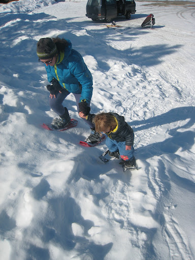
This time we went up in late May with Mirabelle on snow shoes and Jennifer and I skinning. The weather was warm and sunny. Mirabelle complained about snow in her boots and of being tired. I towed her up the last bit to Glacier Vista. Then we turned them downhill.

There were a few parts where Mirabelle was a little concerned about the slope angle. It was late in the day, and the snow was slow and sloppy. But she persevered and I even heard her "woo hoo" once or twice. It might have been mostly type two fun for her anyway, because she remembers the whole fondly.


Monday, November 9, 2015

Utah National Parks Part II

Capitol Reef to Bryce

After narrowly missing getting a campsite in Moab, we opted to take the short way to Capitol Reef. We felt fairly confident that heading to possibly the least visited Utah park on the Thursday afternoon would get us one of the first come first serve campsites in the park. Little did we know that we were traveling on a Thursday that most school districts in the state had off for a four day weekend.

As we approached the park you could see what a geologic wonder it is. Capitol Reef is based around the Waterpocket Fold, a 100 mile long monocline, largest in the US. What looks like a mountain range coming from the east is really the Fold. Contrary to what we experienced in the Moab area, as we drove west on highway 24 was more lush terrain. This is because the highway actually follows the Fremont River into the fold/park. There were green cottonwoods all around and a very different feel than the other parks we had already visited. When we got to the western end of the park, we saw the dreaded "campground full" sign at the visitor's center. I had to press on, in case it was wrong. We talked a bit to one of the campground hosts who informed us of the Utah holiday. She also told us there would be about 11 spots opening the following morning and I could come back at 7:30am to try and get one. And possibly the most important thing she told us was where to find camping as she knew the commercial campgrounds in town were full.

So we made a brief stop in the visitor's center and then headed out to dispersed camping on national forest land just west of the park. This was very primitive camping with no toilets or running water. It was also free, so that was nice. The ground was rough and we had to be careful driving in our sedan. We finally located a patch where we were willing to throw down our tent. But because there was no water, I had to leave Jennifer and Mirabelle at camp while I drove back into the park to secure water for our night's dinner. I came back to discover Mirabelle playing with a large group of kids that were camping nearby. We let her play until dinner and then she sat at their campfire until well after her bed time. The goal was that I would wake up early (which I had been doing) and head into the park to wait for a camp site.

The next morning I woke up and headed right into the park, arriving at the campground just before 7am. I was fourth in line. Around 7:30 the ranger pulled up and the three vehicles ahead of me dispersed. I was now talking to the camp host and he was asking if I wanted sun or shade. I thought beggars couldn't be choosers? So I opted for shade and paid for two nights of camping. I then headed to the Gifford House to wait for cinnamon rolls to bring back for breakfast. I watched turkeys and deer waiting for it to open at eight. Then I rolled in and had to wait fifteen minutes for the baked goods to arrive before I could buy a few cinnamon rolls and a pie and go pick up my family.

After picking up Jennifer and Mirabelle we went back and claimed our campsite and set up our tent. Then we walked over to the Ripple Rock Nature Center for the Snakes Alive show. Mirabelle was pretty excited about it and pushed her way up front. She even got to hold a rosy boa! After the show, we went back to camp and drove out to our hike of the Grand Wash. This was a hike we needed to do this day as flash flood warnings were in effect for the following two days. It can be done as a 2.5 mile point to point, or a 5 mile round trip. The hike started off good, but grew increasing long. Mirabelle usually looses steam in the afternoon and at some point after the narrows, we stopped for lunch. It was looking toward the end we wouldn't even make the other trailhead and Jennifer and I discussed how we would accomplish this hike. That is when the reality of the math struck us. If I hiked back to the car, they would still wait an hour in the parking lot for me. So we figured we would see if someone would shuttle one of us back to the car. When we finished the hike we found a local family who was willing to transport all three of us back in their vehicle and they even had a car seat! This act of kindness really made the hike possible for us. After dinner we stayed up for the evening ranger program at the amphitheater before retiring for the night.

The next day we hiked to Hickman Natural Bridge. This was a fairly short hike that rose out of the parking area and eventually through the wash to the bridge. It was gray and misty, so we weren't too concerned about the short section of wash, but we were prepared to move if it seemed like the rain would pick up. The bridge was fun as you got to walk under it and hike a short loop before returning to the main trail and back to the car.

We then drove to the short hike to view petroglyphs. There were some nice examples, although we could not get as close to them as the one we views back in Moab. It was starting to rain a little harder at this point, so we took the park's scenic drive. This was a good thing to do in the wet, and to give Mirabelle some sitting time after two hikes. However, the road crossed several washes and even was a wash for a short distance before the pavement ends. I was a little spooked by this, so we didn't get out at any of the viewpoints or stay too long on the road. We had reservations at a restaurant in town, so we just headed that way, stopping at a few view points in the park on the way out. One of which was the Goosenecks Overlook which overlooks Sulphur Creek winding through a canyon. It was quite unexpected as some of these deep canyons are not noticeable until you are standing on the rim.

We continued into Torrey to the Cafe Diablo. We probably didn't need reservations for the 5:30pm time we had made, but when we were leaving they had to open the outdoor seating to accommodate people who were arriving without reservations. It was nice to eat inside on the first rainy evening of our trip. While the empanadas appetizer was great, and I enjoyed the pomegranate chipotle ribs, Jennifer wasn't bowled over with her pecan chicken and we felt the restaurant was maybe a bit overhyped. The great thing is that instead of the typical placemat and crayons that restaurants give kids, they let Mirabelle borrow an Etch-a-Sketch. Which made us vow to purchase one for the longer road trip segments as soon as we got back to civilization.

Because of our early meal time we were once again able to attend the Ranger talk at the Amphitheater before turning in for the night.

I awoke early in the damp morning and was planning our travel day in the car when I decided I had enough time for a bit of a hike. So I grabbed the camera and headed up the Cohab Canyon trail which leaves across the street from the campground. The hike up was short and steep and in no time I was at the head of the canyon. I hiked in a bit poking around, but wanted to get back for when Jennifer and Mirabelle woke up so I wouldn't delay our travel day. When I got back to the mouth of the canyon, the sun was shining a bit, and there was a rainbow beyond the campground. After snapping some pics I headed down and we once again had pie at the Gifford House for breakfast. We packed up the tent, and then Mirabelle played with some other kids for an hour or so before we finally got on our way.

We got underway and headed out to Scenic Highway 12. Our goal was somewhere in the Grand Staircase Escalante area but it would be determined by weather. It was raining lightly for the most part and when we climbed through Dixie National Forest, it was really foggy and going was a bit slow. We stopped for lunch at Hell's Backbone Grill, easily the best food we had on the trip. Jennifer had some pumpkin pinon enchiladas and I had posole. The meal was so good we fantasized about returning this way on the way home to eat there again. Then we continued on to the monument.

There was some wild terrain, and some creative highway engineering that went into the scenic highway. At one point the road occupies the top of a ridgecrest called the Hogsback. We drove through the monument before actually reaching the town of Escalante, where we stopped in the monument visitor's center. After talking with the ranger, it was determined that we couldn't do anything in the monument because of the rain. All roads in the monument are unpaved and become streams or sandpits. So we hung out at the visitor's center and checked out the displays which included a dinosaur skull and microscopes for looking at cryptobiotic soil crusts. We decided to continue on to Bryce, which had a similar weather forecast. But being farther west, we hoped it would get out of the rain sooner.

When we arrived at Bryce we checked on the camping situation. There were sites available. I guess not a whole lot of people like to camp when it is raining and in the forties. We contemplated getting a hotel room and drove into town to check prices at Ruby's. (We checked for a room, a cabin and a tee pee.) Then we decided all of that was too much to spend and we should set up the tent. We drove back into the park during a break in the rain and hoped to get our wet tent set up before it started raining again. But by the time we picked out a site it was raining. We made the decision there it was time to get a room, dry off our tent and get some showers. We drove back to the hotel in sheets of rain, streams running down the street and lightning lighting up the sky. We picked the right time to have our hotel night after a run of twelve nights camping.

We immediately took the tent out to dry and then made a choice for food. We opted not to go to the restaurant located inside Ruby's and head down the road a short distance to Cowboy Ranch House. It wasn't worth the trip out in the rain, but it wasn't horrible. Then we went back to the hotel and Jennifer and Mirabelle went swimming in the pool before bed. In the morning it was still raining and we got some laundry done while we ate breakfast at the Cowboy's Buffet and Steak Room located within the hotel. I had a surprisingly delicious breakfast burrito, and I would say the food was a touch better than down the street. After the laundry was done we checked out and headed into the park.

Reminder: Pics are here

Saturday, November 7, 2015

Utah National Parks 10.06-27.15 Part I

Seattle to Moab

We took some time off to visit the Utah National Parks; Arches, Bryce, Canyonlands, Capitol Reef and Zion. We had rough plans to spend a certain amount of time in each park with select itineraries for each. The plan was to head from north to south and return from the southern end of the state.

As road trips with a preschooler go, we left late on the sixth. Our intended destination was somewhere in Idaho, hopefully as far as Boise. During longer summer days, and pre-kid we could have easily made Salt Lake by the end of the day. The drive out was uneventful and we even got to stop at a taco truck we had wanted to try in Yakima. We were benighted before Idaho but pressed on to Martin Landing a nice (and free) campground at the confluence of the Boise and Snake rivers. We slept and headed out the next morning hoping to make it to Moab. Along the way we stopped at the Buffalo Cafe in Twin Falls for lunch (of breakfast items.) We continued on and stopped for dinner at the Red Rock Brew Pub in Downtown Salt Lake City. After our nice al fresco dining experience, we were benighted again on our way to a camp site at Lake Utah State Park. The $30 a night camping was the highest we paid the whole trip, and was as least offset by the previous night's free camping. On the way out of town, we stopped for kolaches at Hruska's in Provo. Although we had to make an extra stop for coffee as they don't serve coffee until the first snow.

We took a nice scenic ride down to Moab and were poised to arrive in the mid afternoon. We opted to skip some hikes we planned earlier in the day to make sure we could secure a campsite. This proved fruitful as when we entered the visitor's center in Moab, we were told there was little camping left but we found a great site on BLM land up Sand Flats Road, just walking distance from the Slickrock trail head. We set up camp for what would be the next seven days. Since we had a free but short afternoon, we went into town so I could secure a rental bike at Poison Spider. Lucky to be an XL frame size, I was able to get a Kona Process 134 for my next days adventure. We went back to camp and had dinner and explored the slickrock around our camp before retiring for the evening.

The next morning was a little lazy and we got down to the bike shop before 10am to pick up my ride. I had to wait a bit before I could catch a lift to the trail head and start my ride. The woman who drove the shuttle said her favorite trail was porcupine and I considered telling her to drive me there, but I stuck with the original plan. The funny thing about the slickrock trail. The practice loop is not easier than the full loop, only less committing. I knew that, but really struggled with the practice loop. Mostly on the climbs. Part of this was the saddle on the bike being set too low. Another part of it was I had a difficult time gauging the steepness of the climbs and usually found myself in too low of a gear. The riding was fun, and I stopped at a canyon overlook before finishing the practice loop. I raised the saddle at the end of the practice (but still not enough) and wondered if it was a good idea to continue on.

With the saddle raised a bit the climbing was a little easier but I still wasn't finding my groove. Many climbs had awkward starts (from sand pits) or even more awkward 90° turns at the start. And I was still finding myself in too low a gear. Then around three miles in I adjusted the saddle upward again. Around this same time I finally attempted to use the larger front chain ring and climbing got easier. The benefit of "discovering" the outer chain ring was now I descending faster as well. I was really enjoying myself, and spent little time walking the bike except for a few sand pits. Later in the ride, I was getting tired as I did not pack enough food and it was getting hotter. The climbing got difficult again, and some climbs I didn't even bother trying as I knew I would expend 10 times the energy of walking the bike and not really go faster. Of course, my descent speeds increased and at the final descent before reconnecting with the practice loop I was able to hold off a couple of motor bikes. Me on a dual suspension bike is point and hold on. Lots of fun.

The slickrock was like nothing I had ridden before. Other than the occasional sand pits all the riding was on rock, and usually smooth. There was little shade, but I did stop to rest a few times under junipers or behind rock outcrops. It was also fun to watch the rock crawlers do their thing on the Hell's Revenge trail as well as a few guys on trials motos doing what ever they could. The uphills were technical in the sense you needed some skills with body position to get up them, but overall the riding is not very technical. I had a some fun riding down the road back into town to meet Jennifer and Mirabelle at the bike shop.

We ate at Milts for lunch (perfect way to end the slickrock.) Then we headed to the civic center to swim in the pool for an hour before buying some groceries and heading back to camp.

The next day we headed to Arches. The road makes quite the entrance into the park. We went on a short ranger led hike and saw Balanced Rock before having a picnic lunch. Then we went over to Park Ave for an "art crawl" at Mirabelle's insistence. This involved hanging out with a Moab artist who gave us colored pencils and paper to draw what we saw. We sat in the shade for an hour or so drawing before we finally started our hike down Park Ave. This was a nice hike through a wash, but late in the day Mirabelle could not make the return trip. I had to hike back and do the car shuttle by picking them up at the courthouse towers parking lot.  That concluded our first day at the park.

The following day we headed up the road to check out dinosaur prints. This involved a longish drive up the highway to a dirt road leading to a small parking area. There happened to be a stage mountain bike race going on, so the small parking area was a bit more full as there was a water station set up there. We took the 500 foot hike to see some cool tracks left in a river bed millions of years ago. We left that location (Copper Ridge) and headed to another location Mill Canyon where the tracks were only recently unearthed or discovered. There was a boardwalk and at least a half dozen different dinosaur tracks including some crocodile tracks as well. A short and quite sandy drive further up the road revealed fossilized dinosaur bones in the rock near a wash. It also happened to be a great place to view pack rat middens. after carefully driving out of the sand we headed back to camp. After that we managed a hike to double arch in Arches. Although perhaps a little ambitious for late day with a preschooler.

The day after that we spent making the long (for a preschooler) hike to Delicate Arch. While it is a fun hike, it is not so much when you are in a conga line with all the other tourists. The trail starts at an old homestead and crosses a stream (with frogs!) before going up slickrock slabs for a quarter mile then winding around a while until taking a blasted into the cliff route to the arch. Mirabelle was perhaps feeling tired on this hike and we were doing it close to midday so it was real slow going on the way up. She was pretty chipper on the way down. This arch is the one on the Utah license plates. It is nice, and you can walk under it. But there was so many people there all I wanted to do was turn back to the car. After the hike we drove Potash Road to look at petroglyphs.

We decided to change things up a bit and head to Canyonlands. Partially to start Mirabelle on her second Junior Ranger badge of the trip, but also to avoid crowds at Arches. (Entry times into Arches for us were about 30 minutes. We were never more than the third car at Canyonlands.) Our first stop was Mesa Arch and the short hike to it. This was a fun arch you could get up close to and looking through it gave you a good view of the canyon as well. Interesting thing about this hike is that it is a loop, but when we were there over 90% of the tourists took the same (southern) trail back instead of the northern leg. We had it all to ourselves on our hike back.

We then headed out to do a hike at Whale Rock. Before we did, we had a picnic lunch at the Upheaval Dome picnic area. Then drove to and started out on our hike up Whale Rock. This was a fun hike with scrambling involved that kept Mirabelle engaged. The views from up top were nice, and it was also not a very populated trail. After finishing that hike we did a little poking around at the Shafer Canyon overlook before returning to camp.

We were back in Arches the following day and did a morning hike on the windows loop. While the main trail in was mobbed, the return "primitive" trail was more quiet and much fewer people which made it a nicer hike. We had a picnic lunch at the shady Devils Garden picnic area, and then proceeded to hike to Landscape Arch. Landscape Arch is possibly the longest known natural arch in the world. But what makes it dramatic is the how thin it is for the length of span. Much more deserving of the name "delicate." On the way in we saw a few other arches and then made our hike out. Right near the start of the trail is a sand slope that Mirabelle and other kids played on before we returned to the car and went back to camp.

The following day it was time to say goodbye to Moab. We had planned to do one hike in Canyonlands before leaving for Capitol Reef because entry into Canyonlands was quicker in previous days. So we packed up camp and headed for Canyonlands and our last hike in the Moab area. For the hike we opted for the Grand View Trail which is at the southern end of the mesa that makes up the Island in the Sky District. We started with a ranger talk and then headed out on the trail. This trail runs along the cliffs for most of its duration. At some point you can see the Green River, but the Colorado remains elusive. The views are expansive and really made me want to explore the other districts in the park as well as the White Rim Trail. In a funny sort of thing, when we got to the southern tip of the mesa and had snacks, I heard a woman calling "Gilbert." I asked if that was in fact what she was calling and she said yes. But not only was her husband named Gilbert, so was another guy that was on the trail. After some joking around, we headed back to the car and the drive to Captiol Reef.

Photos can be seen here

Monday, October 5, 2015

First Mother, Fay, Pleasant and Hessong - 09.24.15

4000' of elevation gain
~8 miles RT
Left Car: 8:15am
Returned: 4:45pm
8.5 hours car to car

I had two days available and was thinking big. I had settled on a plan to attempt two mountains on the Bulger list. But then when the time came, the weather wasn't going to cooperate for two days of scrambling. Closer to the date, it was looking like rain might even come to the North Cascades Thursday afternoon. So I thought of something different that would be adventurous and could be completed in a day. However, with no partner, the Tatoosh Traverse would be a very tall order. I scaled back and came up with scrambling peaks in the Mowich Lake area northwest of Mount Rainier. This plan afforded me the ability to wake up a bit later, and didn't involve a bicycle.

There were a few people camping at the Mowich Lake sites when I left the car and headed toward Knapsack Pass. As soon as I passed the ranger cabin, I regretted not bringing a bear bell. Alone in the morning on a trail through blueberries was just the place to run into a bear. And I wasn't really up for whistling or singing to myself, but did my best anyway. As I made quick work of the trail up to the pass there was only one delicious blueberry left that I could find, but the bushes were on fire with shades of red.

I paused at the pass to view Mount Rainier before heading on to First Mother, a somewhat impressive looking rock form sticking up from the ridge. I donned my helmet and scrambled up the first rock outcropping after some confusion of Peggy Goldman's description. But I soon realized I was too low and headed further toward First Mother still believing it was something different. (It looked steep and third class from where I was.) I eventually read another part of the route description and realized that the tower was First Mother. Once below it, it was not steep and was a simple walk up loose rock to the summit. I paused on top to view the route to The Castle, which looked sort of mundane. Then I looked toward Fay, my next objective. I descended back to the pass and then a few switchbacks below to gain the ridge leading toward Fay. This was fairly easy and I was moving well enjoying some cool rock formations near Knapsack Pass.

I kept going on the ridge until I ran into a cliff off one of the higher bumps on the ridge. So I turned back and found a bypass on the south side of the ridge. It started as a bit of a climber's path, but turned into goat trails pretty quickly and I wandered in the direction of Fay. At some point it was looking a bit more difficult and I turned back to gain the ridge once again. Then it was a quick trip up to the summit where I sat and ate around noon. Two smaller hawks flew by me and one larger raptor that I could not recognize also flew above. I sat and watched (and photographed) the clouds pushing over the summit of Mount Rainier mesmerized. I then started the trek over to Mount Pleasant.

I dropped down off the ridge again and must have missed the location where I originally left the ridge and was now wandering goat trails in the meadows. After traversing under a rock outcropping I decided I should head up to the ridge again. I couldn't attain the ridge. Or perhaps found it too difficult, or too much of a bushwhack, so I traversed at my new higher elevation. It looked like I could descend by following goat trails, so I had to back track and drop low where I eventually crossed under a cliff band and continued to wander the meadows on a goat trail that perhaps humans have also used. I kept looking for a logical place to regain the ridge, but I was not finding one that made sense (was simple and easy.) So I finally made a decision to traverse the basin and ascend to the saddle between Pleasant and Hessong. This proved simple and easy and in no time I stashed my poles and hiked to the top of Pleasant. The view was nice, I ate a chocolate bar and then headed toward Hessong.

After I returned to the saddle I headed up Hessong. Some more confusion with the map from Peggy Goldman had me ascending the ridge ascending from the saddle between Hessong and Pleasant. This quickly got too difficult and I retreated back a bit to read the description which stated to ascend the Northwest Ridge. I started out to get there, but realized there may be a descent off the ridge and I wouldn't need to return the way I came. I then back tracked to my poles at the saddle before finding a climber's path across the talus to the ridge. Again, I covered this terrain/distance much quicker than it had looked from farther away and I was soon standing on the summit and trying to find the "south facing 2nd class gully" to descend. I couldn't find it, so I descended the ridge I so quickly came up. Back at the saddle I quickly found the trail that heads to the Wonderland trail and in no time I was in the meadows of Spray Park. I turned onto the Wonderland and headed toward Mowich Lake.

I made a few quick side trips to Spray Falls and Eagle Cliff before finally arriving back at the car.

When Mirabelle was a bit younger one of the things I missed about the outdoors was night hiking. Whether it be heading up the Palmer Snowfield under a full moon, or hiking Tiger Mountain with some friends.  It was just not possible with a toddler. But after climbing Mount Thomson earlier this year, I realized what I miss even more is off trail travel. The adventure that comes with picking your way through a talus field or the mystery of leaving the maintained trail to seek out the path before you. From the time I left Mowich Lake to the time I got back into the woods on the Wonderland Trail, I did not see another person. While the paths I were on gave me some direction, I did have to make route finding decisions and choose what worked best for me in the conditions I had. This is something I have missed since Mirabelle was born. Hopefully I will get to do more of it in the coming year.

Some pics here

Saturday, August 15, 2015

Mount Thomson 07.30.15

Spoiler alert! Third time is a charm.

I worked it out with KJ that we would do this climb as a "warm up" to Torment Forbidden traverse. We had not yet done it, and we had not climbed an alpine ridge together. So it was sort of a shake down of us climbing together. Although it was a route I had been wanting to tackle since I had been unsuccessful attempting it twice.

We left Seattle on time and somewhat casually at 5am. I think we were shooting for a 12 hour car to car trip. But I was doing this off the couch, so who knew what would happen? We arrived at the trail head a little after 6am, and by the time we were hiking it was closer to 6:30am. I was feeling nervous about losing some time. After sampling some fine thimble berries down low, the miles melted away beneath us in the cool morning forest. We finally arrived at Bumblebee Pass at 9:30am. There we cached our water filter and one liter of water and then started the difficulties.


 In the grand scheme of the climb coming down from Bumblebee pass into the basin in not really difficult. But with the lack of rain this summer the soil was quite loose and sandy with loose rocks deposited in it. KJ was in trail runners and myself in approach shoes better suited for rock. It made for somewhat slow going. then we hiked the climbers trail through the basin where we cached a few items for our return trip that we would not need on the climb like trekking poles. There was some discussion of bringing only one pack for snacks/water, but we both opted to keep our packs on. (After all this is supposed to be a shake down for Torment Forbidden.) We then made our way to the talus field to get to the base of the climbing.

We were now in the sun heading up hot rocks to the base. This also felt incredibly slow, especially trying to avoid loose patches which makes a lot of rocks start sliding beneath your feet. We picked our way up and eventually gained the ridge where we had to scramble an exposed ledge on the north side to make it to the base of the climb. It was now 11am and we took a break and geared up.


We did not bring a route description or topo. I really didn't think it was needed with a five pitch route up a ridge. But perhaps it would have been speedier to have it. KJ took the first pitch, and then I led the next up steep terrain. Perhaps KJ stopped short of the top of the first pitch and I stopped short of the second. But it took us three pitches to make it to the third pitch slab. Which I cruised and brought KJ up and sent him on his way up the next pitch. We simul-climbed for a bit before I took the lead again to the summit with a bit of simul-climbing as well. Arriving at the summit around three hours after we left the base.


Unfortunately for us the summit was not a pleasant place to be. While I belayed KJ up the last bit, I was being bothered by swarming ants flying about me and landing on me. When he went to use the summit register, he too was being swarmed. So we didn't stay long and have a snack, and started the descent quickly. The descent was pretty straightforward. There was some easy scrambling that led to two rappels. Although they are fourth class down climbs, we rapped these as we had the rope out and our harnesses on, so it would be faster and safer to rap. There was a bit more hiking, and then some third class steps before we were once again on loose dirt paths heading down from the notch. This was probably the most unpleasant terrain of the day for me as a misstep would cause you to dirt ski, or worse fall. It was now close to the hottest time of the day and there was little shade. We hiked for a long time on this climber's trail before it gave way to talus again. The talus was actually a welcome relief, but not much faster going. Especially because if there was a faint trail in the talus, I couldn't manage to follow it.


We regrouped at our cache location, picked up our gear and proceeded onward toward Bumblebee Pass. By the time we reached the pass, it was about an hour and a half since we were on the summit, and even longer since we last had water. And even longer for me since I last had food. We shared the stashed liter of water (with NUUN) and headed back to the PCT. We could not wait to get to Ridge Lake to filter some water.

A few uphill minutes on the PCT and we were at the lake. I lagged behind KJ as I was bonking. It became more noticeable when I sat beside the lake with a light headache. I dipped my feet in and got the shivers. We pumped some water and I drank a liter or two. I wanted to jump in, but my body was having difficulty managing temperature, so I thought better of it. I finally got up after being beside the lake for a long time. I was a bit dizzy, and nauseous. I needed food. I tried to eat some bison jerky but it took forever to chew a bite. What I wanted was a fresh juicy Yakima peach, but I didn't have that. The best thing in either of our packs was a Clif beet, banana, and ginger squeeze. It turned out to be the perfect thing, liquid sugar. After a bunch of slurps, we were off again and I was only slowed by picking some really wonderful blueberries on the side of the trail. After we left the blueberries I caught KJ and was back on track.

The hike out seemed to take forever. We kept thinking we were reaching a part we remembered only to have to hike longer to reach that part. This was particularly true with the Commonwealth Basin trail turnoff. This marked the 2.4 miles to go point, but that still meant we were about an hour out. We reached the car around 8pm. We're calling it "less than 14 hours" but I actually forgot to bring a watch so we only checked time when KJ took out his phone.

Overall the climbing was fun if a bit chossy at times. There was no stellar crack pitch or anything like that, just typical Cascades alpine climbing. I was expecting it to be like a bigger version of The Tooth, and maybe it was, but it didn't feel like it. It seemed more adventurous and definitely steeper for the first few pitches. I think this route would get significantly more traffic if the approach wasn't eight miles in. I'm glad to finally achieve this climb and actually enjoy it. Not to mention getting out on a rare occasion.

Sunday, March 1, 2015

Family Day at Paradise - 02.27.15

After taking some time off from work and only getting on snow two days I was desperate to get on snow.  (And one of those days was a pretty mediocre day of skate skiing at Cabin Creek.) So I planned a family back country ski adventure. The goal was to go to Paradise where there would actually be fresh snow and do a little skiing. Jennifer was a little reluctant at first due to the five hours of round trip driving for what we could only hope would be 2-3 hours of on snow activity. I hesitate to call it fun, because you never know how things will go with a soon to be four year old. But Jennifer was also excited about the prospect of having some winter, and trying out her new back country ski kit.

With Jennifer having come home after midnight the night before, and the typical prep work of leaving the house with a preschooler, we didn't get out of the house until 10am. Traffic was light once out of Seattle and we made good time to the park. The road was bare from Longmire to Paradise, but the NPS had left up the "chain up" sign. Fortunately as we were parked in the chain up area, a ranger came by and said we did not need chains, and we were on our way again. There was light snow falling on the way up to Paradise. But it was noticeable how little snow there was down low. (None at Longmire to speak of, and you could not ski to the bridge over the Nisqually.)


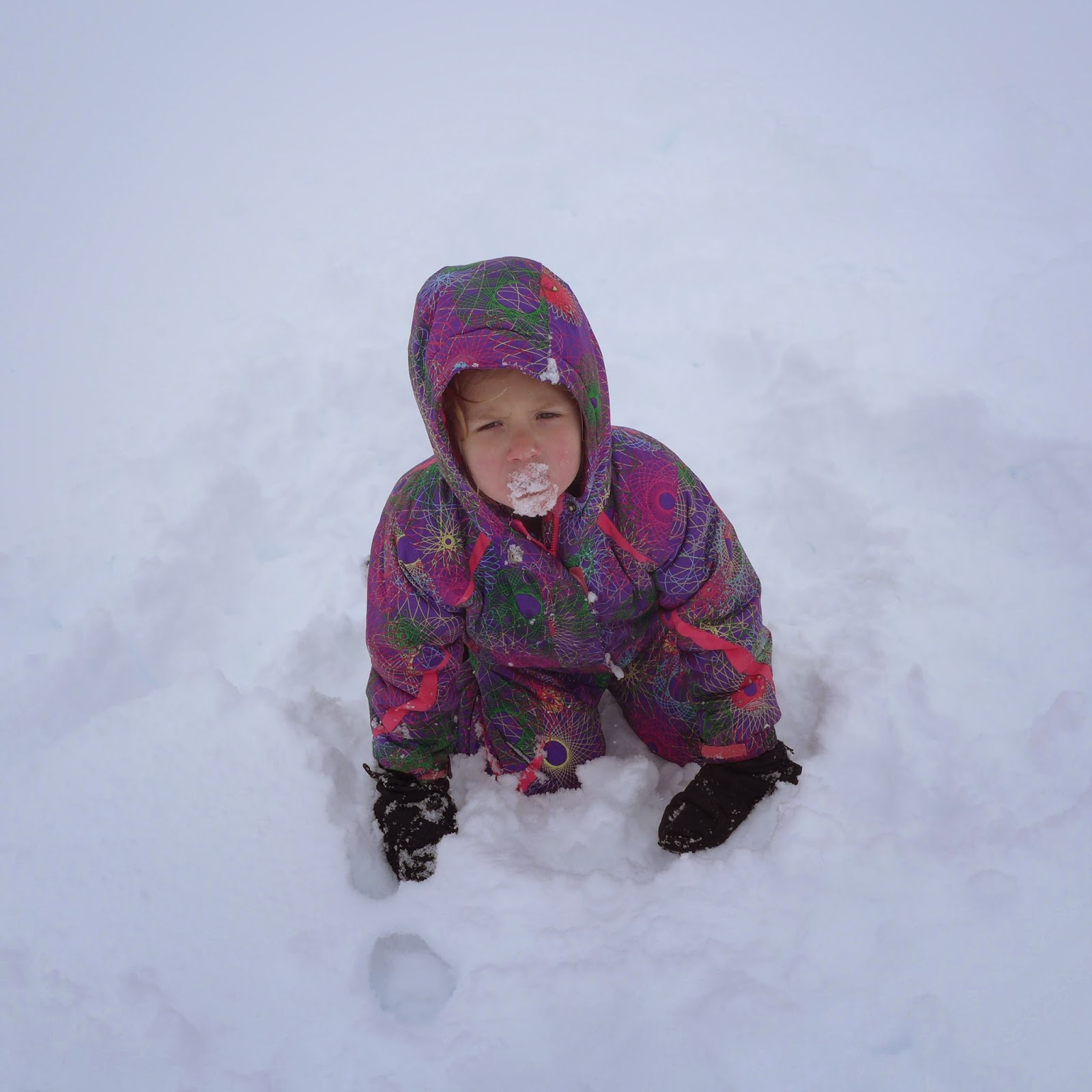
We got out of the car and geared up. We had Mirabelle's alpine ski setup and my goal was to be the human rope tow and tow her up the slope. Once we were geared up and got on the snow we found the failing in this plan. It was too difficult for Mirabelle to stay upright in the roughly five inches of fresh snow. After three attempts and three falls we switched to another method. Which was Mirabelle hiking up while Jennifer and I skinned. This of course was not sustainable for a long distance and we made it not too far from the parking lot before I sent Jennifer on ahead up a slope. While I looked after Mirabelle making snow angels and eating snow.


I had forgot to give Jennifer any instructions on transitioning and she spent a good portion of time trying to figure it out. She claims 45 minutes, but I think it was closer to 30. At some point I felt she wasn't going to come down without help and I asked Mirabelle if it was fine with her if I went and helped out her mama. So I raced up to help and found that Jennifer could not get into the bindings (Freerides) because there was too much snow jammed in them. I cleaned them out and she was able to lock the heels and head down the bunny slope to Mirabelle. I rushed on behind.


At that point Jennifer went for another lap while I hung out with Mirabelle. This lap went much better for her and she was back down in a reasonable time. I took another lap while Mirabelle grew impatient with the process of waiting for us. When I got back Jennifer wanted to go for another run. At this point it was close to 3:30 and the gate would close at 5pm, so I told her we should go. Mirabelle got her skis on and I held her hand to ski back to the parking lot. It went well enough as long as she kept her skis in the track Jennifer skied down. Mirabelle would come to a stop if she hit the fresh snow which was now heavier after the afternoon warm up hit it. Right before the parking lot I picked up too much speed and dragged Mirabelle down which was the end of skiing for the day. We packed up the car and headed out after that.


It was a learning experience for all of us. Jennifer realized why I enjoy skiing so much more than slowshoeing. She had a great time and wanted to stay longer, but the park's schedule as well as our child's was not going to allow it. Mirabelle once again enjoyed another day in the snow. But being close to four years old and attempting to ski heavy wet cascade fresh is not the easiest way to do things. Perhaps we'll be able to get her on some corn snow before summer?

Wednesday, October 1, 2014

Grand Teton and Yellowstone National Parks 05.31.14-06.15.14 Part I

It had been too long since being in the mountains. The not so snowy (but still adequate) winter hadn't gotten us out too much. So we hatched a plan to take three weeks to hit the big three mountain west parks, Grand Teton, Yellowstone, and Glacier. The primary reason for this was to see the dying glaciers in Glacier National Park, but it soon became a trip focused around Yellowstone. Where many of the big attractions are less than a mile from the road. This facilitates an easier time with a three year old who doesn't prefer to do her own hiking all the time.

We had taken three weeks off to drive out and enjoy the parks. We opted to head south into Oregon so that we could time our travel well. Mirabelle had stopped taking naps, and we were doing the drive in two days instead of the one that we would have done before having a kid. Our southern route would also take us near Craters of the Moon National Monument. So we had put into the schedule a visit there.

Initially we were going to do the trip without reservations anywhere. But we were blessed with my Father-in-Law booking us two nights in the Grant's Village Lodge in Yellowstone. It put us on a timeline to get there for our reservation. Which had its positives and negatives.

The trip started smoothly, although finding food on the road was a bit tricky, but we managed to get a decent, if not too salty, dinner in rural Oregon before spending the night in a Walmart parking lot in outside of Boise. In the morning we drove into Boise, and ate breakfast at Goldy's. After a long breakfast session we went to the local food COOP and purchased some provisions before heading out to Craters of the Moon.

The drive out to Craters was pretty amazing with some high desert scenery on a two lane road. But it could not prepare us for the scenery at the park. Most of the area at the park is covered in black pumice, with some small hills that are cinder cones or craters. Except for the abundant wildflowers and some trees, there is good reason to think of the park as moon surface. It is wild and other worldly. We hiked to the top of Inferno Cone and had some great views. Then we checked out the Spatter Cones and Snow Cone, which lived up to its name by having a pile of snow in the bottom. Due to our schedule of having to get to the lodge for our reservation, this is all the time we spent at the park. (We did picnic and visit the visitor's center too.) I would have like to have camped a night in the park and explored the lava caves, but it was not in the cards for this trip.

We left the park and continued to our final destination that evening, the Gros Ventre campground in Teton National Park. Of course, we made a stop for dinner in Idaho Falls first. This was a better offering of food than the previous evening as we stopped in MacKenzie River Pizza and Pub. Oddly situated on the Snake River near the river walk. A stop for dinner and then Mirabelle biking on the path and playing at the river's edge before we got back in the van and headed east. Soon we left the high desert and were in the trees making our way up to Teton Pass where the van topped the 8431 foot pass at 25mph and then we coasted down into Jackson and straight to the park to a campsite to go to sleep.

We awoke to moose in the campground, and the Tetons peeking out from behind the trees. Bison wandered the sagebrush out in the plains, as well as pronghorn. With this abundance, we decided to go check out Mormon Row, passing lots of wildlife on the way there. When we arrived there was a group of photographers with telephoto lens waiting patiently. We discovered that a coyote had put its den underneath one of the buildings, and there were seven coyote pups playing about near the house. We watched a bit and then took a walk along the row, watching magpies and ground squirrels before heading back to the car and driving up to Gros Ventre slide. On the way back into town we stopped at the Kelly Warm Springs and put our feet in. The water was warmer than anything we have at 6000' in Washington, but the air temps and breeze didn't make us feel like we need to submerge. After the dip we headed into town.

In town we went to the visitor's center and learned a few things, including getting a coupon for a future activity; The Jackson Hole Tram. In town we hung out at the square and ate ice cream from Moo's. We checked out the local area a bit, and then headed to the Jackson Whole Grocer for provisions before returning to camp.

The next day we planned to take the boat across Jenny Lake to the Inspiration Point hike. We drove up to the lake and got on a full boat with a nice ride across the lake before reaching the other side. Mirabelle had a snack, and then we hiked up. The trail was fairly crowded but we still managed to see a fox run across the trail in front of us before reaching our high point at Inspiration Point. Mirabelle got out of the pack for a bit to jump and climb around while we had our lunch. Then we headed back down to the dock where we were the last people to get on board the ferry that was leaving toward the visitor's center.

After that we drove into town to have a dinner. Unfortunately, none of the local restaurants were really in our price range. Although many looked interesting, a burger was going to run us over $15 in many of them. We walked around trying to find something that had local flair, a menu we liked, and prices we could afford. Right before almost settling on something we walked past the rafting shop. There was a sign in the window advertising the Snake River Brewery. This was what we were looking for in a dining establishment. We walked inside to ask for directions and made our way over for some delicious food and beer. Then we returned to camp to sleep for the night.

After Mirabelle had gone to bed that night, some bison wandered through the campground. Since there were no calves, we presume it was an all male group. They were only a few campsites away from us when two tussled a bit, butting heads, before the group of seven or so wandered off into the night.

Our next day was a travel day, so we packed up and headed to some sights before  arriving at our final destination. We rode over to Teton Village Tram to the top of Rendezvous Mountain. After days of staring at mountains I could not climb on this trip, it was nice to get on a mountain, even if by tram. With the coupons, it was still quite expensive, but we wanted to get to some snow and be in the mountains more. The only way to really make that possible with a three year old is via the tram. Of course, once at the top I just looked around and saw terrain I wanted to ski or climb even more. I realized I would have to live in Jackson for a few years just to do everything I want to do in the Tetons (and the Winds.) After a short stay outside, and a mediocre waffle inside, we headed back down.

On the way back into town, we stopped at the Teton Raptor Center. Which was pretty standard fare for that sort of thing. Get to see a hawk fly, and get fairly up close with some raptors inside the barn. A nice little side trip before heading back through town and up to our next campground at Colter Bay.

The Colter Bay campground was the opposite of the Gros Ventre campground. It was nearly full (although partially because two loops were closed.) There were lots of RVs and plenty of noise. We got there in time for us to make dinner and put Mirabelle to sleep. The mosquitoes were worse there, so we didn't spend too much time hanging out after Mirabelle's bedtime anyway.

The next morning I awoke early and took a walk by the lake. This is the point where I was really glad we purchased the bear spray before the trip as I would not have walked alone, by the water's edge, at dawn, by myself without it. It was a nice morning activity and headed back to camp to eat breakfast before we rented a canoe. The simple two hour canoe trip was the best thing we had done to this point, It reminded Jennifer and I why we like being in wilderness. We really didn't see other people for a major portion of the paddle. Mirabelle enjoyed it too. We have had a portage! We got to see a white pelican and a number of raptors as well. After the paddle we packed up camp and hung out on the rocky coastline for a while before making the trip up to Yellowstone for our reservation that night in the Grant Village Lodge.

Had we not had the reservation, we would have like to stay in Teton a bit longer.

Pics can be found here


Sunday, July 28, 2013

Dragontail Peak - Backbone Ridge - 07.23.13

Matt and I had talked early in the year about getting out and doing an alpine climb. Some grand ideas were tossed around until we landed on the Backbone Ridge with Fin Direct on Dragontail Peak. This was a route we could do in a day which was all I really had available for a climb.

We had worked out some logistics, but Matt and I had never climbed outdoors before with each other. Our calculations put us at 16 hours car to car which we felt good about for the trip. So we headed out the night before and slept in the car with a wake up time of 4am.

We hit the trail at 5am right behind a mountain goat and followed him to the first creek crossing. We were making good time to the lake when we stopped for a break at the one hour mark. We were off again and hit the far end of the lake and went around it a bit before ascending to the moraine. This turned out to be a bit longer and more time consuming than heading straight up the moraine from the corner of the lake. At the time we thought nothing of it, but looking down from the route later it was obvious to me that the way we had chosen was longer and not necessarily less difficult.


We got to the top of the moraine and that is where the difficulties arose. Crossing the snow was easy with a fair amount of sun cups. I took the lead in my heavier approach shoes while Matt followed with his trail runners. We took a bit of time to figure out where we should gain the rock and after taking that time made an incorrect decision. We took the highest of three ramps which had a steep start and at one point a tree to climb through. Higher up on the scramble we noticed the nice ledge system below us and worked our way down to easier terrain. Then we were questioning where the route started. A quick look at the route description told us we had to gain 500' of elevation scrambling, so off we went until we got to what we decided was the base of the route.

I geared up for the first pitch and at this time another party caught us and their leader climbed past me leaving me in a position of having to climb under his rope to continue which I did not look forward to. So I waited until their second climbed past, and I remained hot on his heels. I brought Matt up to the belay and we waited for their party to finish the pitch before we started.

Once Matt started the off-width pitch he made steady progress. It didn't look too hard, especially seeing the second from the other team going up it. Matt got to the top and put me on belay. The first moves in were easy enough with some extra cracks and bulges to use for hands and feet. The lower portion of the main crack was also taking a foot jam from me without any real off-width technique being employed. Then I got stuck. I could not make upwards progress. The nubbins for my right foot ran out, and I got in a position where it felt like my right half of my body was useless in getting me up the pitch. I struggled. I grunted. I thrashed. Nothing was working. I yelled up to Matt about the possibility of lowering me back to the bottom of the pitch and hauling the pack. He wasn't into it. I contemplated a lowering and putting the approach shoes back on for the ability to jam the crack. I wasn't going to get lowered. I put a prusik on the rope and tried to pull up a few times. This got me a little progress, but not significant. As I panted and my heart raced, I decided we needed a quicker way and yelled to Matt to set up a haul. He did, but I still had to help him somewhat. So I still thrashed up the route. Every time I would stand up, he would haul rope. I eventually made it to the top and we had a talk.


We had blown lots of time in the approach and the first two pitches. Matt asked if I was up to continuing. I said yes. I told him we could be more efficient, and being there was no more off width, I could run up pitches if he led them. We opted not to rap off at this point, but knew we were setting ourselves up for a significant uphill battle for the rest of the route as we had lost a lot of time. Neither of us wanted to descend Asgard Pass in the dark. We had about eight hours of daylight left to make that happen. We had a brief lunch and continued.

Matt led the next pitch which mostly felt on route, although had quite a bit of lichen on the later part of the pitch. The two of us climbed that third pitch in less than a half hour which lifted our spirits for getting back on track. The next pitch was decidedly off route and took a touch longer, but we were still optimistic about our timing. I led a short pitch and then another to a corner feeling like perhaps we were finally at the pitches we might be able to simul climb. This was untrue as Matt had to climb around a corner and upward still. I fell following that pitch on a lie back roof, which left me further beat up.


Once at the top of that pitch we finally simul climbed. Rope drag slowed us down and I stopped us a bit short of the fin so I could belay Matt in from the shade of a rock. I led up the fin next but also stopped a bit short, although I had most of the rope out. Then we wandered up the ramp system on the fin for two more pitches before Matt saw a ledge system he was willing to conquer. At this point I told him I was too tired to lead and it would be all him if he wanted off the peak without sleeping up there.


This is actually where the nice climbing began. Unfortunately for us, we were too tired and thinking about getting off before sunset to enjoy it. Matt led out on a ramp than turned upward and left to a hand crack with some exposure. (Pretty much the first exposure of the route for us.) He went a touch too far to the other side for the belay, so I set up a belay at the top of the ridge to belay him back up and on his way to the next pitch. Unfortunately during that belay up and out we forgot to transfer gear to him and a bit out on the pitch is where he realized. He down climbed back to the first piece he had in and then hauled the gear up on the rope so he could continue. I followed the pitch which had a crack that widened to off-width. This one was significantly easier. However, having struggled through the previous off width and having been on my feet for the past 15 hours I was done. I didn't have the strength or the reasoning to overcome the problem. I applied a prusik to the rope and yarded up through a few moves before reaching easier ground and a traverse to Matt's position.


We did one last pitch on the fin (total of six pitches on the fin) as we watched the sun set over the mountains to the west. We simul climbed the last of the ridge to the finish where I heard Matt exclaim "we can descend!" as he popped over to the south side and witnessed the full moon over the enchantments. We took our first rest in hours sitting in the glow of the moon while we removed rock shoes and put our approach shoes back on. We left our helmets and harnesses on and put most of the gear away before starting down. I gave Matt the lower portion of my whippet to use as a tool to help get down the snow and we made our way slowly down to Asgard Pass under headlamp and the shine of the moon. We stopped for water on the snowfield briefly and continued down. The snow was soft enough for plunge stepping and we made good time for it being dark and having been up for so long.


We really started to slow down on the way down Asgard Pass as we had to pick our way down trying to stay on the trail. We passed a few people camped out in tents who perhaps underestimated how strenuous it is to get up Asgard before dark.


Back at the lake we lost the trail a bit and wandered through drainages until returning to the trail to hop some boulders back to the other side of the lake. Then it was a relatively uneventful hike out in the darkness for a few hours. We arrived at the car around 3:10 am a full 22 hours after we left it in the morning. Our hope was to drive into town and get some food before returning to Seattle. But as suspected, Leavenworth was all shuttered up and we could not get food. So we drove to the rest area west of town on Highway 2 and slept for a few hours before continuing home.

It was really fun to get out, but this trip highlighted a few concerns about my lack of time in the mountains. One is climbing ability. While I don't know if I would have had an easier time with the off-width if I had been climbing a lot, it would be nice to have at least been ready for the rest of the technical climbing. I don't feel I did as well as I could do on the rest of the route. Of course this could be related to expending a ton of energy attempting to thrash up the off-width and being significantly more tired for the rest of the route something that more climbing would probably not have mitigated. But that brings me to the second concern of conditioning. While I was able to complete the 22 hour long trip, I was slower than I would like at many parts of the trip. (The walk out most notably.) Could I have been faster and less tired if I was doing this every weekend? I'd like to think so, but perhaps nothing really prepares you for 22 hours on your feet? Part of the time while on the climb I was thinking "You're 43 now, and 'off the couch' is not working anymore." While it may be true it is not a good idea to work hard for 22 hours off the couch, I feel more like this was a unique circumstance as I did seem to feel fine until climbing that second pitch.

Oh well. Next trip out might determine just what kind of shape I am in.

Sunday, March 3, 2013

Echo Ridge Nordic - 02.26-28.13

We had some time to get away and decided on trying out Echo Ridge. A Living Social coupon sealed the deal for accommodations and we were off. Our drive out was planned so we would stop in Leavenworth for lunch and then Mirabelle would nap between there and Manson. Arriving in Leavenworth to our favorite lunch spot, the Munchen Haus, closed had us spending more time there then we wanted. And as hard as Mirabelle tried, she didn't fall asleep until we were near Knapps tunnel which had us driving around before we arrived at the hotel. So we didn't end up getting any skiing in the first day, but due to the daily fee of the location that may have been for the better.

The next day started well with breakfast baked goods from the Red Apple before making the 30 minute drive up to Echo Ridge. I hadn't seen the grooming report for two days and wasn't sure what to expect. They were clearly getting close to the end of season, but it was difficult to determine how close. And they were still grooming almost all of the runs, so it had to be good...right? The drive up involves leaving town and heading through orchards until reaching the Echo Valley downhill ski area, which seems like a nice little family place to ski. Then the road turns to dirt and continues up switchbacks with some snow drifts and steep drop offs thrown in. We arrived to bluebird skies and parked in the lower parking lot expecting perhaps to only ski the green runs out of the lower lot. The goal was to ski those runs in the morning and return to the van for lunch and head out again in the afternoon. But we would see what Mirabelle might want from the day.

After bundling up Mirabelle in the Chariot and handing her a churro, we were ready to go. It appeared the trails were groomed the previous day and there was about a centimeter of fresh snow on top as well. Conditions in the track were a touch icy going uphill. And pulling the extra forty pounds or so behind me kept me out of the track all morning. The trails were pretty mellow and we were having a good time so when we completed the trails out of the lower lot I asked Mirabelle if she wanted to keep going and she said "yes!"


We headed up the connecting trail to the upper lot which was the only blue we would do for the day and then did all but one of the green trails out of the upper lot. At some point Mirabelle had fallen asleep which allowed us to get in about eight miles of skiing for the day. The conditions we found on the upper trails were equal if not better to the lower trails and we really had a good time. The upper trails offered more views including down to Lake Chelan and over to the Stuart Range.
We skied back down the steeper blue trail to the car and had lunch.


After lunch we donned snowshoes and walked away from the parking lot thirty meters or so to build a snowman. Mirabelle at first enjoyed snowshoes, but as the terrain became more uneven she had difficulty not stepping on her own feet and was starting to lose patience with them. The end result is her memory of snowshoeing is positive. After snowman construction Mirabelle did a lap of the parking lot on her skis before we opted to head back to town.


The next morning it was raining in town, but I had hopes of snow level occurring before the ski lot and I was right. This time we headed up to the upper lot to get on some blue runs. Snow was coming down steady, but not very heavy as we geared up and left the parking lot. Since we weren't sure on conditions we started out on the only green we had not yet done and if we found it to be too icy we would turn around and repeat some of the trails from the previous day. While the grooming done the previous afternoon had hardened up overnight, the fresh snow falling on top made conditions pretty good in most places with some more sun soaked parts being more icy than treed sections. This trail would have offered some nice views, but due to the snowfall, there was limited visibility. An interesting thing this trail did offer was what I'd call the magic white carpet. Some areas where there was no snow around except for the eight foot wide (16" deep) swath in which we were skiing on. The surrounding hillsides looked almost like summer. Turn the corner on the ridge, and you were back in winter wonderland complete with better trail conditions.


We arrived at the end of our green trail and opted to take blues back. These were pretty fun and not nearly as steep as the lot to lot trail and were not significantly more difficult than the green we had been on. I feel like they did offer more terrain variation though. Somewhere on our way back Mirabelle said she was done, so we headed back to the car sticking to blue runs and finishing our morning with about 3.5 miles under our feet. The snow was still coming down, but it was around the time we wanted to leave for home. We thought about staying another night, but opted not to and started heading down the mountain for home.

This was a really fun outing and reminded both of us why we like Nordic skiing so much. Mirabelle had a great time too! We had a lot of fun and so no one else on the trails while we were out. (We saw some people in the lot, and the groomer about to go to work, but we had the trails to ourselves.) It was really fun and a great location. We are thinking of making this into an annual trip.


Tuesday, February 12, 2013

Steven's Backcountry - 02.10.13

Steve was kind enough to invite me along for some powder hunting when I had no other partners. We got a mellow start and got to Smith Brook Road around 10am. There were others parked on the side of the highway, but after five minutes of skinning in the road, we didn't see anyone for the rest of the day. 

We were out looking for slopes still holding snow and after a fair bit of climbing we found some. Our first run was low elevation and pretty good considering it hadn't snowed in days. Our second run was at higher elevation and was really good considering again that it hadn't snowed that recently. 

Our run back to the car was somewhat ugly with wetter heavier snow due to the sun and warmer temps. It was good to be out for the first time this winter. It also made me realize just how much more fun I'd have if I had newer and bigger skis. 

It was a beautiful sunny day out, but both Steve and I neglected to bring cameras. Steve at one point lamented as the views were great. 

Friday, September 21, 2012

Orcas Island - 09.16-18.12

In a stroke of luck I had off for two days while my father in law would be camping in the San Juan Islands. So Jennifer and I hatched the plan to join them on Orcas Island.

After Jennifer got home from work on Sunday we packed up and drove up with the intention of Mirabelle sleeping in the car. It worked and soon we she was running around on the Ferry having the time of her life, interacting with others, and enjoying the wind and views.

After the hour boat ride, a reasonable car ride got us to our campsite in Moran State Park. We had grand ambitions of heading to the summit of Mount Constitution for the sunset, but by the time we were done preparing dinner, we were all ready to call it a day. Our guests would be meeting us the following morning and we wanted to be ready.

I awoke early and went for a hike near the campground while waiting for them to wake up. When I got back we had breakfast and then attempted to hike to Cascade Falls from our campground. We stopped a tenth of a mile short of the falls at a small waterfall where Mirabelle got to play with rocks and leaves before we headed back to the campground.

At the campground we found our relatives and hatched the plan to drive to the false summit of Mount Constitution and hike to the summit to give Mirabelle a nice nap, and conserve energy so she could walk down the trail. Mirabelle slept from early on to the Summit Lake and then proceeded to do her own hiking for most of the final mile on her own. Making the hike a bit longer than anticipated to reach the summit.


We stayed a while on the summit taking in the fantastic views while Mirabelle played with a new friend on the rocks.

 Mountain Lake and beyond

Mount Baker and the Twin Sisters group

Then Mirabelle got into the pack for the significantly shorter hike back to the car. We then drove into town (Eastsound) and had dinner before retiring to camp.

The following morning we were leaving, so we opted for a short hike to the beach at Obstruction Pass State Park. Mirabelle did the hike in by herself, and played/explored on the beach while we explored and took dips in the refreshing water.

Then we made a quick hike back to the car and an even quicker ride back to the ferry to be on time at the dock.

This was Mirabelle's first two night camping trip and she loved it! Hopefully we'll get a few more trips in the next weeks before it may get too cold for her.