Monday, December 28, 2009

Hyak Sno Park - 12.27.09

The original plan was to ski with Ken at Cabin Creek. After Ken had to bail, we headed to Cabin Creek to find icy conditions (expected) and poor grooming (not expected.) We attempted to do a short loop, but without a track, our skis kept slipping out and there was also a couple on snowshoes who had dogs without leashes. (I almost ran into one.) So we headed back to the car after the short loop figuring the flatness of the john Wayne Trail would serve us better. And I knew it was groomed the previous day. When we arrived at the parking lot the groomer arrived, but we didn't wait to see what he would do, so we still took the ten minute drive back to Hyak.

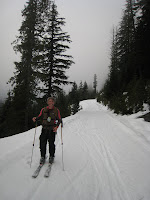
Although the sledding hill was closed, the Sno Park was jammed with cars and city folk attempting to find a slope to slide on. We got on the trail and got going. Shortly after leaving the parking lot the crowds subside. Being an old railroad grade the trail is super flat. But this was nice to work on form and getting into a rhythm. Since it is by the lake, it was actually pretty sunny which was also nice. Of course, we had a tremendous headwind during one stretch and I was wishing I didn't have any exposed skin.

We worked our way along the lake and decided to go to the dam on the eastern end. Once there we had a snack and started back. It was a longer trip than we anticipated, and we were already a touch tired before heading back. (We estimate our round trip to be around 13 miles.) Jennifer got a head start as I wanted to check out the dam a little more. I caught her back on the trail and we continued out. We eventually saw Gabriel and a friend and we chatted a bit before continuing to the car.

Never did I have such difficulty walking after skiing. After taking the skis off I hobbled to the car trying to remember how to propel myself without skis. We packed up and were on our way.

This was a trip that was more fun than I expected. A nice sunny day and a fairly scenic ski. Skiing some of the other Sno Park locations is similar to jogging Green Lake. They are courses, and you do a lap or two. The scenery doesn't really change (mostly trees) and you don't really get anywhere. This trail was great for getting into a rhythm and seeing some scenery and getting someplace. You can actually take the trail all the way to the next Sno Park if you so desire as well.

Pics are here.

Friday, December 25, 2009

Leavenworth Ice - 12.24.09

Jennifer was supposed to work Christmas and Christmas Eve, so I was trying to find something to do. I successfully wrangled Ryan and Dylan to be followers and climb an ice line up Icicle Canyon. I was hoping that the recent warm weather didn't destroy it, and we would be rewarded with an early Christmas present to ourselves.

We took a casual start and arrived in Leavenworth around 10am. The beauty of this route is the "ten minute" approach. So we readied ourselves at the car and hiked into the woods. The route was easy to find having done the trail to Condor Buttress earlier this year.

The route in Spring

Within ten minutes of hiking we were at the first step of the route. Since it was a bit steep, we opted to hike past it and start at the second step. So we roped up and started with the second step. The second step had an easier line on the right, and a steeper line on the left. Since it was the first lead of the day, and I wasn't sure how strong the ice was, we kept to the right side. After the step there was quite a bit of flat stream so I set a belay and brought Dylan up who then brought Ryan up. We unroped and hiked up the stream bed a distance before reaching the next step. While this step was a solid WI2, it was short and we decided to solo it as we knew there was more hiking above it.

While the climbing so far was generally easy, the ice conditions were quite variable. As I suspected, the wet warm trend from earlier in the week left the ice poorly bonded to the rock in some areas. A section of the first step had a hollow 3' square area surrounded by well bonded ice. This next step that also had areas of poor ice as well, but fortunately I used the pick holes from a soloist (who had passed us) so as not to damage the ice further when I went up.

Some more hiking through a now brushy and less open creek bed got us to the next step. This is where the real climbing starts. From the base of this next step, I thought I could make it to the base of the final step in one rope length. But once at the top of this step, there was a little more distance before another penultimate step. So I led to the base of that step and brought the guys up. I then led out on the penultimate step which was really fun. There was a bit of snow on the ice and there were some hollow sections, but I was able to sink screws in it fairly well including a 19 cm screw. Once at the top of that step I was in the basin below the final step and proceeded to the ice to build an anchor. Unfortunately, the ice on the final step was thin and I couldn't sink screws well. (I was out of shorties.) I had to use 21cm screws not fully sunk as the anchor.

I brought Ryan up and he belayed Dylan up. We discussed the final pitch when we were met with another soloist. We chatted with him a bit. (Turns out the other soloist was his buddy.) And then we let him go ahead of us. The left side of the final step starts with about 12' of 85° ice. It has been climbed as it had pick marks. The right side had also been climbed usually on the far right. I decided to take something right up the middle where I knew there would be pro (wrong) and it was a bit steeper than the right side.

I started up heading toward an icy rib that looked like it offered good protection. Unfortunately, it would not take a screw all the way and I had to tie it off. The stance also was not great for placing the screw and I really worked my calves while placing it. Just past the screw the ice was tympanic and did not feel comfortable, but this passed. A little further up and I found a rest stance, so I placed another screw in shallow ice. My calves were really getting worked and I decided instead of heading a bit to my left for a short step, that it was time to head straight for the top. I worked quickly and methodically through the final bit of the pitch and was on flat ground heading for a large Ponderosa. Once there, I made it my anchor and brought Dylan up. He belayed Ryan up while I sought out the descent or a possible continuation.

Most parties stop where we did and descend. This is the option we choose after the bits of ice above our location didn't seem to offer any great climbing (that we could do.) So we headed down, following the trail of footprints in the snow. Most of the descent was fine to do in bare boots, but there were a few icy sections that would have been nice to do in crampons. Not sure it would have benefited to leave them on the whole descent, but Ryan did and he didn't complain.

This was fun route, but the climbing really starts farther up and the first few steps are warm ups. Due to the short approach and the length of the non technical portions, it is an easy day trip. (Car to car for us was around six hours.) The ice wasn't in the best condition, and was hacked out in a few places as well. (Very different from how we found The Goatee.) The climbing on the upper three pitches was great, and I'd go back to do this again.

My pics are here.
(Dylan took pics, but I haven't seen them.)

Tuesday, December 22, 2009

Erling Stordahl - 12.21.09

Jennifer and I went out again for some Nordic turns. The weather was colder and wetter than on Saturday but we persisted, hoping it would be drier once we were on the east side of the crest. It was moderately drier, and we left the car in a light rain/mist to check out the trails.

We paid extra for these level of trail grooming?

While it appears the main snowmobile road was groomed. When we got off it and headed toward Trollhaugen the grooming wasn't quite right. It appears they did attempt to groom, but only made one pass and that bare boots and four wheeled vehicles destroyed it somewhat. Past Trollhaugen the grooming effort was more obvious, but still wasn't up to par. We reached the same point in the woods we had last time and proceeded to follow other skiers tracks in the woods which returned us to the "groomed" section after a short loop.

Skiers tracks in the woods

We started heading back to the car on a different set of skiers tracks and then took a turn to make our trip a little longer. (At this point the rain was changing to a wintry mix.) After a bit of fun easy terrain, we got to a hill. I was inclined to turn around and call it quits when a family came down the hill. I asked the teenage girl what was that way and she responded with "fun hills." So I asked Jennifer is she wanted to turn around or continue, and we decided on continuing.

We climbed up a hill for a bit and then were on rolling terrain before tackling a larger hill. Then we had the task of descending the large hill which neither of us were up to. If it was groomed we would have had better success, but Jennifer took off her skis and walked it. While I sidestepped parts and tried to snowplow other sections. After a few falls we were back on more level terrain that we knew where we were. At this point is was full on snowing and we just headed back to the car.

Happier now the snow is falling.

This was a good workout with the uphills, but I'm still not ready for those types of downhills without grooming on skinny skis. Not sure why the grooming was so bad and incomplete. There was certainly enough snow for it. I'm guessing the grooming won't be right there until January.

Sunday, December 20, 2009

Cabin Creek - 12.19.09

Jennifer and I got out for some Nordic skiing on the groomed trails of Cabin Creek Sno Park. The weather was miserable for our endeavour because it was above freezing and raining constantly. (More of a mist, but everything was wet.) Of course, this is still better than track skiing with icy snow, so it wasn't all bad. Not to mention it seemed to keep the crowds away. Usually if you show up in that parking lot when we did (Noon?) it is way full. It was interesting to get out on the skinny skis. The more I ski on my backcountry skis, the more I find the skinny skis scary.

The Road

We did an out and back on the road to warm up and then got on the intermediate loops for the fun. I fell once on a downhill, and Jennifer fell twice. But we weren't injured and the snow was soft and wet so was good cushioning. The trails and grooming aren't quite there yet as some of the track disappears into the ditches on the side of the trail at various times. There was also a fair amount of cones and dirt in the track which I think should be covered by another snowfall or two. It was nice to get out and although it didn't feel like that much of a workout, my legs are a little sore today.

Coming down one of the short hills

Friday, December 18, 2009

Year End - Best of 2009 - Recap

Once again, I'm posting this before the end of the year. Things tend to wind down in November and December. And with the trend of not being able to find willing partners continuing, this blog entry started getting written up early. So usually Winter is not in full swing, and the warmer weather activities are no longer available in the PNW. Perhaps in a future year I'll take a November trip to Joshua Tree or Red Rocks to keep the climbing going.

Unlike last year, this year does not have a stand out. So I'll write a few things down and perhaps by the end of a bunch of paragraphs I'll have a winner. Perhaps one of the reasons there is no clear pick at this time is that I got to do a lot of amazing outings this year. Heck, the hike Jennifer and I took to the Mer de Glace in Chamonix could easily place high in the list. Or for that matter the whole trip to France. But I am going to exclude the France trip which would win for other reasons and keep the contenders to outings in the backcountry or outdoors. I'm going to start by listing some highlights and we'll see what happens.

First, I'd like to say that the Mount Adams ski trip was my favorite ski trip ever, so it would have to be in the running. I couldn't see doing the easy route without being on skis. And it was worth it. The skiing was some of the best I've ever done as well. It was nice to summit another Cascades volcano (five total for me now.) Even with the horrible AMS I had, the trip is still a contender.

While not a specific climb, my trip with Julie to Squamish was possibly the best rock climbing trip I have ever had. We climbed multiple four star routes and I had a great friend to share it with. We also climbed about 35 pitches which is probably the most I've climbed in a four day span. And while climbing routes like Diedre and Calculus Crack were fantastic, I cannot say definitively they were the top highlight of my year.

And while on the topic of climbing multiple four star routes, my trip to Peshastin with Julie is equally as memorable as the one to Squamish. While it was a backup plan, we had a great time and climbed well on multiple four star routes. Thinking about the trip makes me eager to return to Peshastin again. Although with Winter here, it will have to wait until Spring.

Another topic to talk about is all the goals I accomplished from my objectives. While the trips may not have been memorable or super enjoyable while doing them, they hold a special place with me because they were objectives I set out to do and accomplished them. They would include my ski trips of Mount St. Helens and Mount Adams, my climbs of Prusik Peak and South Early Winter Spire, and my scramble of Three Fingers.

An unexpected highlight would be the climb of Mount Rainier. (Thanks Josh) A couple of the guys pressured me into doing it earlier in the year, and while I also was once again afflicted with AMS, (unlike my previous Mount Rainier summit) it was an enjoyable trip which renewed my love affair with the mountain. I think I may attempt to climb Mount Rainier by a different route each year.

And while it may be more memorable for the epic Steve and I had, Forbidden was a nice trip as well. However, as I stated last year it is difficult to remove the emotions from the climb. Although I had a great time with Steve and he is a great partner, there were many moments burned in my memory of fear and doubt that may overcome this climb's position as being the best of the year. (And I guess technically the best should also have a better success story as climbing in better style.)

Another possibility is the late comer Chair Peak. I had been itching to get another Snoqualmie Pass summit, and this fit the bill with a fun and not too hard route. It probably receives a higher placing due to its recent occurrence, but it was pretty special just the same.

Now with the main contenders on the table, it is time to make a decision. And the winner is: Me! Having so many great trips to choose from really makes me the winner. But, in all seriousness, I think the Mount Adams ski was the top trip of the year. While the AMS was a drawback, it showed me how susceptible I could be to that ailment. The rest of the trip was great!. Although we did the climb in 12 hours, we didn't have to come out by headlamp and that always leaves a positive impression that you had done things correctly. Also, it is possibly the longest ski run I have done and I skied it well. This was a major accomplishment considering I have only been skiing for two years.

Here's to hoping I have a bumper crop to choose from next year.

Tuesday, December 15, 2009

The Goatee - 12.14.09

Steve and I got out to climb some ice before the weather turned warmer. While the weather wasn't supposed to warm significantly until Wednesday, precip was in the forecast from Sunday on. And this meant possible burials of lower angle ice by snow. We headed out the Leavenworth where we knew there would be cold temps and less precipitation. (And more options for ice.)

Our original intent was to climb Hubba Hubba. But with the recent snowfall and the thin looking first 15', we decided in the car not to climb it and to head for a new route, The Goatee. This route has seen lots of traffic since its first ascent on December 5th. This is probably due to the moderate nature of the climb. The first ascentionists did the climb in three 70m pitches with the first two pitches being WI2 and the third being WI3. And there was a walk off as a bonus. (Although it appears reading the thread that many people had trouble with the walk off.)

We left the car at 10:30am for the long hike up the Snow Creek Trail. We spotted the route a little farther after we expected to, and continued a bit further to make sure we had the correct path up in the snow. After a few minutes of hiking we returned to the location where tracks left the trail assured that this was the correct way to the route. With recent snow coverage (including the few centimeters that fell the night before) the footing was difficult going up. We were watched by a few goats around the time we made it to the climb.

We actually skipped the first step. (bummer) And we started climbing just above it where I led out on a full rope length. This stretch could easily be simulclimbed all the way to the base of the WI3 pitch. Instead, we belayed it and I led it putting in three screws and then bringing Steve up. After Steve came up, he ran up the flat section for a rope length putting in one screw before setting up a belay at the bottom of the steep section. The ice conditions were great. There was a little slush on top from 2cms of snow from the previous night. The ice underneath it was plastic and took pics well.

In about an hour we were both under the crux pitch and we decided that I would lead up it part way and then set a belay so Steve could lead the rest to finish the climb. Due to our late start Steve suggested taking the easier ramp on the right side of the route. I wanted to get on something harder, and went nearly straight up where there were a few convenient ledges for me to set screws. The climbing was difficult. Not so much because of the steepness, but because of my difficulty to swing the tools and keep them parallel. At one point one of my tools pulled from the ice, but both of my feet and other tool stuck. It was a scary moment for both me and Steve. This section also dinner plated a bit and I took a few chunks of ice to the face during the lower steep section. After completing around half of the steep section I moved right and set up a belay. I had numerous difficulties with screws on this pitch because two I had tried to place earlier had ice plugs which I could not remove. And this pitch required one handed screw placements. The other reason for difficulties I am not sure, but I eventually sunk two 22cm screws for the anchor and started to bring Steve up.

Steve came up to my position after cutting his lip on ice he broke off during the pitch. We quickly re-racked gear and he was off to finish the steep section. He placed three screws during the final steeps and then after going out of sight on lower angle terrain he had me take him off belay. (It just was not possible to belay someone that quickly especially with the iced up rope.) After running the rope to the end he set a belay and brought me up.

We were one short step away from the walk off. But Steve encouraged me to go one step further thinking we could still walk off from that position. I hurried up the two steps and set a screw to belay Steve up to my position with a hip belay. (Our tube belay devices were practically useless with the iced up rope.) We assessed the situation and determined we would belay our "walk off" because we were too high and the terrain a bit sketchy with loose snow over rock.

Steve led out a bit and slung a bush and then disappeared out of sight. He put me on belay. As I was holstering my ice tools, I somehow managed to drop a screw down one step below me. I quickly rappelled off the screw anchor I had and then soloed back up the step after retrieving the dropped screw. I then tore down the anchor and started the mixed climbing over to Steve's location. This variation on the walk off really wasted time, and while Steve attempted to coil the frozen rope, I set about trying to find the true walk off. I followed foot prints in the snow until they started going too far skier's right (At least I thought.) Then we saw foot prints going back to the left and followed them. After a short distance I realized they were goat prints and not human, but opted to keep following them as I could see they would get us passed the first step.

By this time Steve was almost right behind me and we came to another step where it appears the goat stopped and realized it couldn't find a way down and turned around. We continued on the goat tracks to a gully and made our way through some bushes on the steep gully where Steve accidentally left behind a biner with three screws on it. Fortunately at this time I was behind him and picked it up. It was getting dark and these things would be more difficult to see in the coming moments. But shortly after coming out of the gully, we had rejoined the base of the route. Once we recognized our footprints from the morning, we stopped to put our gear away and put on our headlamps. This would keep us from accidentally dropping any more gear, and at this point we needed the headlamps to see our way out. It was also around this time that it started to snow harder as we made our way back down to the trail.

The hike out was uneventful. And Steve and I had discussed that neither of us had ever come out on that trail under daylight. We made quick time back to the car and were off back home.

This was a fun outing that would have went smoother had we got and earlier start. Now knowing the route, I would recommend belaying the first step (sometimes called a WI2+) and then simul climbing up to the base of the steep pitch. If we had more time, Steve and I were intrigued by the ice continuing up the gully for what looked like a few more fun steps. It was a nice and enjoyable climb and the best ice I have been on this season. I am hoping to see more like that before the end of winter. But for now, the snow is falling and it is time to get back on the skis.

Pics are here.

Sunday, December 13, 2009

Chair Peak - Northeast Buttress - 12.12.09

Elevation Gain: 3000'
~4 miles RT (Not including our little off route excursion.)
Left car: 5:30 am
Summit: ~2:30 pm
Back at car: 6:30 pm
13 hours car to car

I was finally able to make this happen. Although truthfully I had little to do with the planning of this trip. After a few failed (as in not even leave town) attempts of Chair, Scott had contacted me about climbing it on Saturday. Steve was unavailable, and I snapped at the chance. This was actually nice because it meant that I did not have to do the planning. And Scott's plans were in line with what I wanted to do. (A climb of the North Face of Chair.)

We met at the very early time of 4:15am at the Mercer Island P&R. We arrived in the parking lot with one car ahead of us and they left behind us as they awaited their friends (from another car) to gear up. We hit the trail under headlamp at 5:30am. The snow was very firm and Peter started with crampons on. It wasn't long before Eric caved in and put some on. I lasted only a bit longer before I decided it would be easier as well. Before we left the woods, all four of us were on crampons. While it made for surer footing, and faster movement, but it was noticeable to me at least that it required more energy. Also, using crampons on relatively flat terrain hurts my feet.

In what seemed like short time we were already heading uphill from the Source Lake basin. This is where the law of diminishing returns applies to alpine starts.* Peter was the only one who had climbed the peak previously and he suggested we were too far left. I stated that going right would lead us to Snow Lake but the north face did run down to Snow Lake, so perhaps that was correct. We checked the map by headlamp occasionally and wound up at what is probably the very toe of the buttress near Snow Lake. Unfortunately, we didn't like where we were and had to backtrack to get back on course. By this time the sun was up and we could see our objective. We were also able to see that the other party of four had passed us.

We were moving slowly but Scott was still full of energy. He arrived on the ridge before us, and went to check out the north face. He came back saying it was thin and thought that the Northeast Buttress was a good plan even if it meant waiting for the other party of four ahead of us. So we geared up and ate while waiting for the other party to get under way. While we waited, we got pelted with snow from the first party above and two other parties arrived behind us.

There are at least three variations to the first pitch of the route. I'll describe them in the conditions we saw them in. The right variation which follows the summer rock route was very thin ice and snow on rock. The party that went ahead of us placed mostly pitons to protect it. It had a steeper section but most of it was lower angle. The middle variation went up some steep snow to a thin ice slab and then to a steeper step of thicker ice. The left variation which we took crossed a rock rib and then got on some ~60° ice that was good climbing. Since we were there to climb ice, that is why we chose that variation.

After some equipment issues, Peter was the first of our group to lead off. When he went out of site after crossing the rock rib about a half rope length up he was stationary for a while. (When I arrived at the belay I found it was because he was having a crampon malfunction.) He continued up and eventually I was on my way. Followed closely by Scott. The first pitch climbing was enjoyable. The ice was firm and took picks well and soon I was on the snow slope above.

I arrived at the belay and exchanged the rack for a steep snow slog to the next belay. The snow had a sun crust and below that was sugar snow. (At this point I believe we have moved from the NE buttress proper to the East Face Variation.) Footing wasn't great, but it mostly held. If you were kicking new steps into the slope (I was trying to use existing steps) you would shower everyone below you with chunks of the crust cascading down. During my lead Peter took a piece of ice from another party to the cheek and left him with a battle scar. Protection on this pitch was limited. I moved mostly from rock to rock to gain protection. This included my first placing of a piton on lead. Then I ran it out to the next belay.

A good rock anchor was already occupied by the party ahead of us so I had to look elsewhere. We were planning on taking this ice step to the left, so I moved leftward in hopes of building an anchor out of ice screws. The ice I had to use was perforated with at least a dozen existing screw holes. I placed a screw in a new location higher than all existing holes, and then I placed another lower in an existing hole. Since the ice was thin, I had to tie off both of the 16cm screws. I brought up Peter and he began the next pitch.

We were taking the easiest option on this pitch which was a hacked out section of lower angle ice just to the left of a pillar. Peter climbed it well and was soon on the snow slope above. Later, I was yelling that he was running out of rope. Then the rope tightened. I could not hear him due to all the parties around trying to communicate. Fortunately he knew to build an anchor and I did eventually hear him yell I was on belay. This possibly gave me little confidence in climbing the next ice step which I had difficulty with. Partially for not being able to find pick placements, but also because it was a bit awkward. I cleared the ice step with no issues and reached the snow slope above where Peter was belaying me off a picket and an ice ax. (Yipe!) When I got to a rock that he had placed a few cams in, I made that a belay and belayed him to a few small trees so he could belay me up the slope proper.

I continued from that position up a bit more where the slope narrowed on a bit of an arete and reached the false summit. I gave Peter a belay up and we basked in the sun. (The first time I had been in the sun since the start of the second pitch.) The wind in the summit area was strong and it was difficult to eat and organize gear. We waited quite a while before Scott and Eric joined us. Then we all ran over to the summit. Once back we geared up to get down.

Truthfully in the conditions we had we could have down climbed the first gully. But since we had two ropes, we rappelled the gully. The lower gully does not look easy to down climb and required another double rope rappel to gain the bottom. Unfortunately it was off a wonky anchor. Once done with the second rappel, we down climbed the slope below it before it opened into the basin and we were able to hike out. During our descent we shared our rope with a party of two who arrived near the summit after us. This lengthened our descent, and we were using headlamps by the end of the second rap. We then slowly worked our way back to Source Lake and out to the parking lot.

Overall this was a great trip. The weather forecast of afternoon snow never occurred, and we had mostly clear skies during the day. (There were some low clouds on the peak early on and then when we were leaving.) Conditions were good and we all had a great time. My only complaint is that I did not get to lead any of the harder pitches. We all had a fun time and were moderately delayed by other parties. Next time I'll go back and try the north face. While I do not think we did the NE buttress proper, it was an enjoyable climb and exactly what I was looking for. And I think having those options on the route make it what it is, choose your own adventure.

My pics are here.
Scott's pics are here.

*The law of diminishing returns as applied to alpine starts:
While I am a fan of the alpine start, I notice that too many times the start is too early. This can be gauged by the pre-dawn mishaps that occur and possible late day issues. If you wake too early, party members may not get enough sleep and that affects performance throughout the day and may even cause mistakes. Although my hunch is that leaving too early causes everyone to be slower and ultimately you wind up returning at the same time as if you had left later. Another issue is navigation by headlamp. If you know the route, then this is not really an issue. Or if it is a well beaten path or trail, it may not also be an issue. But we had difficulty navigating in the dark and it did cost us the ability to be first on route. So timing is everything to get the most out of your alpine start investment. Too early and you risk mistakes. Too late and you risk success.

Thursday, December 10, 2009

Alpental IV - 12.09.09

Adam and I went to do some ice cragging at Alpental Falls. After viewing the falls Monday with Steve, I figured they would fatten up enough for us to give them a go on Wednesday. However, we did want to get on them early as they saw full sun in the heat of the day and that seemed dangerous. We left Seattle around 7am and were in the Alpental parking lot in about an hour.

Another single digit start in the parking lot and after the ten minute hike we noticed that the sun was already hitting Alpental IV on the far left. But after assessing Alpental I-III, we decided that IV was our best bet. But since there was a fair amount of running water behind the ice, we opted to head up through the trees to set up a top rope and climb the pitch. Once above the first pitch, we saw the rest of the falls above us. They looked to be in better shape and I told Adam I'd lead the first bit as it looked we could walk off climber's left if things got a little thin or scary.

I started up trying to climb the fatter sections with less running water. With 19cm screws being my shortest, I was tying off screws because I could not bury them to the head. After the first step, I set up a two screw belay in great ice in a shady corner and brought Adam up. Being on top rope, he was able to take a sportier line than I did. We discussed the next section, and away I went on the next lead.

The next pitch started with a lower angle ramp up to a step with two pillars. The left pillar looked fatter, but had water running under it at the top of the pillar where it meets the rock. The right pillar was chandelier ice and had lots of water running on top of it. I decided on the ramp I would try the right pillar, but upon arrival at it I found it too sketchy to lead. I attempted to bypass this step of the right near a fallen tree. Unfortunately, above the step on the right was only snow and no ice, and it made a difficult transition. I made several attempts at various locations with no real success. Then I went back to the point where the ice transitioned to snow. I could make a step up with my left foot onto a ledge, but it was an awkward high step. I didn't feel comfortable making the move with my last screw below my feet a bit. So I manufactured a screw placement in an ice tube on the surface and placed a screw with a screamer attached. I wasn't sure it would hold, but it was the mental pro I needed to make the move. Once past the move I contemplated the next step.

Once on this step, it is possible to walk off climber's left. But there was another large pillar that I would like to climb. But I was short on screws and decided to head around it to the left to see if I could climb the shorter curtain on the left side of the step. After several attempts to get a screw in the ice without the threads showing I made the decision to head left up some snow to a tree belay. I brought Adam up to my location after he successfully climbed the right pillar.

Since the belay was above the last step, I started the next pitch by traversing the current step we were at rightward. Then up lower angled ice for almost a rope length. The ice was thin, and there were open sections with running water. I stayed left on fatter (relative) ice without getting too wet from the spray. At some point the running water to ice ratio was getting ridiculous, so I exited the trench left and found a tree to belay Adam up from.

After Adam climbed the pitch we hiked down toward our packs and found some nice lines in the woods. We left the rope there and went to eat lunch in the sun by our packs. (Despite the frigid temps, it was quite pleasant in the sun.) After eating we headed back into the woods to top rope a line we thought was nice.

The line was fun and offered the most solid ice of the day. Unfortunately, I got a pick stuck at one point and it really ruined my climb. Adam climbed it and then we packed it in for the day.

Overall, another nice trip in the mountains. I wish the ice was more formed up, but I'll take what I can get. It was nice to be leading on ice. Unfortunately, with my skills and the conditions I was not able to take bolder lines up the route. But ice is what you make it, and there are usually options on wider flows. So it was a good time. The interesting thing about the route we climbed in the woods was that it was narrow and did not offer too much variation.

My pics are here.

Monday, December 7, 2009

Exploration Day - 12.07.09

This was a day I was looking forward to since Thursday. Jennifer was sick all week and I was trying not to catch it while saving energy for Monday. The plan was to go climb ice. Steve and I had loosely coordinated on Friday and the initial goal was the North Face of Chair Peak. Temps have been silly cold. (With overnight lows in Seattle in the 20°s.) During the weekend I saw that someone had climbed it on Saturday. We were on. Until it snowed Sunday. Well that wouldn't totally deflate our plans, but being on the dark side of a mountain with the high temp at sea level around freezing sounded really cold to us. That added to the high winds and possible cornices and bombs that would await us at the top of the face. (The wind chill for Monday at Snoqualmie Pass was predicted to be -11°F.) Rather than hike out there and turn around, we decided on Sunday evening to give the South Gully of Guye Peak a try. There was less of a hiking commitment and the route is wind protected.

Heading up on the road

We had a bit of a late start, and arrived in a parking area on the Oberstrasse. The outside temp was 7°. It took a bit of effort to remove our heavy coats and start moving. At least the sun was out although we were in the woods immediately off the road. Soon we got on a forest road and heading in the general direction of the Southwest Rib. We left the road near the end and headed generally east under the rib. Going was not too difficult with bare boots as the snow pack was firm except for the fresh 5" from the previous day. (Steve and I were regretting not going out to ski instead as conditions were nice for that activity.) We finally arrived at what we believed to be the gully and did some checking to confirm this. However, the gully did not have much snow above our location and we started rethinking our plan. We hiked up to the area where there was less snow (which was in the sun.) The going was not as easy as previous with the increased slope angle we eventually donned crampons. We debated a bit, and then made the decision that climbing snowy rock and a possible loose 3rd class gully didn't sound appealing to us on this day. So we turned around.

Our high point in the gully

The hike out was uneventful, but we got a good look at Chair Peak and could see cornices and thanked ourselves for the decision not to head there. We made a plan that once we got to the car we would go take a look for ice at Alpental Falls. We made the short drive and hiked up the Snow Lake Trail to the falls. Most of the ice was there, but looked a bit fragile, or had running water behind it. While there, we heard a few icicles falling. It was midday and they were in the heat of the sun. We assumed they would look better in the morning.

Checking out the ice

We hiked northwest from that location and found a few short solid patches of ice that we would be willing to top rope from trees. (We had only brought three screws for Guye, so we didn't have the capacity to lead.) Steve then searched a gully while I hacked at the ice a bit to see how durable it was. Due to the deep cold, it wasn't as plastic as I would prefer for ice climbing, but it was solid and climbable. We poked around a little more without actually climbing anything and then headed to the parking lot. I took my watch off below the falls (which were no longer in direct sunlight) to gauge the temperature. By the time we reached the parking lot it was a mere 15°. Steve and I got in the car and headed out.

On the way home we checked out some other areas that we knew ice up and investigated their feasibility for later in the week. We will see.

While not the grand goal I had originally planned, it was a fun outing. We now know where to find the gully on Guye Peak and may return when there is better snow cover. For now, I am excited to get out and climb ice while the temps are low and there is no precip in the forecast.

Sunday, November 29, 2009

Amabilis Mountain - 11.29.09

Ken had organized a mellow outing up Amabilis so that people could either ski or snowshoe. The road up or in has not been groomed yet, so I made the decision to bring fat skis. There were six of us on the trip and it was split with two people snowshoeing and the rest skiing. We had a casual start, and didn't leave Seattle until 8am. With a few stops on the way, we were finally on snow around 10am and headed up the road.

The road conditions down low

Despite the recent warm weather and rain, there was enough coverage down low. Shortly after getting on the road to Amabilis, there were a few dirt patches, but there was adequate coverage from previous skiers to keep going up a track that was put in by multiple parties before us. We skied up under cloudy skies and hoped that they would turn "partly sunny" like the forecast had told us. While the coverage was nice on the road, snow depth in the trees was minimal. The snow on the road had a packed section where people had previously traveled, but the snow was deep and mushy outside of that section.

Upon reaching the intersection for the loop of the upper mountain, two of our party decided to turn around. Liz turned around because she had Nordic skis which just weren't ideal for the situation. And Jack turned around due to blisters from his boots. This was his first time using his AT setup to skin. After our little break the rest of us continued upward, choosing a clockwise direction to complete the loop.

In the woods near our turn around

The conditions got worse from there as there were few people who had gone up that section of trail. The snow had a breakable crust which wasn't good for the two remaining skiers or the snowshoers. It took a long time for us to continue up while the weather worsened. When we finally made the last section of woods before our turnaround, a cool mist was wetting us and I quickly put on a rain shell. In moments we had reached our turn around point, where I donned another layer under the shell. We all had a quick snack/lunch. While us skiers transitioned into downhill skiing we discussed with the slowshoers that we would wait for them at the intersection of the top loop.

And away we went. The skiing was surprising not horrible. With a slightly steeper road than on Mount Catherine, I was able to glide without a whole lot of double poling. But Ken and I did have to remain in the track otherwise we would slow to a stop. A few portions were difficult to maintain speed as they were lower angle or the track wasn't wide enough for both of my skis. Had we not had to wait for the snowshoers, Ken and I would probably have returned to the parking lot in a little over and hour.

The ski out

After a certain distance, the track widened, and was more compact and our speed picked up. I had to occasionally snowplow in order to maintain speed. Sometimes you could just steer into the deeper snow to lose some speed, but this practice proved to be a little difficult as you didn't know what to expect outside of the track. Once closer to the intersection, the packed swath of road was wider and more firm. I really picked up speed on this section without trying. And the last stretch into the meeting point was all snow plow. Ken followed behind me and attempted to scrub speed by sticking a ski into the deeper snow off the packed section. He started to lose control and laid down instead of continuing toward the immanent crash.

Ken on a faster section of the road

We waited a long time before our snowshoe friends arrived. We greeted them and asked if they needed anything. They didn't. And we were on our way. I got to the car in about 20 minutes from that point, and that even included one stop to rest my legs and a short uphill that I had to side step. The lower section of the road had some good snow and the packed section comprised more of the road in certain areas to the width where I could actually make small turns. Before I knew it, it was over and we were back at the parking lot where Liz and Jack were waiting. Once again we waited for the snowshoers, and then it was time to head back to Seattle.

Jennifer and I had done this trip with Gabriel and Lindsay a few years ago. At the time I was new to skiing and debated about trying it on my skinny skis. I opted not to and stuck with snow shoes. After seeing Gabriel's ease of skiing it, and the relative easy conditions, I had wished at the time I had attempted it on skis. While it would be interesting to try it with a Nordic ski, they weren't the right option for today's conditions and I was happy to have my backcountry skis which did not inhibit my performance at all.

Wednesday, November 25, 2009

Mount Catherine - 11.25.09

Scott had the day off and wanted to ski before Thanksgiving. I wanted to burn the calories that I was about to consume, so I happily obliged. The plan if there was good snow was to go yo-yo somewhere and have fun in the powder. However, it looks like we have hit the El Nino segment of our dark months with higher temps. This meant rain at the passes the day previous and a 10000' freezing level on the day of our trip.

Skinning up the slopes of Hyak

So we headed for Mount Catherine with the hopes of a summit. Chad joined us at the Mercer Island Park and Ride and we were on our way. The weather was clear and we saw a beautiful sunrise before arriving at Snoqualmie Pass to low clouds and fog. Instead of taking the Sno Park and forest road in as it seemed tedious. We opted for the skin up Hyak and over the other side. We followed forest roads (Nordic ski trails) down the other side a bit before leaving on a bearing across the North Face. After endless traversing through trees, we got to an open area which we confirmed with the map was the east end of the summit ridge. There were cliffs and no obvious way up, so we traversed more and more which reminded Scott and I about the Ski Patrol Race we had done back in February.

Heading into the trees

We occasionally crossed open slopes and contemplated trying to gain the ridge to the summit but we were having little luck. Our difficulties were exacerbated by the constant fog which made seeing ahead not easy and gave us little incentive to try and head up only to be confronted by cliffs. So we maintained a fairly level traverse and then we started seeing flatter terrain. We finally made it near Windy Pass and eventually saw a sign with an arrow pointing in that direction. There was a weather monitoring station there too, and some blue diamond trail markers. We stopped for lunch. (It was around 1pm.) The sun just barely came out briefly enough for us to see our shadows. Then we deskinned for a short ski down to another road. At this point we had forsaken our summit attempt and were content with a circumnavigation.

A more open area

Unfortunately due to the poor sloppy snow conditions and the ungroomed state of the road, going downhill on the road took almost as much effort as going uphill. We worked hard to make our way out and after it seemed like there would be no more downhill, I gave up on the skinless skis and stopped to put my skins back on as it seemed they would offer me better propulsion. They did, but Scott and Chad were out of site, and I did not catch up with them until the final downhill to the parking lot in the Hyak ski area. (Which was in more disappointing slop.)

Boulder field

Overall, I was happy to get out. The weather wasn't great, but that wasn't really a big deal. We knew going into it that the snow wasn't going to be so good for skiing, but it was more about the journey. Even though the road out was tiring and tedious, it was still better than being on snowshoes. Plus I think this is the first time I have circumnavigated a peak. Cool.

The road out

Saturday, November 21, 2009

Crystal Springs - 11.21.09

Got out on the skinny skis for the first time this season. Jennifer and I were originally planning a trip to one of the MTTA huts but were not able to on short notice due to their archaic reservation system. (That and our hut of choice was already full.) We decided on one day of skiing but where would we go? While the state was already charging to park at Sno Parks, no grooming had actually occurred except on the MTTA trails. I checked with the ranger stationed in REI and he told me the I90 Sno Parks would be groomed starting December 5th. Since this information was not online I took it because it was all we had. Jennifer and I were still going to head that way because we didn't know where else to go.

Meany snow cats awaiting more snow

Signs were good when we arrived at the pass and it was snowing. We continued east and stopped at the Crystal Springs Sno Park. We figured with the snowmobile traffic, it would resemble groomed and be good enough to ski on. To our dismay, the parking lot was not plowed and a high clearance vehicle was needed to negotiate it. So we drove down the highway to Cabin Creek to see what was in store. When we arrived, we saw a few guys digging a spot out in the parking lot so they could park. I wasn't particularly interested in that kind of workout, so we went across the highway to check on the trail condition. It certainly was not groomed. There was a small trail trench in the middle and that was it. We decided to head back to Crystal Springs.

The road

From our earlier trip to the parking lot we knew there was a spot to park just outside the lot where the road was plowed and we would not be in the way. We parked there and geared up. Jennifer was excited to use her new skis for the first time. We skied through the parking lot and onto the trail while keeping a close eye out for snow machines. The snow coverage wasn't great, but we didn't have to ski on dirt anywhere. Once we hit the road, there was low coverage from wheeled vehicles driving on it, so we kept to one side. We decided to head down the road to Trollhaugen as they had run their snow cat on it but did not groom. (That, and it was off limits to snowmobiles.) We skied down that way on what was nice compacted snow from the cat. Once at an intersection, the cat had turned around and we ventured out into untracked snow on the trails there. We made a small loop and returned back out to the road.

Skiing in the untracked forest

On our way out we stumbled upon ski tracks heading into the Erling Stordahl trails and we followed them for a loop. While not quite as nice as skiing on the trails the cat had driven on, it was nice having the track in there for us already. After that loop we called it quits and headed home.

Faster skiing on tracked snow

It was fun getting out on the skinny skis for a change. They'll probably make me better on the fatter skis, because I find it more difficult to balance and ski with them. Jennifer had fun and cannot wait to go back. Unfortunately, the trails will not be groomed until December 5th. Which makes sense to me now that I saw that the coverage probably wasn't enough for a proper grooming. And they wouldn't want to start grooming on Thanksgiving Weekend for obvious reasons. (Although I bet the state could have earned more money if they did.)

Wednesday, November 18, 2009

Paradise Ski - 11.18.09

After failing to connect on Saturday, Dan and I got out to go skiing today. Unlike our plan from the weekend to go close and short by heading to Steven's Pass, this time we headed south to Mt. Rainier where avalanche danger was predicted to be lower than further north. On the way down we came up with a plan to ride the Mazama Ridge area. Mostly because neither of us had, and with the weather forecast, neither of us really wanted to skin up to the snowfield to get turns especially because higher winds were predicted.

We arrived at Longmire to find the gate closed and it was not set to open for another 90 minutes. We lounged around the inn for a while and then decided to get something to eat in the restaurant to pass the time. Even after breakfast, we still had 25 minutes to go before the gate opened. We read some magazines, and then it was 10am, and the gate opened right on time. Unfortunately, we headed down to the park with the thought of a 8am opening time. This was based on the information that the road opens at 8am if there is six inches or less of snowfall the previous night. According to the weather telemetry, Paradise saw around 6" of snow that night. But I guess the telemetry was wrong, because the gate opened at 10am and when we arrived in Paradise, I'd say there were at least 8" of new snow.

So when we finally arrived in the upper parking lot we were the second car there. We opted to skin out Valley Road. This would mean actually going back uphill slightly at the end of the day, but would be an easy skin in to where we wanted to head. We left the road just before Myrtle Falls and headed up into the slopes north of the road. We skinned up to the Skyline Trail and used it to cross a creek that was not well snow covered. We then left the trail and headed uphill again. This is when the sun came out. (Something we were not expecting.) This is also where we started noticing some wind affected snow. There were sections where there was little more than 2" of fresh on a hard base, while other areas had over a foot of deposited snow. The wind was blowing a little more the higher we went, but we wanted to top this slope to get an idea of what was above it.

At the top of the slope, the terrain leveled out for a bit. Mt. Rainier was out of the clouds and we made the decision to transition there as we would have to traverse flats a bit before reaching steeper terrain, that may not have had as good of snow. Our transition spot was quite windy, and we were sure the wind was worse higher up. So we transitioned and headed down. My first set of turns were good on powdery snow. I made a bunch of turns and then signaled for Dan to head down. He stopped at my location and then headed through some short trees to a stopping point. He signaled me to follow, and I immediately fell when transitioning from firmer windswept snow into a depression with deep powder. It took me a while to get up as my legs were crossed. After that embarrassment, I skied down to Dan and we both headed down to the trail.

We skinned back up our skin track and opted to descend a little further east where the terrain looked good. Once we left our initial transition spot, we experienced much more wind affected snow. There were sections of hard snow with no powder on top and we were starting to see sections with a wind crust as well. Once at the top we headed down. The conditions were not as nice as we saw on our first run with a breakable crust and sections of hard snow. After coming down a bunch of turns we decided to make this our last run and head out to the road. Closer to the trail and road, the snow was better and less wind affected, but the lower angle didn't warrant trying to do another lap. So we reached the road, and skinned back out.

Overall it was nice to get out. I had a terrible time skiing the conditions on the second run, and was slow and fell because of it. This made the decision easy not to do another lap as we felt assured we would run into those variable conditions again. While the Paradise area has the most reliable snow pack for winter enthusiasts, it is just too exposed and rarely offers up ideal conditions for skiing in the winter. Also, the road opening at 10am really put a limit on what we would be able to do. It eliminated a trip up to Camp Muir, although neither Dan or I were interested in that objective anyway. Dan and I vowed to head somewhere else the next chance we get.

My pics are here.

Tuesday, November 10, 2009

Steven's Pass Ski - 11.10.09

First ski of the season. (Or about four months, ten days since my last ski.) I couldn't get a mid-week partner, but figured it would be safe enough to poach at Steven's Pass. The ski area is planning on opening on Friday, and I had seen a few trip reports reporting an adequate snow pack. The trip reports I saw for Hyak didn't appear as promising.

I left Seattle casually after 8am figuring that would give the DOT some time to clear the road. By the time I got to the pass, it was sunny and there was a bit of slush on the road, so nothing to worry about.

The scene when I arrived

I geared up in the parking lot where there were already 30+ cars! I guess many others had the same idea. I hiked up the stairs and walked in the snow a bit before putting my skis on. The snow was already fairly tracked out from previous days. (Probably Sunday.) So I went in search of fresh tracks by skinning under the Skyline Chair and eventually reaching the top of the Brooks Chair in a half hour or so. I transitioned at the top of the chair. Four months is plenty of time to get a little rusty transitioning. I then turned the skis downhill to go nowhere. The lower angle and deep unconsolidated snow was sticky. (Those factors combined with a need for a wax.) I worked my way to a slightly steeper section and mostly headed straight downhill without turning. It was the only way to keep up speed. Then I jumped back on a cat track for a bit before trying some other slope near the bottom. While I didn't fall, things were not smooth, and I wouldn't exactly say I enjoyed the run. So I decided to try something different on the next lap.

The next lap had me skinning to near the top of the Hogsback Lift. Once near the top, I decided to turn around and head down before getting into terrain I didn't want to be in. On the way up and from where I transitioned, I could see plenty of rocky areas that did not have good coverage, and I wanted to avoid those. So I ended up riding a cat track almost all the way down from my transition with a slight excursion into the powder near the bottom. Once again, the deeper untracked snow proved slow and unenjoyable. The time was now 12:30pm. I wanted to get one more run in that I really could enjoy. So I transitioned to skinning and headed up.

Dork

This time I headed up near the Big Chief Chair, skinning up the Showcase run. It was fairly tracked from early in the day as well as days earlier. (There were about 25 teenage boys with snowboards running up the slope to catch turns. They were also building kickers near the bottom of the slope.) I went up the slope for almost 30 minutes and decided to turn around at a flatter section of slope so I would not have to attempt to ski down this slower low angle area. During my transition I was joined by one of the teenage snowboarders. We had a chat about whether the ski area could kick us out or not and then he took his ride down. I followed shortly afterward on what was my favorite run of the day! Unfortunately, I was looking to get home and get my skis to the shop for a wax as I hope to get out later this week. So I headed to the car after ending on a high note.

Closing shot

Overall, I enjoyed my day out. The weather was mostly sunny, and fairly warm. (High was supposed to be 33°) I skinned in a light base layer and shell pants. I put on a shell jacket for the descents. It was nice to get back into the motion of skinning/skiing as well as working on my transitions without having others to wait for me. I tried out my new ski helmet which seemed to work as advertised and will be anticipating bringing it on other trips in the future.

Thursday, November 5, 2009

Wish List 2010 - Objectives

With the year winding down, it is time again to come up with some ideas for next year. Since I did not do such a great job on the 2009 tick list, some of those goals will be back. And of course, I'll have to come up with some new ones as well.

Leftovers from '09:
West Ridge of Thompson
NE Ridge of Triumph
NE Buttress of Goode
Torment>Forbidden Traverse
Curious Cube (at Static Point)
Dreamer redux
Outerspace redux
Tatoosh Traverse (Unicorn)

Ski objectives:
Sahale
Ingalls (approach)
(These were from last year, but since they are not exactly new objectives...)
Three Sisters Traverse
Ruth or Ruth/Icy
I'd like to get onto something a bit steeper as well, but I'm not sure what that is.

New objectives:
Alpine ice routes, Kautz? North Ridge of Baker? Adams Glacier?
Glacier Peak
A route on Mt. Stuart (W. Ridge/N. Ridge)
Something in the Olympics (Brothers traverse?)
Something that takes a while to get to (Dome? Pickets?)

Since my to do list doesn't dwindle it is hard to think of new routes that I may be interested in. Unlike last year, I have a different take on my list for 2010. This time I'll schedule a bunch of the big items, but the one day trips might be more spontaneous in planning. I'd also like to revisit North Twin Sister, and possibly the traverse to the South Twin. As well as doing it on skis, and at least bringing a mountain bike. Goals like North Twin Sister and The Mole will stay off the list and be used as alternates and backups when avy danger is high in early season.

I feel like I am running out of routes to climb in Leavenworth. (I know this is not true.) But I have a few on the list and perhaps a few more in my head that I am interested in attempting next year. I would also like to go back to Squamish next year as I have a few more routes on The Apron I'd like to tackle. Not to mention having another shot at The Ultimate Everything!

I'd also like to do more climbing/skiing etc. in Oregon this Winter if possible. Perhaps a trip to the Wallowas or to Bachelor. I'm not adverse to skiing some of the other volcanoes as well. A trip to Smith always seems to be a good idea at some point. There are definitely some routes there I still need to tackle as well.

I'll say that sometimes I get ideas from friends who propose them to me. I wasn't so much interested in the West Ridge of Mount Stuart until Josh proposed it. Now I find it quite interesting. In the mean time, I'm going to try and get on some steep snow and ice this winter and I even may be going to Joshua Tree before our rock season officially starts here.

If you got any ideas, or want to join me on some of the ideas I listed, let me know. I'm not sure how this next year will play out.

Saturday, October 31, 2009

Hibox Mountain - South Route - 10.31.09

Elevation Gain: 3900'
10 miles RT
Left car: 11:30 am
Summit: 2:30 pm
Back at car: 5:00 pm
5.5 hours car to car

Since it looked like my chances of skiing in October were going down the drain I contacted a few people to see what they were doing. Matt was talking about hiking up to McClellan Butte. I told him I wasn't interested as I didn't want to get snowed off the top, which has happened to me before. I suggested Hibox, and he and Josh seemed amiable to the idea, so it was planned. A late start was planned as the other guys were out late. (Well that is the excuse I am making for them.) We agreed to meet at the Mercer Island P&R at 9:30am. Due to difficulty finding it, we didn't actually leave until around 10am, or even a little after.

It was sunny in the morning, but was chilly and cloudy at the trail head. Matt told Josh and I that he and Shari would head for Rachael Lake while Josh and I headed toward Hibox. It started raining almost as soon as we hit the trail. The trail at times looked like a creek and at other points was heavily flooded. (6"+ of standing water) We stopped to admire Canyon Creek raging where I was able to walk across just a month ago without getting my boots wet. During one long stretch of deep water Josh and I ran across and to our amazement did not get any water in our boots. At that time Matt said he would meet us back at the car as they were going a bit slower, and attempting to navigate the big puddles with a minimum of wetness.

Josh and I continued onward. After a few more creeks/trails we reached the cutoff trail to Hibox in a hour from the car. This trail gets down to business quickly with steep elevation gain and quick switchbacks in the forest. Fortunately there was lots of old growth Douglas Firs to keep most of the rain off us. The trail was pretty good except for a few sections of overgrowth, and a waterfall we had to traverse. Shortly afterward we broke from the trees and it was starting to be a Wintry Mix of precip plus a bit of wind. The elevation was 4700'. We donned our shell jackets and continued. It became more difficult to follow the trail due to the light dusting of snow on the ground while it rambled through grassy slopes.

We kept getting closer, but the summit block was just a shadow in the thick haze of clouds and snow. We reached a point where the grass gave way to talus and snow, and the going got more difficult. It was starting to get slippery. I had doubts we would make the summit. We finally regained the trail and stopped to add another layer as the wind had picked up and it was even colder. I swapped my light liner gloves for a heavier fleece glove. (Which was still not waterproof.) We stashed our poles and continued to the summit block.

We surveyed the first gully we met. Josh thought it might go. I told him if that was the way, I wasn't going to summit. We checked the Peggy Goldman beta. It appeared we needed to keep going around to the right to reach the SE Ridge. Before reaching it, we got a good look at the final gully before the ridge. It was snow filled near the bottom and was less exposed than the ridge. We gave it a go. Josh was making quick time of it while I lagged behind a bit. After the deep snow in the gully, we had to climb some third class rock covered with snow, ice and slush. No moves were that difficult, but it was stressful grabbing the wet cold rock and trying to see which rocks were permanent, and which were removable.

We made the summit, and didn't stay long. We started making our way down as quickly as possible as both of our hands were numbing from the cold and wet. After a slightly more difficult down climb, we were back on more level ground making our way back to our poles. My hands warmed up immediately after I stopped grabbing snowy rocks, while Josh's took a bit longer. We hustled back down the grassy slopes as the snow started to fall more intensely. Back in the woods, we were once again sheltered from the precip and waited until we got back onto the Rachael Lake Trail before losing a layer. The hike out from there was uneventful except for the clever navigation of the wet trail.

If I had this to do over again, I would have preferred a helmet. This was just the sort of alpine experience I was looking for. A small bit of snowy/icy scrambling to reach a summit. There were no views, but that's not what we were after. I think in dry weather, the SE Ridge would be a nice alternative. The rock is supposed to be a little better, but there is more exposure.

My pics are here.

Wednesday, October 28, 2009

Methow - 10.26-27.09

There's snow in dem dar hills!

Jennifer had a few days off, but the forecast was "Winter Weather Advisory" for the Cascades and Olympics. We wanted to get out, and I decided we would gamble and see what the Methow Valley held in store. Surely if there was precip there, it would be snow, but probably not a whole lot.

We headed out Monday morning over Steven's Pass where there was already an inch or two on the highway. Once down the other side, it was already less wet in Leavenworth where we stopped to have lunch at South. By the time we had got to Cashmere, the sun was out and there were only a few light puffys in the sky.

This was the first time either of us had been on 97 north of Wenatchee. It was very scenic, bright and sunny. We were hoping to see Lake Chelan, but we didn't see it on the road we were on. We continued on to Twisp, and eventually Winthrop, where we took a little stop to buy the best peanut butter cups on the planet. Since it was in the afternoon, we decided to just explore a little bit. Jennifer had never been east of Washington Pass, so we would take a look around.

The goal was to find where to stay for the night, and to plan our day for tomorrow. Also we wanted to check out how much snow was up at Washington Pass. So we drove west on Highway 20 to the pass. Despite the light snow falling, the road was bare and wet. But according to the snow gauge in the woods at the pass, there was about 4-5" of snow. (It seemed like more.) The lookout site was not plowed, so we made that our turn around point and headed back into the valley.

We checked out possible camp sites on the way back. Lone Fir already was under 3-4" of snow and not plowed. So we ruled that out. We then drove into the Klipchuck campground to check it out. We discovered that the Driveway Butte trail head was located there, and that was to be where we would sleep for the night to have a quick start in the morning. Then we drove into Mazama where we checked out the general store a bit after driving out to Lost Creek. The pastries looked good, and since they had coffee, we decided to have breakfast there in the morning, which changed our campground to Early Winters so we would have less travel in the morning. Then we headed back to Winthrop to see about dinner.

We drove to Twisp hoping the Twisp River Pub would be open, but it was not. So we headed back to Winthrop where we knew the Duck Brand would be open. There were a few places open, but we settled on the Duck Brand, as we knew there would be some vegetarian options for Jennifer. While I like the breakfasts here, the dinners are a bit disappointing. After dinner, we headed out to set up camp. (Park the van.)

It was too cold and dark to wake up with our alarm on Tuesday and we slept in until 8am. It was a while before we managed to get over to the general store for breakfast. By that time we had changed out destination to Goat Peak due to its shorter hike time. We both had excellent pecan rolls and then we were off to the Goat Peak Lookout trail head. Since we had left the guidebook home, and didn't have a map for it, we asked in the store about getting there. There was a lot of forest road driving and it appeared pretty simple. We drove the road for a while and it got to a point where there was continuous snow coverage. We stopped at a lookout area and contemplated turning around. (We weren't sure if we would have another opportunity to turn around as the road was narrow and cliffed on one side.) We decided to continue and check the next mile marker to make a decision. (The road is 9 miles to the trail head.) We passed a five mile marker and I started to look for a turn around. We found it in a little side road just before a stock gate. It turned out that the snow was about four inches deep, and with four miles to go before the trail head, we would have been driving in some deeper snow for sure. If we had brought Nordic Skis, we could have skied the last four miles of road. Fortunately, I had little problem turning around and we headed back down to hike Driveway Butte.

By the time we got to the trail head it was around 11am, and not really a great amount of time to do a eight mile 3000' gain hike. But we started on our way. Early on, I had to run back down some 400' of elevation because I forgot to turn the headlights off on the truck. It was cold, and snowed on and off. Sometimes heavy, but mostly light snow fell. Around 4500' or so we were probably in continuous snow. We lost the trail briefly and it got a little windy. Jennifer stated she wasn't interested in completing a hike to the summit. I told her with the time and the weather, (By now it was snowing steadily and the wind was blowing quite a bit.) we wouldn't make the Driveway Butte summit. So I decided to change the objective to Point 5545 which was supposed to have a decent view. We stopped for a lunch break where there was an opening in the trees and the sun had come back out. I hoped to get a good view of Silver Star, but it remained buried under a cloud the whole time. Then I left Jennifer where she was and took a 15 minute hike up to tag the summit of Point 5545 and rejoin her. Near the summit, the snow was calf deep and soft. It was snowing again and the sun went behind the clouds. We moved quickly to get to lower less exposed terrain. The hike out was fairly uneventful, and as we went lower it got sunnier and warmer.

Once back at the car, we decided it was time to head home. We made the decision to head over Washington Pass as the road was better than Steven's Pass on Monday. Also, if everything went well, we would be home in time to actually have dinner at home. While taking the alternate way home might have led to staying overnight in Leavenworth, or eating dinner out somewhere due to a late arrival home. Driving Highway 20 (about a week before its likely close) was really amazing. There was about an inch or so on the highway at various points. (Like Washington and Rainy Passes.) I haven't seen so much snow high up there as I usually don't get out to Washington Pass until June. It was quite a "Winter Wonderland."

Pics are here.

Tuesday, October 6, 2009

Three O' Clock Rock - Big Tree One - 10.05.09

With Adam unemployed, we finally connected on a weekday outing. The original plan was to head up to Static Point, but this late in the season my inclination toward walking long distances diminishes. So we opted to go to Three O' Clock rock with its half hour approach.

Due to roadwork near my house, we got a late start. We finally got to the base of the route around Noon after taking a slight detour to check out the North Buttress side of the rock. It didn't take us too long to find the base of the route, but the beta said "wide crack" and the crack does not start until you are more than ten feet off the ground, so it was not immediately apparent. Since the third pitch was 5.8 and gear, it was decided that I would lead the odd pitches and Adam would lead the even pitches. That also meant that if we opted to, I could lead the fifth unprotected pitch.

There was a seep at the base next to a dirty corner. It was inevitable that one foot or the other would get wet/dirty. I chose the left foot putting it in the dirty corner while keeping my right foot dry on the rock between the corner and seep. There is no gear for the first eight feet or so before gaining the crack which made it a little more interesting than I was looking for. Once in the crack, I moved left to where it steepened. The first few moves on the steeper section was the crux of the pitch. There was a good fist jam, and then the crack widened to an off width that was difficult to jam. I placed a #4 cam and attempted an arm bar move only to slip off. It was barely a fall. I blame it partially on my ability to climb the crack, but also on the still wet/dirty left shoe I had. I eventually did a sort of lie back on the crack keeping my feet on the left side of it to get through the steep section. (one or two moves) The angle eases off after that, and I cruised up to a ledge below a finger crack. I climbed the slab using the crack for hand holds and gear. Once passed that I was at the belay.

Adam at the finger crack

I brought Adam up who complained about the dirt and moisture. I told him it would get better the higher he climbed. Once at the belay he we exchanged the rack and we discussed the next pitch. He headed up and placed a nut behind a flake and then started toward the slab that is the main feature of the second pitch. There are two bolts on it, and it appears quite run out. Adam's head was not into making the committing move onto the slab and continuing up the run out. So he backed off and handed me the lead.

I started up and used the gear he placed and then ran it out to the bolt. It is probably over ten feet to the bolt from that first piece of gear, but the climbing is 5.5 or under. After the bolt, the climbing gets a touch easier with knobs on the slab for feet. I was able to sling a small tree, and get a small cam into an overlap before making a committing move right to reach the second bolt. After the second bolt it is a few friction moves up the slab before gaining a flake roof. Once at the roof the climbing was really fun. I placed a piece just at the roof, and then moved right around it the surmount it. A few more pieces, combined with some friction and stemming allow you to grab a nice hold and haul yourself onto a ledge above the roof. The ledge is a horizontal crack, which I followed to the left to get to the bolted anchor. I used the crack/ledge for feet, but I'm sure it would also work for hands. Although, if I had used it for hands, I would not have been able to protect the traverse, which was about 15' long. (I had used all my big gear coming around the roof.)

Once I got to the belay I started bringing Adam up while contemplating the next pitch. The opening sequence looked hard and I was sweating it. When Adam got to the belay, we re-racked and I got prepped for the next lead. From the topo, we knew the route went up a shallow left facing corner, and would briefly cross over before gaining another shallow left facing corner. It appeared steepest in the first 12' from the belay and then appeared to ease off. So my concern was getting through an overlap about eight feet up. My moves went smoothly and while I was concerned with the climbing I found it relatively easy. But due to my concern, I placed gear often early on. (Adam counted something like seven pieces in the first 20'!) I think that shows that I was mostly comfortable in placing gear and that the climbing was not too difficult. It also shows the head space I was in when leading the pitch. After the initial overlap, the route is somewhat of a lie back or contrapressure routine.

After the first corner peters out is where I found the crux of the pitch and therefore the route. There was a nice stance above a small bush with a small left facing overlap that offered more contrapressure climbing. The move from contrapressure to on top of the slab was a difficult transition. I initially went up to make the move and couldn't figure it out. I down climbed the move or two back to a good stance and surveyed my options. I also wiped the slab where I was going to be putting my feet as it seemed a bit dirty when I initially went for the move. I went back up and made the first move with my right foot on top of the slab. I felt in melting down the hold until it stopped, and I was in a good stance to continue on a few friction moves before regaining hand holds on the other side of the slab and into the next corner. With only one cam left that would fit the crack, I had to be creative, and run it out. This was really no issue as it is usually not too wise to maintain a lie back for long periods while placing gear. I headed up the final corner which was a perfect lie back while slinging a small bush, and placing a cam and nut. At the top of the corner, I slung another bush before moving right onto the slab to the anchor.

Adam about to go into the last stretch of lie back.

Adam came up and said he found it to be quite strenuous. Especially toward the end. For me, that was where I felt I was getting in the groove and was almost sad that it ended.

On the fourth pitch the topo shows three bolts before reaching the belay. I could see one bolt about 25' straight up, but there was a line of two bolts heading rightward. Adam agreed to lead this one which put him out of his comfort zone. He quickly got to the second bolt, but instead of heading to the other bolt in sight, (Which neither of us, especially me, thought was on route,) he headed to a depression and climbed straight up about 20' above the last protection. He found a decent set of bolts with old rap slings on it. He set up a belay, and I followed. Shortly after the second bolt I noticed the real top anchor and headed toward it. This is when we realized that the other bolt we could see was on route and about halfway between the second bolt Adam clipped and the chains. I got to the true anchor and belayed Adam over. We looked at the fifth unprotected pitch ending at a tree and decided it was not worth it. From the chains we made three raps to the base. There was no issues rapping and we were back to our packs in no time. We relaxed a bit and checked out more of the crag before hiking out to the car.

Adam heading into the unknown.

This was a great outing. I don't know if it is because I hadn't climbed in three weeks, but I found the climbing really enjoyable. The guidebooks have this route as two stars, but I would say it is perhaps a three star route. While not particularly difficult the climbing on the first and second pitches is interesting and fun. (While surmounting the roof on the second pitch, I couldn't stop yelling down to Adam how much fun it was!) The third pitch was really nice too and for a brief while mimicked Diedre in Squamish. (Although it was facing the opposite way.) This was a nice outing, and one that can easily be combined with some other shorter routes at Three O' Clock Rock. While the air temps were warm (60°s) we were in the shade from the second pitch up, and subsequently wore poofys the rest of the route.