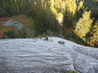
Saturday, October 31, 2009

Hibox Mountain - South Route - 10.31.09

Elevation Gain: 3900'
10 miles RT
Left car: 11:30 am
Summit: 2:30 pm
Back at car: 5:00 pm
5.5 hours car to car

Since it looked like my chances of skiing in October were going down the drain I contacted a few people to see what they were doing. Matt was talking about hiking up to McClellan Butte. I told him I wasn't interested as I didn't want to get snowed off the top, which has happened to me before. I suggested Hibox, and he and Josh seemed amiable to the idea, so it was planned. A late start was planned as the other guys were out late. (Well that is the excuse I am making for them.) We agreed to meet at the Mercer Island P&R at 9:30am. Due to difficulty finding it, we didn't actually leave until around 10am, or even a little after.

It was sunny in the morning, but was chilly and cloudy at the trail head. Matt told Josh and I that he and Shari would head for Rachael Lake while Josh and I headed toward Hibox. It started raining almost as soon as we hit the trail. The trail at times looked like a creek and at other points was heavily flooded. (6"+ of standing water) We stopped to admire Canyon Creek raging where I was able to walk across just a month ago without getting my boots wet. During one long stretch of deep water Josh and I ran across and to our amazement did not get any water in our boots. At that time Matt said he would meet us back at the car as they were going a bit slower, and attempting to navigate the big puddles with a minimum of wetness.

Josh and I continued onward. After a few more creeks/trails we reached the cutoff trail to Hibox in a hour from the car. This trail gets down to business quickly with steep elevation gain and quick switchbacks in the forest. Fortunately there was lots of old growth Douglas Firs to keep most of the rain off us. The trail was pretty good except for a few sections of overgrowth, and a waterfall we had to traverse. Shortly afterward we broke from the trees and it was starting to be a Wintry Mix of precip plus a bit of wind. The elevation was 4700'. We donned our shell jackets and continued. It became more difficult to follow the trail due to the light dusting of snow on the ground while it rambled through grassy slopes.

We kept getting closer, but the summit block was just a shadow in the thick haze of clouds and snow. We reached a point where the grass gave way to talus and snow, and the going got more difficult. It was starting to get slippery. I had doubts we would make the summit. We finally regained the trail and stopped to add another layer as the wind had picked up and it was even colder. I swapped my light liner gloves for a heavier fleece glove. (Which was still not waterproof.) We stashed our poles and continued to the summit block.

We surveyed the first gully we met. Josh thought it might go. I told him if that was the way, I wasn't going to summit. We checked the Peggy Goldman beta. It appeared we needed to keep going around to the right to reach the SE Ridge. Before reaching it, we got a good look at the final gully before the ridge. It was snow filled near the bottom and was less exposed than the ridge. We gave it a go. Josh was making quick time of it while I lagged behind a bit. After the deep snow in the gully, we had to climb some third class rock covered with snow, ice and slush. No moves were that difficult, but it was stressful grabbing the wet cold rock and trying to see which rocks were permanent, and which were removable.

We made the summit, and didn't stay long. We started making our way down as quickly as possible as both of our hands were numbing from the cold and wet. After a slightly more difficult down climb, we were back on more level ground making our way back to our poles. My hands warmed up immediately after I stopped grabbing snowy rocks, while Josh's took a bit longer. We hustled back down the grassy slopes as the snow started to fall more intensely. Back in the woods, we were once again sheltered from the precip and waited until we got back onto the Rachael Lake Trail before losing a layer. The hike out from there was uneventful except for the clever navigation of the wet trail.

If I had this to do over again, I would have preferred a helmet. This was just the sort of alpine experience I was looking for. A small bit of snowy/icy scrambling to reach a summit. There were no views, but that's not what we were after. I think in dry weather, the SE Ridge would be a nice alternative. The rock is supposed to be a little better, but there is more exposure.

My pics are here.

Wednesday, October 28, 2009

Methow - 10.26-27.09

There's snow in dem dar hills!

Jennifer had a few days off, but the forecast was "Winter Weather Advisory" for the Cascades and Olympics. We wanted to get out, and I decided we would gamble and see what the Methow Valley held in store. Surely if there was precip there, it would be snow, but probably not a whole lot.

We headed out Monday morning over Steven's Pass where there was already an inch or two on the highway. Once down the other side, it was already less wet in Leavenworth where we stopped to have lunch at South. By the time we had got to Cashmere, the sun was out and there were only a few light puffys in the sky.

This was the first time either of us had been on 97 north of Wenatchee. It was very scenic, bright and sunny. We were hoping to see Lake Chelan, but we didn't see it on the road we were on. We continued on to Twisp, and eventually Winthrop, where we took a little stop to buy the best peanut butter cups on the planet. Since it was in the afternoon, we decided to just explore a little bit. Jennifer had never been east of Washington Pass, so we would take a look around.

The goal was to find where to stay for the night, and to plan our day for tomorrow. Also we wanted to check out how much snow was up at Washington Pass. So we drove west on Highway 20 to the pass. Despite the light snow falling, the road was bare and wet. But according to the snow gauge in the woods at the pass, there was about 4-5" of snow. (It seemed like more.) The lookout site was not plowed, so we made that our turn around point and headed back into the valley.

We checked out possible camp sites on the way back. Lone Fir already was under 3-4" of snow and not plowed. So we ruled that out. We then drove into the Klipchuck campground to check it out. We discovered that the Driveway Butte trail head was located there, and that was to be where we would sleep for the night to have a quick start in the morning. Then we drove into Mazama where we checked out the general store a bit after driving out to Lost Creek. The pastries looked good, and since they had coffee, we decided to have breakfast there in the morning, which changed our campground to Early Winters so we would have less travel in the morning. Then we headed back to Winthrop to see about dinner.

We drove to Twisp hoping the Twisp River Pub would be open, but it was not. So we headed back to Winthrop where we knew the Duck Brand would be open. There were a few places open, but we settled on the Duck Brand, as we knew there would be some vegetarian options for Jennifer. While I like the breakfasts here, the dinners are a bit disappointing. After dinner, we headed out to set up camp. (Park the van.)

It was too cold and dark to wake up with our alarm on Tuesday and we slept in until 8am. It was a while before we managed to get over to the general store for breakfast. By that time we had changed out destination to Goat Peak due to its shorter hike time. We both had excellent pecan rolls and then we were off to the Goat Peak Lookout trail head. Since we had left the guidebook home, and didn't have a map for it, we asked in the store about getting there. There was a lot of forest road driving and it appeared pretty simple. We drove the road for a while and it got to a point where there was continuous snow coverage. We stopped at a lookout area and contemplated turning around. (We weren't sure if we would have another opportunity to turn around as the road was narrow and cliffed on one side.) We decided to continue and check the next mile marker to make a decision. (The road is 9 miles to the trail head.) We passed a five mile marker and I started to look for a turn around. We found it in a little side road just before a stock gate. It turned out that the snow was about four inches deep, and with four miles to go before the trail head, we would have been driving in some deeper snow for sure. If we had brought Nordic Skis, we could have skied the last four miles of road. Fortunately, I had little problem turning around and we headed back down to hike Driveway Butte.

By the time we got to the trail head it was around 11am, and not really a great amount of time to do a eight mile 3000' gain hike. But we started on our way. Early on, I had to run back down some 400' of elevation because I forgot to turn the headlights off on the truck. It was cold, and snowed on and off. Sometimes heavy, but mostly light snow fell. Around 4500' or so we were probably in continuous snow. We lost the trail briefly and it got a little windy. Jennifer stated she wasn't interested in completing a hike to the summit. I told her with the time and the weather, (By now it was snowing steadily and the wind was blowing quite a bit.) we wouldn't make the Driveway Butte summit. So I decided to change the objective to Point 5545 which was supposed to have a decent view. We stopped for a lunch break where there was an opening in the trees and the sun had come back out. I hoped to get a good view of Silver Star, but it remained buried under a cloud the whole time. Then I left Jennifer where she was and took a 15 minute hike up to tag the summit of Point 5545 and rejoin her. Near the summit, the snow was calf deep and soft. It was snowing again and the sun went behind the clouds. We moved quickly to get to lower less exposed terrain. The hike out was fairly uneventful, and as we went lower it got sunnier and warmer.

Once back at the car, we decided it was time to head home. We made the decision to head over Washington Pass as the road was better than Steven's Pass on Monday. Also, if everything went well, we would be home in time to actually have dinner at home. While taking the alternate way home might have led to staying overnight in Leavenworth, or eating dinner out somewhere due to a late arrival home. Driving Highway 20 (about a week before its likely close) was really amazing. There was about an inch or so on the highway at various points. (Like Washington and Rainy Passes.) I haven't seen so much snow high up there as I usually don't get out to Washington Pass until June. It was quite a "Winter Wonderland."

Pics are here.

Tuesday, October 6, 2009

Three O' Clock Rock - Big Tree One - 10.05.09

With Adam unemployed, we finally connected on a weekday outing. The original plan was to head up to Static Point, but this late in the season my inclination toward walking long distances diminishes. So we opted to go to Three O' Clock rock with its half hour approach.

Due to roadwork near my house, we got a late start. We finally got to the base of the route around Noon after taking a slight detour to check out the North Buttress side of the rock. It didn't take us too long to find the base of the route, but the beta said "wide crack" and the crack does not start until you are more than ten feet off the ground, so it was not immediately apparent. Since the third pitch was 5.8 and gear, it was decided that I would lead the odd pitches and Adam would lead the even pitches. That also meant that if we opted to, I could lead the fifth unprotected pitch.

There was a seep at the base next to a dirty corner. It was inevitable that one foot or the other would get wet/dirty. I chose the left foot putting it in the dirty corner while keeping my right foot dry on the rock between the corner and seep. There is no gear for the first eight feet or so before gaining the crack which made it a little more interesting than I was looking for. Once in the crack, I moved left to where it steepened. The first few moves on the steeper section was the crux of the pitch. There was a good fist jam, and then the crack widened to an off width that was difficult to jam. I placed a #4 cam and attempted an arm bar move only to slip off. It was barely a fall. I blame it partially on my ability to climb the crack, but also on the still wet/dirty left shoe I had. I eventually did a sort of lie back on the crack keeping my feet on the left side of it to get through the steep section. (one or two moves) The angle eases off after that, and I cruised up to a ledge below a finger crack. I climbed the slab using the crack for hand holds and gear. Once passed that I was at the belay.

Adam at the finger crack

I brought Adam up who complained about the dirt and moisture. I told him it would get better the higher he climbed. Once at the belay he we exchanged the rack and we discussed the next pitch. He headed up and placed a nut behind a flake and then started toward the slab that is the main feature of the second pitch. There are two bolts on it, and it appears quite run out. Adam's head was not into making the committing move onto the slab and continuing up the run out. So he backed off and handed me the lead.

I started up and used the gear he placed and then ran it out to the bolt. It is probably over ten feet to the bolt from that first piece of gear, but the climbing is 5.5 or under. After the bolt, the climbing gets a touch easier with knobs on the slab for feet. I was able to sling a small tree, and get a small cam into an overlap before making a committing move right to reach the second bolt. After the second bolt it is a few friction moves up the slab before gaining a flake roof. Once at the roof the climbing was really fun. I placed a piece just at the roof, and then moved right around it the surmount it. A few more pieces, combined with some friction and stemming allow you to grab a nice hold and haul yourself onto a ledge above the roof. The ledge is a horizontal crack, which I followed to the left to get to the bolted anchor. I used the crack/ledge for feet, but I'm sure it would also work for hands. Although, if I had used it for hands, I would not have been able to protect the traverse, which was about 15' long. (I had used all my big gear coming around the roof.)

Once I got to the belay I started bringing Adam up while contemplating the next pitch. The opening sequence looked hard and I was sweating it. When Adam got to the belay, we re-racked and I got prepped for the next lead. From the topo, we knew the route went up a shallow left facing corner, and would briefly cross over before gaining another shallow left facing corner. It appeared steepest in the first 12' from the belay and then appeared to ease off. So my concern was getting through an overlap about eight feet up. My moves went smoothly and while I was concerned with the climbing I found it relatively easy. But due to my concern, I placed gear often early on. (Adam counted something like seven pieces in the first 20'!) I think that shows that I was mostly comfortable in placing gear and that the climbing was not too difficult. It also shows the head space I was in when leading the pitch. After the initial overlap, the route is somewhat of a lie back or contrapressure routine.

After the first corner peters out is where I found the crux of the pitch and therefore the route. There was a nice stance above a small bush with a small left facing overlap that offered more contrapressure climbing. The move from contrapressure to on top of the slab was a difficult transition. I initially went up to make the move and couldn't figure it out. I down climbed the move or two back to a good stance and surveyed my options. I also wiped the slab where I was going to be putting my feet as it seemed a bit dirty when I initially went for the move. I went back up and made the first move with my right foot on top of the slab. I felt in melting down the hold until it stopped, and I was in a good stance to continue on a few friction moves before regaining hand holds on the other side of the slab and into the next corner. With only one cam left that would fit the crack, I had to be creative, and run it out. This was really no issue as it is usually not too wise to maintain a lie back for long periods while placing gear. I headed up the final corner which was a perfect lie back while slinging a small bush, and placing a cam and nut. At the top of the corner, I slung another bush before moving right onto the slab to the anchor.

Adam about to go into the last stretch of lie back.

Adam came up and said he found it to be quite strenuous. Especially toward the end. For me, that was where I felt I was getting in the groove and was almost sad that it ended.

On the fourth pitch the topo shows three bolts before reaching the belay. I could see one bolt about 25' straight up, but there was a line of two bolts heading rightward. Adam agreed to lead this one which put him out of his comfort zone. He quickly got to the second bolt, but instead of heading to the other bolt in sight, (Which neither of us, especially me, thought was on route,) he headed to a depression and climbed straight up about 20' above the last protection. He found a decent set of bolts with old rap slings on it. He set up a belay, and I followed. Shortly after the second bolt I noticed the real top anchor and headed toward it. This is when we realized that the other bolt we could see was on route and about halfway between the second bolt Adam clipped and the chains. I got to the true anchor and belayed Adam over. We looked at the fifth unprotected pitch ending at a tree and decided it was not worth it. From the chains we made three raps to the base. There was no issues rapping and we were back to our packs in no time. We relaxed a bit and checked out more of the crag before hiking out to the car.

Adam heading into the unknown.

This was a great outing. I don't know if it is because I hadn't climbed in three weeks, but I found the climbing really enjoyable. The guidebooks have this route as two stars, but I would say it is perhaps a three star route. While not particularly difficult the climbing on the first and second pitches is interesting and fun. (While surmounting the roof on the second pitch, I couldn't stop yelling down to Adam how much fun it was!) The third pitch was really nice too and for a brief while mimicked Diedre in Squamish. (Although it was facing the opposite way.) This was a nice outing, and one that can easily be combined with some other shorter routes at Three O' Clock Rock. While the air temps were warm (60°s) we were in the shade from the second pitch up, and subsequently wore poofys the rest of the route.