Tuesday, December 28, 2010

Snow Lake skiing - 12.27.10

Steve, Toph and I headed up to Snoqualmie Pass for a ski. Steve had all kinds of ideas for where to go in the area, but after some contemplating forecasts and aspects, we opted for a skin into Snow Lake.

There was one other car in the Alpental upper lot when we arrived and the blower was still clearing the lower end of the lot. We parked and geared up as two other cars arrived with skiers. We were trying to stall to let one of the other groups break trail, but we were all too ready to go before they were. So we headed up taking turns breaking trail. The ski area's cat had not yet groomed the road portion, so we were breaking trail from the parking lot. Occasionally we would hear shells from avalanche control above us. The echos they made from across the valley lasted longer and sounded like thunder.

We made good time reaching Source Lake in a little under an hour. We had followed a faint skin track from a previous day. Around this time a group of three caught us and introduced themselves. As it turned out two of the men where avalanche instructors including the locally renowned Gary Brill. They offered to do some of the trail breaking and for us to work as a team of six on the uphill. We agreed. And shortly after crossing under Source Lake and venturing out onto steeper terrain where we were not following a faint skin track, we let them take a turn at the front. It was around this point that instabilities in the snow were being noticed and we took care in the open slope above the lake to reach the next bench.

The course we took on the bench led us a bit too far east and the three of us departed the other group on a more northwestern course to our first run drop in. We snacked and transitioned. Steve took a short run down to check out the line. I then joined him. I felt the steep angle with the trees was a little too tricky for my skill level and traversed skier's left to see if it eased a bit. I passed over a first chute and when coming over the rib to the next a slab cracked above me. I got scared and just kept going to the other side of the chute to safe ground. Steve and I had some discussion and I told him I was going to stay put at least until he or Toph had their run. I was in a position where I could see a portion of their runs, and was safe.

Toph had enough of our talking and came down between us running the first chute and releasing a soft slab with a 8-12" crown. He rode it out to the rib between the chutes and after a pause, he continued down. Once at the lake he advised me to take the next area to my left as it was lower angle. Steve went next and rode the first chute on the clean surface until reaching the debris lower. My run was mellow at the top, but finished in the lower chute with all the debris. The debris skiing wasn't too hard, but transitioning from the packed debris to the deep powder resulted in Steve and I falling.

Now down at the lake we snacked and transitioned again. It was around 11:30am and we had plenty of time for another run. We followed the skin track of the other party up the basin below Avalanche Mountain. We caught them and soon took over duties laying the track. As we went into the trees up to the ridge instabilities in the snow presented themselves. At all the kick turns a slab would crack to a ski length. At one point as I (second to Steve) rounded a turn the cracks propagated multiple ski lengths. We got a running commentary on the conditions from Gary as we stopped frequently to do test blocks. Within 100' of the ridge we stopped as the last turn Steve made calved a block a dozen feet across without sending it anywhere. It was time to turn around.

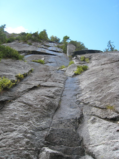
Our high point (Photo by Steve Machuga)

We transitioned and had a really nice run through the trees back to a tarn where Toph had to post hole to get through rather than split his board. One last steeper section to the next pond and we put the skins back on to ski out the last rolling bits before heading uphill once more.

Soon we caught the other group and we took over trail breaking duties once more. We opted to try and ride out the trees while they continued further west to make runs down to Source Lake in the open. Our last run was tricky. The steep slopes sloughed at every turn. The narrowly spaced trees made turns difficult. We took turns making our way down the slope until we were all in the more mellow open terrain above the lake. Some booting back to the other side of the lake got us back to the "luge run" out. Unfortunately, the luge run was not as fast as I am used to it being and it took a bit of effort to get out due to the slow speeds and rolling terrain.

This was a fun day. Although it was my first experience with an a slab trying to take me down the mountain. It was a scary moment, but I now have a better understanding of the situation. Lucky for me, Toph and Steve are better riders than me and can release slabs and ride them out making conditions for me safer. The second run off Avalanche Mountain was really fun. Steep treed skiing similar to Yodelin. It was also great to have Gary Brill present and constantly discuss the conditions. It was like having a free refresher class in avalanche safety.

My pics are here.

Sunday, December 26, 2010

Gold Creek Christmas - 12.25.10

I took the skinny skis up to Gold Creek for a short Christmas tour. Conditions were pretty good for the Nordic skis with lots of compacted snow on the road from snowshoers.

The road

It was cloudy and warm, and outside the track, the snow was wet and sticky clogging up the scales on my skis. I wanted to be back before Jennifer woke up, so I only went a few miles in. Once the trail left the road it climbed slightly and got more twisty with little ups and downs. This wasn't the greatest terrain for the skinny skis. Just before a clearing I took my skis off and hiked up to the clearing to check it out. Visibility was poor with low cloud cover. I hiked back to my skis and proceeded to head out. I avoided a downhill section in the track by cutting through the woods and eventually regained the track.

Once back on the road I checked out a small pond and skied over to Gold Creek to check it out. Wild tear drop icicles on a log over the creek:


Then a deep snow trek back to the road where the skis were more like snowshoes. Once back on the road it was a quick ski out to the car.

Gold Creek

This was a pleasant jaunt for a Christmas tour. The weather was nice enough and I got some exercise. The only complaint I would make is that there were too many unleashed dogs about.

Thursday, December 23, 2010

Wish List 2011 - Objectives

With the baby on the way, I'm going to not do my typical wish list for this year.

I figure that I will have less time, but perhaps not reduced as much as I currently anticipate. This coming year I hope to get on some things that I haven't done before, but keeping my options open for objectives will be key. Jennifer has already told me that I can have some weekends to climb, but whether that will change after the arrival of the baby is another matter.

So my only real goal is to climb Mount Stuart, hopefully by the North Ridge. I think some of the other big objectives are still there, but my guess is I'll be confined to mostly day trips. No big deal, but hopefully I can find partners and manage to be flexible and conform to the goals of my partners rather than go off on my own agenda.

No list this year, only anticipation.

Year End - Best of 2010 - Recap

I'll keep the tradition of posting before the end of the year again. Although with one weekend left, and no partners I feel pretty safe typing this now.

This year brought me out on lots of trips, but unfortunately not nearly as many as last year. I think this is once again due to lack of partners willing to do similar objectives. Or perhaps lack of partners with similar time freedom. I have a number of friends who complained about the weather, but I remember it being really nice for climbing most of the year, and a great summer for snow, ice and skiing with the not so warm temps and lack of precip.

This year I got a lot of new climbs in. Plenty of objectives I wasn't specifically planning on or wasn't really on the list for this year. Some trips were repeats, and some were on the list and I can now check them off.

Two events that stick out in my memory were trips to other states. First in February when a group of us visited Hyalite Canyon in Montana to ice climb for a long weekend. This was a pretty memorable trip and lots of fun considering the general lack of consistent quality ice in Washington State. The other trip was going out to City of Rocks to crag for another long weekend with Sabrina, Anne and Rod. That trip was a really fun time and a fairly new experience for me having never been there before. (And the long drive to crag for a few days.)

Other standouts are getting to climb Orbit in Leavenworth and Skiing South Sister and Bachelor in Oregon. And it probably goes without saying that climbing a classic like Liberty Ridge is on the list as well. In addition, the North Face of Mount Buckner was a nice trip and gave me a whole new perspective on the Cascade Pass area. Other notable climbs would be the winter ascent of The Tooth, and the lowly Mount Ellinor in the Olympics.

I just don't feel like I had a stand out this year. Some trips were wonderful and very memorable. Some were great purely due to the company I kept. Where did I shine? It is hard to say.

I'm inclined to say Liberty Ridge was the highlight of the year. But is that because it is a "50 Classic?" It was a great climb and a fun challenge, but left me feeling like it was too easy. I'll immediately discount the trip to Hyalite as I was sick and did not have the greatest time due to that. City of Rocks was really fun and a great time with great friends. But I also didn't feel like I climbed that well when we were there, and truthfully I wish I climbed more while we were there.

I think I am going to say the best trip of the year for me was to Bachelor and South Sister. [This marks the second year in a row I picked skiing a volcano.] Once again stuck without partners, I made the most of a situation. The weather was great, and I successfully summited both peaks on skis. Sure the skiing wasn't great, but it was more about the challenge of doing it and going alone that enhanced this experience. The solitude of having the summit crater to myself on top of South Sister was fantastic and an experience I'll never forget. Not relying on anyone else to have fun and be in the mountains is great, and is something I have to try not to overlook in the future. Cheers to not having partners and to a year that will be as productive as the last!

Wednesday, December 22, 2010

Leavenworth Ice - 12.21.10

Adam and I once again set out to find some ice on the shortest day of the year. This time we were headed to Leavenworth where we were sure we could find something climbable.

The plan was to head out early and get there just after the sun was up to start climbing. But a later than planned start and some travel delays put us in the Icicle around 9:30am. Icicle road was not yet plowed, and we slowly made our way to the Bridge Creek area to hike in and see if there was ice.

The road past the closure was well packed by snowmobiles and we made good time walking the short distance to our cut off into the woods. The woods were a different story. We did not bring snowshoes on the poor assumption that there was not a whole lot of snow out in Leavenworth. Well there isn't a whole lot compared to the west side, but we post holed our way up to the flow we were interested in only to find out it was not ready to be climbed. So we headed back to the car. That burned an hour of time so we headed elsewhere.

Our final destination was most likely the Snow Creek parking lot, but we decided to take a look at Chicken Gully on Icicle Buttress on the way there. We parked on the side of the road and gave it a closer look. There was enough ice to climb and protect early, but the slab was definitely mixed climbing and protecting it looked difficult. We once again hiked back to the car.

This time we parked at the Snow Creek parking lot. We opted to have lunch since it was already 11am and it would keep us from packing sandwiches up the trail. Since the trail receives steady traffic, we felt encouraged about our progress up the trail, especially considering there was a car there and some snowshoers ahead of us. We headed off at 11:30am and made good time up the packed trail. Then the snowshoers passed us on the way back to their car. A short distance beyond and we ran out of freshly compacted trail. But the going wasn't too bad. Someone had been there in the past week with snowshoes.

As we navigated the switchbacks, we ran into some snow drifts that were waist deep. I almost decided to stop when I couldn't find the trail on the other side of one particular drift. But we found the trail and continued. At some point around 2000' we were only following a boot track which we believed was at least nine days old. The narrow compacted track was buried under 8-12" of snow and falling off of it meant plunging down calf or thigh deep. This occurred frequently and Adam and I took turns breaking trail. At this point we were committed to getting up there. I think the challenge of making it to Millennium Wall had become the goal of the day.

A hike that takes an hour or less in the summer took us two and a half! We arrived at Millennium Wall where there were a few freshly downed trees making our getting to the base of the wall even more difficult. After more wallowing we got to the base where I didn't feel so up to leading the wall. I think mostly due to how late in the day (2pm) and my tiredness from trudging up the trail without snowshoes. We looked for an easy way around to set up a top rope. But the additional wallowing left us frustrated, and we opted to do a bit of "ice bouldering" at the base as a consolation. We shortly tired of that routine and packed up to head back to the trail.

On the trail we dropped our packs and navigated numerous downed trees to head up the trail a short distance further to get a look at The Goatee. Due to the low visibility, it was hard to tell the exact condition, but it did not look like it was climbable to me. After making our way back to the packs, we trudged back down the trail. Both of us at one time or another attempted to cut a switchback, but this proved more energy and time consuming than staying on the trail. We made it back to the car just as the remaining light left the sky.

It is frustrating to want to climb ice in Washington. If Adam was a skier, we could have gone out skiing. But we quested for ice and while we found some, we were somewhat out of time when we arrived there. I think I'm going to stick to skiing for the next few weeks until it looks as if ice is in.

My pics are here.

Monday, December 20, 2010

Hyak Nordic - 12.19.10

Jennifer and I went out to Hyak Sno Park to ski again. She had a good time last time and she is eager to get some type of exercise while pregnant. Fortunately Nordic Skiing is pretty low impact, and we went to Hyak due to the extreme flatness of the trail. (It is a converted railroad grade.) Jennifer is concerned about falling on anything remotely hilly, so the flat trails fit the bill.

Momma zipping along

Conditions were windy when we got out of the car. Not surprising being at a mountain pass and near a five mile long lake. I was wishing I had brought more clothing. We both started out with our poofy jackets on and eventually stopped to take them off once we had warmed up. I went considerably faster than Jennifer, but kept checking on her to make sure she wasn't overdoing it. We got a special treat in that the track got groomed while we were there. Although truthfully the track was in pretty good shape prior to the grooming. It would have been more special if we were skate skiing.

Along the lake

At some point Jennifer decided it was a good time to turn around. I told her I was going on further and would catch her before the car. I probably went about a half mile further before turning around. I was slowed by seeing someone I knew and chatting for bit. But I did catch Jennifer with at least a half mile to go before the parking lot. I think I did about six miles total.

This was a fun outing and Jennifer is caused less pain from skiing than walking. She is having fun getting exercise, and her exercise level had picked up since we started skiing because the pregnancy usually causes her to lose steam when walking.

Thursday, December 16, 2010

Scotty Creek Exploration - 12.15.10

Adam was interested in heading back to the Swauk Pass region where I had been during the weekend. I showed him few topo maps and we thought it would be a fun adventure to see if there was ice.

We got a fairly early start and arrived at the Sno Park around 8:30 am. There was not nearly as much snow as driving up on Saturday. We donned snowshoes and headed down the road. This time we were going to head downhill toward Scotty Creek. We also had the advantage that the trail was packed with some previous snowmobile traffic which made walking easier. Off the trail was horrible breakable crust conditions which impeded movement.

On the way down to the valley we passed a few small streams. While it was cold enough for ice formation, none of the streams were icy. And they were also too low of an angle to make sense to climb even if they were. Within an hour we arrived at Scotty Creek. While it is a named watercourse on the map, it is little more than a three foot wide low flow creek. It too was not icy. We followed the road a bit and came upon some mountain lion tracks in the road. The tracks appeared to be used a few times, but perhaps for only one trip back and forth. We followed the tracks into the woods a bit where they went to a 4" log to cross Scotty Creek. While it would have been tempting to follow them to a den, I am not a big fan of disturbing wildlife, especially if it could threaten my own life.

We turned around and started to head back. But we had decided to follow a watercourse up to see if it would produce ice at any point. We snowshoed through the woods taking turns to break trail. We found a short section of about twenty feet that would have made a nice easy WI2 climb, but it was just running water. Perhaps the recent Pineapple Express washed away any ice that had formed and these creeks were starting over again? As we went higher, we started to see some rock pinnacles, so we headed to them. We first crossed a road and then investigated the pinnacles.

It turns out these are the Swauk Pinnacles and they had some routes on them. Adam and I contemplated climbing one since we had a rope and draws, but when then sun went away, it became much less appealing. We then attempted to hike back using the road we had found. It was heading slightly downhill, and did not have the packed surface our previous road had, so the going was a little more energy consuming. At one point the road forked. We opted for the left fork which went uphill while the right fork continued downhill. This proved to be a bit of a mistake because in ten minutes the road appeared to end. We opted to try some cross country travel to make it back to the car. This tactic involved attempting to gain a ridge and then side hilling until we made the ridge top a mile or so further. Once on the ridge top going was a little easier but we were getting tired and wanted a familiar sight. After a few hours, we made it back to the road and had a half mile hike out.

Even though the search for ice proved fruitless, we enjoyed finding the rock pinnacles. It was also a fun exercise in cross country travel. We definitely got a workout as well. I was enamored with the mountain lion tracks too. There were also many other tracks we saw in the snow, some we could identify and some we couldn't. One set was possibly ermine tracks. I look forward to hitting the pinnacles in the summer.

Some pics here.

Saturday, December 11, 2010

Blewett Pass - 12.11.10

Technically it is Swauk Pass. The old highway went over Blewett, and the name was kept when they rerouted over Swauk Pass. I headed out with the intention of seeing if there was any climbable ice in the area, but as best I could tell there wasn't any. It appears to me that the terrain is not steep enough, but there could be other issues as well.

I took the skinny skis out on the ungroomed forest service road 800. I have always stayed away from the Blewett Pass area because it is an area where snowmobiles coexist with skiers. This is usually not that pleasant, but I wanted to give it a try. After a few hundred feet into the woods, I could almost no longer hear them and I had stopped coughing on the two stroke fumes. Then it was a peaceful ski in. If I stopped, all I could hear was the snow hitting my body.

Peaceful skiing up the road

There are a few turns in getting to the correct road on the ridge, but it was fairly easy navigating. A group of three women started off long before me, so I had a decent track to follow, although with how heavy it was snowing, it wasn't obvious to me if they had been there the day before or not. (It wasn't until I caught them at my turnaround point that I could confirm they were there the same day.) I think they were following a track put in earlier in the week. Unfortunately I brought my track poles which were way too long to use efficiently when my skis were 4-8" in a trench. It really turned out to work my shoulders due to that fact. For future reference, I'll bring shorter poles in this type of scenario.

Snowing hard

This route would be fairly scenic if it wasn't snowing so much. But I did get some nice glimpses at the surrounding area. There isn't a whole lot of hills, and it made for a nice workout plugging along the road. Some of the downhills I could coast a bit, but mostly I had to keep kicking or double poling on the downhills as the snow was offering a little too much resistance to just coast every hill. At about the three mile mark or so I stopped to have a bite to eat and turned around. I wanted to get home to see Jennifer off to work, and hopefully eat dinner with her.

By the time I got back to the car it was covered in two inches of fresh snow. It was coming down fast enough that I had to scrape the windows three times before I eventually left the Sno Park. Then it was a slow ride down from the pass and out to I90. There were a few cars in the ditch on 97. From I90 things didn't get much better and I maintained a ~35mph pace from Cle Elum to Snoqualmie Pass. The area between Cabin Creek and Hyak was the worst. A plow hadn't been by in a while and there were stiff peaks of snow between the wheel ruts that made driving difficult. Heading up the hill from Hyak plows had recently cleaned the road, so it was much easier. Then everyone got stuck behind the plows on the downhill side and there were a few cars in the ditch near the big right hand turn before the Denny Creek exit. Soon after that we were low enough for the change over to rain and the speed picked up to near the limit. The forecast hard rain was being delivered, and I had to turn the wipers on high.

Being from the Northeast US, I had never associated insects with snow. Having lived in Seattle for a while now, I have learned to see spiders and insects on melting snow in the Spring and Summer. But now twice this Autumn I have seen this one type of insect on the snow. A quick search on the internet makes me believe it is a snow fly or winter crane fly. I have seen a bunch of these walking around today, and a few weeks ago with Steve at Hyak.

Snow fly?

Tuesday, December 7, 2010

Jim Hill Mountain - 12.06.10

Steve persuaded me to join him and Seth on an exploratory ski trip on Jim Hill Mountain. Now I should have guessed with the term exploratory that this would not be a straightforward trip. But that did not cross my mind. So we left Steve's house around 7:30 am to park near Hwy2 on the road into the Steven's Pass Nordic Center.

We parked near a closed gate and skinned across the lot to a gated forest road. There was a skin track in the road and it was easy going up the numerous switchbacks. At one point the road took a right hand bend downhill and we contemplated our options. We decided to backtrack around the corner and head into the woods there as the undergrowth was not as severe. Within a hundred vertical feet we ran into our first obstacle of getting around some downed trees. After circumnavigating them, we attempted to stay a bit lower off the ridge to avoid the more wind damaged areas.

We traversed through some thick woods up and to our right and arrived below an area with many blow downs. It would have been arduous and time consuming to cross through it (if we even could.) So we passed under it and then continued on our course upward and rightward. The snow seemed good for skiing, but was deep and made for strenuous skinning on the steep treed slopes. We eventually made the ridge and crossed the tops of some open slopes before the terrain got too difficult for skis and we resorted to booting a hundred feet or so. We were hoping to ski off the right side of the ridge, but the terrain was steep (over 50°) and heavily treed. It wouldn't have been easy to even walk that terrain. We contemplated continuing in the hopes of finding a suitable ski path, but it was already after 2:30pm. We had maybe two hours of daylight left to get out, so we started to backtrack on the ridge to find a suitable descent route.

Seth dropping in the clearing (photo by Steve Machuga)

A little before the point where we started to boot was the decided upon descent route. We put the skis on and headed down. It was lightly treed at first but a fairly steep slope probably more than 35°. After only a few turns, I had to jump a downed log as there was no way around it. I was successful, but had to hit the brakes as soon as I landed. Then the trees became more dense and I side slipped and stepped down through a few sections linking a few turns and traversing where I could. I made a lot of downhill kick turn in tight spots. This probably progressed for a few thousand feet with Steve encouraging me the whole way down. I had some good moments like jumping/dropping logs without crashing. But I had some bad moments, especially lower down. I think the fatigue was getting to me and I crashed a bit including some real mix ups with my skis. I think my final crash had me sliding into a small tree like it was home plate.

Yes it really was that thick at times (photo by Steve Machuga)

We eventually made it to flatter ground where we donned headlamps and skins. After a short time skinning we found an old overgrown road and followed that through some alder. There was a moment when we had a clear cut above us and it looked like the road ended and Seth checked to see if the road switched back. It didn't and we continued through thicker alder before we quickly arrived at the road we skinned in on. Steve and I removed our skins, while Seth kept his on and his board split. From there is was the typical luge run down the now firm skin track until we hit the car. I was glad to have a good headlamp with a spotlight, because fast skiing at night is difficult without a fair amount of light.

Coming out by headlamp (photo by Steve Machuga)

Overall this was a fun trip. We now know this is not the way to go to achieve turns on Jim Hill Mountain. It was a fun outing and it pushed my limits in skiing. So next time I am in terrain that is more sedate I should be feeling more confident.

My pics are here.

Saturday, December 4, 2010

Nordic at Hyak - 12.04.10

I discussed with Jennifer earlier in the week about getting a Sno Park permit for this winter. I wondered if she was interested in skiing and would feel up to it being pregnant. Jennifer was interested in seeing if she could go skiing and Ken wanted to go, so we headed out with him today. Jennifer didn't want to head to Cabin Creek due to the hills. She didn't want to fall. So we went to the Hyak Sno Park to follow the railroad grade.

The temp read 32° in the parking lot, but it felt colder. I put on all the clothes I had and couldn't wait to get moving. Jennifer had packed more warmly and wore a large down poofy to start skiing. Ken had little clothing but he hoped as I did that skiing would warm us. It didn't work for Ken, and he headed back to the car after we were out for 10-15minutes. I kept skiing along in an effort to get to an outhouse to pee. Once there, I warmed up a touch and started back. I saw Jennifer and she told me about Ken heading back to the car. I said we should head back too.

An interesting outing for the first of the season. Ken said one of the reasons he turned back was to not sour himself to the rest of the season with a bad first outing. While it took me the whole time to get back to the car before I actually started generating enough heat to perspire, it was a fun time. The snow conditions were better than any we had track skiing last winter. Soft snow, well packed and nicely groomed. Only there was a large group of boys (scouts?) that were snowshoeing on the groomed trail, and that is just bad etiquette. It also marks baby's first ski outing!

Baby on board

Tuesday, November 30, 2010

Hyak Skiing - 11.29.10

Went up to Snoqualmie Pass with Steve to see what looked like we wanted to ski it. After wallowing around in waist deep snow the previous day I thought skiing would be a better option than chasing ice. We drove around scouting slopes for a bit before settling on Hyak with its easy access, and well covered slopes. Of course, it had been pretty well skied out during the weekend, and probably by dawn patrollers from earlier in the day.

My backside run (photo by Steve Machuga)

We skinned up a well worn track and passed a few guys on the way up. At the top we opted to ski a little to skier's right of the main slope between some trees where there weren't as many tracks. Steve tested a rollover for avalanche danger and then we were off rejoining the main slope about half way down. There were two other skiers coming down and they informed us the backside was less tracked out, so after our first run we opted to head down the back side.

Steve on the backside

There was lots of snow cat activity at Hyak as workers are busy getting the two new lifts ready to open this season. We arrived at the top and had a much nicer run down the less traveled backside in the newly cut run down to the base of the back side chair. We skinned back up the cat track to the top and had a final run down a steeper section further skier's right on the front side before heading back to town.

Hotshot

It was nice to be out skiing, but the skiing was not of great quality. The snow was skied frequently to the point where some sections developed moguls. The back side run was much nicer though. Like I said, I can't complain I was out, but the quality of skiing lacked.

Sunday, November 28, 2010

Alpental Ice - 11.28.10

So the quest for ice begins. (Earlier this year due to La Nina.) Adam and I were thinking of getting out earlier in the week to check conditions at Alpental. Early reports were not positive, so we delayed. I was hoping to head to Leavenworth this weekend, but that plan fell through, and so a quest for ice at Alpental was planned. I was going with Rod, while Adam, Zach, Steen and Kristy were also coming separately from us.

Rod and I were one of the first cars in the lot and we geared up in what felt like weather that was too warm. We commented that we might be "taking the tools for a hike" as Washington State ice climbers will often say. We donned snowshoes, and hiked into Alpental Falls where we hiked up to the falls.

Hiking up to the falls

Alpental I looked in from the base. There was a bit of a boot track to it, so perhaps it was climbed in previous days. I didn't like the drum like nature of the right side as it seemed not to be bonded to the rock underneath. Right in front of me was a snow gully like feature which I told Rod I'd give a try at. So we geared up and I started climbing. When I got to the first step, I didn't feel comfortable with the thin ice, and down climbed off the route collecting my screw on the way. We decided to head up valley to see if anything else was in to climb.

Around this time our friends showed up and went past us before we regained the trail. Zach and Adam headed back to the car to get their snowshoes for the off trail travel. We joined the women near the base of Alpental IV. Rod and I inspected the possibility of climbing Alpental IV while the other group set up some top ropes in the woods. We eventually joined them as neither of us wanted to lead any of the falls. Way too much running water.

So we all got to top rope three short lines in the woods. A fairly thick line on the right, a mixed (mostly rock) line in the middle, and a mixed (mostly ice/snow) line on the left. After we all tired out and started to get cold we took the top ropes down.

Kristy on the fatter ice

This outing went about how I would have expected it to go. I was happy to use my (new to me) tools and go leashless for the first time. Surprisingly, I did not over grip. But I was very concerned about dropping them as I have yet to build my umbilical. The freedom of going leashless was wonderful, and I was surprised that it did not take much for me. Perhaps because I haven't climbed ice in a while, I forgot about relying on the leashes. I look forward to more leashless climbing.

Monday, November 22, 2010

Crystal Backcountry - 11.21.10

Steve invited me to join him, Sebe and Toph for some skiing. The decision was made to head to the Crystal backcountry and so I tagged along. There were flurries, and a temp of 33° when Steve cam to pick me up in Seattle. We met Toph somewhere south on Renton, and continued in his car. I don't have a great idea of where we skied, but best I can tell we skinned up under the Gold Hills chair and made a few runs in the Pickhandle Basin.

The chair we skinned under was not yet open, due to lack of coverage. No rocks, but plenty of shrubs visible. It didn't impair our skinning and soon we were at the top of the chair ducking into the woods. This is where it got slow. The trees were narrow and we spent plenty of time avoiding downed trees and forcing through narrow gaps between other trees. If there were a few more feet of coverage, we would have had it easier, but these were the cards we were dealt. At one point we even booted a bit due to a steep section with many trees. After that, the forest opened up a bit and we started skinning again until booting the last thirty feet or so to the ridge. We then skinned on the ridge, which was not that great and we should have booted. We got to a nice area out of the wind to drop in and transitioned over.

The snow was deep! Deepest snow we had experienced yet on the day was our first run down. Deep powder, and no rocks. A really fun run. Wasn't too steep, probably a blue run. I had a little difficulty starting out as I was third in line and wanted to go farther right to get into cleaner snow. The snow was slow, and the traverse almost stopped me before I rounded a small tree and turned downslope.

My first run (Photo by Steve Machuga)

We gathered at the bottom and headed up again to a different location on the ridge and a sub bowl on the original run. We found a fun wide chute to run and transitioned back to downhill. Steve went first on a bold run of an arete which slid a bit after he made a few turns. I was third in line and enjoyed the run, but it was definitely a little more avalanche prone and a bit rocky in spots. At the bottom we skied through the tree for a bit until we came to a meadow.

My second run (Photo by Steve Machuga)

We all figured that the terrain would drop again in the woods on the other side of the meadow, so Toph was going to post hole across and then put his board back on while us skiers would shuffle with no skins. Unfortunately, on the other side of the meadow the relatively flat or rolling terrain continued and we all skinned up to make it out of the woods. More unfun tree skinning and we were finally back at the top of the lift ready to make one last run to the car. No issues on the final run and soon we were driving back to Seattle.

This was a fun outing even considering the poor skinning in the trees both up and down. I skied well, but not great. Not bad for almost five months of not skiing. I look forward to getting out again soon.

My pics are here.

Thursday, November 11, 2010

Some Aid Practice - 11.10.10

Since we were blessed with another nice (not raining) November day in Seattle, Adam and I decided to hit the north wall of the Mountaineers Clubhouse for some light aid practice. It had been over a year since I had been in aiders, leading or following, so it was shaking off the rust.

I geared up and led a pitch with a short traverse to the chains at the top. I continuous ran into problems the whole pitch with my easy daisies, not having cut them loose and occasionally clipping through them. These issues stayed with me at the anchor as I had to lower down and right to get on rappel. It wasn't pretty. Once I sorted all my issues, I rapped and Adam followed.

Adam started with difficulty until he sorted the easy daisies and got his jugging setup right. Then he cruised to the top and re-aided the traverse to the chains. He enjoyed it, but we didn't have time for him to lead a pitch, so we packed up and called it a day.

Friday, November 5, 2010

Leavenworth - Givler's Dome - 11.03.10

Adam and I discussed an outing, but I had to be back in town in time for my class. So cragging was an obvious choice. I wanted to do something that involved placing gear and not just clipping bolts, so I convinced Adam to head to Leavenworth. Being that it is November we didn't get an early start, as it is usually a little too cold in the mornings to make climbing not fun. When we arrived in the Icicle, the temp was around 36° and clouds/fog were keeping us from direct sunlight.

November morning in the Icicle

Our plan was to hike up to Givler's Dome to climb Givler's Crack. This extra 45 minutes of hiking would give us more time for the day to warm up. Within ten minutes or so we were above the fog and receiving the warmth of the sun. We got off route a few times on the way up and had to scramble a bit to get back on track, but eventually made it to the base.

Since Adam was not up to leading the route, I would lead both pitches. And for whatever reason, the first pitch scares me. Perhaps because I flailed on it the first time I climbed the route. I've climbed it twice since then with no problems though. I placed a nut high and started up. I found the hands difficult as I had placed the piece where it interfered where I wanted to put them. I down climbed to the ground and restarted. After a few moves, I placed a second piece which then interfered with further hands. But I was able to move past it and continue. I finished the pitch feeling like it was the worst I had ever climbed it.

I brought Adam up and he had to hang on the rope to remove my stuck #4 from down low. He then climbed the second half of the pitch not using much crack technique for his hands. He arrived at the belay stating the first section wasn't as hard as I made it look.

Adam on the first pitch

We exchanged gear, and I was off leading the next pitch. I don't recall how I previously climbed it, but this time I wanted to try and keep my feet in the crack as much as possible. This proved a bit uncomfortable, but I persevered. Instead of going all the way to the top, I set up an intermediate belay once the angle eased, so I could see Adam climb. Unfortunately, the best spot for a comfortable belay did not offer a good view of the pitch, and I only got pics of him on the last portion of the pitch.

Adam on the second pitch

When Adam arrived at the belay, he kept going to the top finishing with the easy section to the boulder. We quickly hiked down to our packs. We took a lunch break and basked in the sun before heading to another destination, Rare Earth.

Adam finishing the route

For the second time this year, the Rare Earth crag has eluded me. Adam and I hiked around trying to find it, but wasted all of our time. Even consulting the newer guide book was unhelpful as it shows the crag to be down and right of Mastodon Roof. Turns out it is really down and left of it. After almost two hours of scrambling, hiking and bushwhacking, we found it but not with enough time to complete it and get back to Seattle. So we made note of where it was at, and hiked out.

It was great to be out on such a beautiful November day. It was a bummer that we only climbed one route. And even though we pitched it out to three pitches, it really is only two. I think we'll have a better idea of how to find Rare Earth the next time as well. I think this trip satisfied my urge to get out and rock climb, and perhaps my next trip this year will be to climb snow or ice.

Tuesday, October 19, 2010

Esmerelda - 10.18.10

I got to go out with Steve for what seemed like the first time this year. (I wanted to say Summer, but it is no longer, and I doubt I have been in the mountains with Steve since Spring.)

Due to my long hard day the previous day, and Steve bringing his wife's cousin along, we opted for a fairly mellow scramble of Esmerelda Peak in the Teanaway.

To avoid traffic we started a touch late, and arrived at the De Roux camp trail head after 9:30am. We hiked up the trail and took frequent breaks. After consulting the map we ignored the turn off point thinking it was just a cut off a switch back. We went too far and arrived at Gallagher Head Lake. We hung out a bit on some wooden benches taking in the scenery and getting cold. We altered our approach and headed cross country to the ridge to climb.

With some light bushwhacking we were on rocky slopes picking our way up the mostly solid terrain. With a few sections of third class rock, we were on the summit, taking in the views. We hung out for a while and then headed to the next "summit" on the ridge to the east. We continued to the next and then developed our plan to hike down a different way. A few loose third class bits got us down the ridge where we followed game trails down most of the way back to the trail. The slope was steep and loose and only got easier as we descended. I saw a fat garter snake on the way down and then we hit the trail and hiked out.

Scrambling the second summit (photo by Steve Machuga)

This was a fun trip and a good trip to do after the bruiser I had the previous day. It was fun to be out with Steve, and the summit of Esmerelda offers pretty nice views in all directions. It took almost as long to do the round trip drive as it did to climb the peak. Steve and I discussed how the book listed it as a T3, but we found it to be fairly easy with only a few steps of 3rd class. However, I am beginning to think that the technical scramble rating used also increases for navigational difficulty. But who knows. Yet another nice day out in the mountains.

My pics are here.

Exfoliation Dome - Westward Ho! - 10.17.10

Rod and I planned to get out on Sunday. Our goal was going to be The Blueberry Route or West Buttress of Exfoliation Dome. We wanted to get an early start, but not so early we had to ascend the "granite sidewalk" in the dark. We left Seattle around 5:45 am and arrived near the parking area around sun break.

However, we did not fully comprehend the beta for parking. Which I read as "park at the granite sidewalk." Other beta said it is the second wash. Well, we parked where a slide blocked the road and we walked the road for ten minutes before deciding that it must be the slide we parked at and proceeded back. The initial section was fairly wet, and we bypassed it in the woods before descending to the granite slabs in a few minutes. The slabs were still fairly wet and dirty, and I opined that we may not be on route, but we continued. We met an area that could be considered "the Grotto" and we climbed out of it on the left via a horizontal tree. At this point I continued in the woods as there was no undergrowth, and the going was fairly good. I found this better compared to the dirty wet slabs. Rod stayed on the slabs before eventually joining me in the woods.

At a section that looked like we were near getting out of the trees I suggested again that we may be off route. But we both managed to tell ourselves everything would be clear after the next bit. Rod started up some scary, possibly 5th class slabs. I didn't like them, so tried to bypass them around the left. But the slabs went on for a bit, and when I rounded the corner, I saw Exfoliation Dome about a quarter mile to the east. Rod was out of sight and high on the ridge above me. After some shouting we worked out a plan that would have him descend to me and then we would continue to the Dome from my location.

As he descended, I crossed an avy path bushwhack to a stand of trees. I waited for him there. He ended up having to rappel to get down and eventually reached my location where I was cold. It was not almost 11am. I told him there was no way we could keep the goal of the Blueberry Route, and we would have to settle for Westward Ho! a shorter mostly bolted route. We continued toward our route across another avy path into another stand of trees. On the other side lay the true granite sidewalk and we made some difficult moves getting onto it from the wet slimy corner that bordered the trees. The sun had yet to shine on the sidewalk, and it was still a touch slick from the morning frost. (It was 28° in Arlington as we drove through.) Rod and I gingerly made it up to the base of the route where we had lunch.

We actually made it halfway up the first pitch of Blueberry Route where there was a nice ledge and two rock seats. We had the crag all to ourselves, and geared up there. We packed the rope, water and a couple of poofy jackets and we were ready to go. We had brought a full rack for The Blueberry Route, but the beta for Westward Ho! was specific on what gear to bring. We decided to bring the full rack minus a few items just in case. I led up the first bit which completed the first pitch of The Blueberry Route, a wide crack up a slab. Unfortunately, a #4 didn't really fit in there, and made me wish we didn't bring it. I tried going further, but realized I would run out of rope if I intended to make it to the top of pitch one of Westward Ho!, so I backtracked and anchored and brought Rod up.

Rod led out on the next pitch, but skipped a bolt he didn't see before crossing the gully. then he had difficulty committing to the final move to make the first true on route bolt. He did finally come up with the right sequence, and then balked at making the moves above the bolt. He made a few attempts with very short falls, and a bit of hanging as well. He even attempted a lower and climb of the pitch on top rope to the bolt before he told me he wasn't feeling it and asked if I could give it a go. I lowered him back to my position and we switched ends of the rope before I headed out.

I climbed to the bolt on top rope. I initially feared what the pitch might look like as I often think of Rod being able to climb harder routes than me. I got to the bolt and found it to be fairly typical 5.8/5.9 slab. I eyed up the features, and climbed to the next bolt, clipping it. I did the same for the next bolt as well. Then there were some interesting moves up an overlap and leftward under a medium sized attached flake before rounding a corner and heading up after clipping another bolt. The difficulty eased off and I ran out of rope about four feet shy of the anchor. Rod tore the anchor, and I reached the anchor and brought him up. I think he slipped once, but otherwise had no major difficulties with the pitch on top rope. When he got to the belay, we discussed if he was up to leading it. This pitch was rated at 5.8 unlike the 5.9 previous pitch. He said it was now or never and took the rack and started up.

It appeared he may have been a little to the left of the route when his feet gave way while attempting to make a clip near the crux of the pitch. He took a fall that where he started on his feet, but finished with him skidding on his side down the slab. I asked if he was OK, and he said yes. I told him nice work in warning me about his fall, as he said "take" or "falling" just before he popped. He continued back up and had no issues with the rest of the pitch. I arrived at his location and we briefly consulted the topo before I set out on the third pitch.

This pitch was the easiest of them all, but once again rated at 5.9. The early section of the pitch was 5.6 and had at least 12' of spacing between the bolts. I had a bit of a scare between the widest spaced bolts when I was a bit left of the route on more lichen covered rock, and my left foot blew out. I did not fall, but it made me careful about getting the next bolt. The crux of this pitch did not at all feel 5.9, and I cruised the final section before bringing Rod up.

We swung leads and he headed off on the final pitch. From below, it was noticeably more dirty than the previous pitches and headed up through some overlaps before reaching the chains. Rod led this pitch and slowly overcame the overlaps placing tiny cams along the way. This was really the only pitch that required traditional gear. I hurried up behind Rod, and we began to rap the route.

No issues rapping, and we rejoined the rest of our gear at the base. We packed up and we started the long journey down the granite sidewalk. We were somewhat hampered by our lack of having not taken the sidewalk up and had to pick our way down like it was new to us. Fortunately the descent started easy with sandy ledges to skier's right of the slabs. Soon, we had to get on the slabs, and followed some corners and other features down. Then there were a few blank sections. I don't know if it was because I had a heavier pack, it was late in the day, or I had been sick, but I couldn't handle walking down the slabs at this point and reverted to crab walking. This proved not to be much slower than me walking, but we weren't making the best time. We eventually reached some bushes above The Grotto. We bushwhacked and down climbed a bit on the tree (mentioned in the guide) before getting into the grotto. The remaining slab bits were fairly wet and dirty and we were slow avoiding all the water down to where the path became boulders and not slab. Around 100m later, we were back at the road with headlamps on hiking back to the car. Turns out there is a nice parking area just after the granite sidewalk, but somehow we were unaware of that in the morning.

Overall this was an interesting trip. I am sort of bummed about not getting on the route we anticipated, but not surprising considering we turned the hour approach into a four hour ordeal. Westward Ho! was great, but descending the granite sidewalk I found not so fun. I think it will be a while before I head back to Exfoliation Dome again.

My pics are here.

Wednesday, October 13, 2010

Static Point - Lost Charms - 10.12.10

I wanted to get a multi pitch trad climb in before the season really ended. Adam was game for something and we set about a plan. Adam wasn't interested in something too hard, so we came up with a plan to climb Lost Charms. Adam tried to suggest climbs I had not previously done, but I wasn't feeling so great and opted to do something I know and would enjoy.

Unfortunately I forgot how arduous the approach feels for Static Point. But in 90 minutes we were through the wet overgrowth and out of the convergent zone jungle where the sun started poking through the clouds and warming us up. We geared up leisurely before doing the scramble to the Lost Charms tree. Once there I debated about the real first pitch and even considered doing the Pillar first pitch. Last time I was here with Julie, we took more of a Spencer's Spaceport approach to reach the anchor, and this time I wanted to climb the real first pitch.

We looked at the topo, and I eventually set out in an upward direction to the right. I aimed for a seam shown on the topo and was able to plug a tiny nut in before stepping out onto the slab with the seam. It turns out the seam took some gear and I was off. I had to go through some run out sections and eventually reached the fixed piton listed on the topo. From there I ran it out right to the belay on ledgy ground. This was the same station Julie and I were at, but now I believe it to be the correct belay station and not Spencer's Spaceport. When Adam arrived at the belay he stated the first pitch scared him too much and he was not interested in leading. I found that OK, as this route was well within my abilities to lead every pitch, and hopefully not get too mentally frazzled.

I led out, this time on the correct second pitch. It went up the mossy corner and broke left for a large ledge that became a right facing corner. It was easy terrain, which was nice as it was not well protected for the traverse. The corner section was really fun and protected decently. Above that there were a few choices. I went straight up as I thought that looked like the right way. There were a few unprotectable moves on some shallow cracks/seams before reaching some easier knobby terrain just before a big ledge that marks the end of the pitch. I brought Adam up and we had lunch. The remaining pitches would be on familiar terrain.

I hadn't led two of the three pitches we were about to do, and I was quite excited about the prospect. After our lunch break, I headed out on the next pitch, which climbs a blocky corner to the right of the pillar and then heads through a more blank slab before gaining the Bridge Flake. I found the moves easy, and while the crux of the pitch did not protect well, the rest of the pitch did. I didn't have gear for a belay at the end of the flake, and had to go a few steps further to build an anchor for the belay in a less comfortable stance. Adam cruised the pitch on top rope and declined the offer to lead the fourth pitch so I was on my way after we sorted the anchor mess.

The fourth pitch I remembered to be fun, and it was. Gear was a little tricky and I sewed it up where I could, and ran it out when I had to. Mostly it was reasonably protected, and I ran it out on the ledge to the anchor location. I set up another gear anchor, and brought Adam up. He attempted to climb a variation different than mine, but got back on track once he realized the flake he was on petered out. We re-racked, and I was off on the crux pitch.

I hesitated a touch on the lower portion where there are some thin ledges to gain a ledge system that bring you just below the bolt. Once there I clipped the bolt, and eyed my foot placements. About four steps up the slab, and I was able to grab the flake. It seemed so much easier than the first time. I then lie backed around the corner and headed to the next belay. The terrain was not well protected and it was traversing left. I contemplated the easy out of heading to the 5.8 finish, but did not want to deal with the rap route that would lead us to. So I continued with rope drag to the dirty corner for the finish at the chains. When I brought Adam up, he commented about the pitch three section being potentially harder than the true crux, and then we contemplated finishing the route by doing the sixth pitch. Adam told me it was around 4pm and that was all I needed to start rappelling.

The rappelling was a bit awkward as they stations are usually longer than 30m apart, but not even 50 m apart so there is a lot of extra rope leading you to think you can skip a station. Once at the bottom, we snacked and packed up for the uneventful hike out.

This was a fun route to return to two years after my previous climb. I wanted to check out other routes in the area, and now I have a better idea. There is no way I'd be leading most pitches of Online any time soon as the run out is a little unsafe for my pleasure. But The Pillar looked tamable, and I tried to spy The Curious Cube as much as possible, but it was difficult to see protection opportunities. Compared to Darrington crags, Static Point is more run out, and in a fashion that does not make sense to the mind. For instance, the Green Crab Traverse has a .10b crux between the first and second bolt. A fall there leading to bad consequences. Of course, they had to place bolts where they had good stances, and the crux was not a good stance. Lost Charms protects well and I did not mind most bits of run out. I'll return to Static Point, but not too soon, as I do not imagine there are too many other routes I would do there.

My pics are here.

Sunday, October 3, 2010

Squamish - 10.2-3.10

I finally got someone to go to Squamish with me this year. The weather was looking good for what I am sure may be the last weekend that I would attempt to go up there. Matt Jillson was game and we opted for a plan of heading up casually on Saturday morning and staying until Sunday evening. While I had big dreams of climbing on the Apron Saturday and Sunday after talking to Matt in the car we opted for a day of single pitch cragging on Saturday and to get some multipitch action in on Sunday on the Apron.

It was interesting to see the improvements of the Sea to Sky Highway. Although there did not seem to be many. But we did notice the signs were now in English and Salish, to which Matt said Squamish has a seven in it. Indeed it does.

When we arrived we set up our tent at the Chief camp ground. And, like last year there were no envelopes, so we couldn't pay, even though I actually had the ten Canadian Dollars needed. We opted to check out Murrin Park as our first destination, and hit the Sugarloaf area to warm up. There are some easy four star routes there, and since we both didn't sleep well, we wanted to warm up easy. When we arrived at the cliff, ropes were on most routes, but no one was in sight. I led Little Spark first which was a wide crack followed by super easy blocky steps near the top. We found a group getting instructed up top, and walked off for our next route.

Matt led Lieback Crack, a three star 5.7 which we both awkwardly liebacked higher up. It didn't feel right the way I did it, but I could not figure out another way to do it. We watched a pair climb it on top rope later, but neither really did any liebacking on it.

I then led Magnet, another four star 5.4. This route was really easy, but really fun. After we both climbed that we set the rope up above Power Smart a fun 5.8 slab that didn't look like it protected well. (And our top rope laps convinced us of it.) After that we opted to head to Smoke Bluffs to see what we could find.

At Smoke Bluffs we ran into Bram and his friend going to climb Split Beaver, a difficult .10b offwidth. We headed to Neat and Cool in an attempt to climb Cat Crack. However, the Neat and Cool crag was overcrowded, and probably an instructional group as is typical of Smoke Bluffs on weekends. We looked through the book and found Laughing Crack which is above Zombie Roof. Since it had a fixed line to reach, we figured not too many people go up to climb it. Upon climbing the fifth class rock with a chain, we reached the route to find another party just packing up. We geared up for the route and Matt led it. This was an awesome five star crack route that had a nice position and was a joy to climb. (Except for the pain it inflicted on my feet as I jammed the smallish crack.) We rapped off and then climbed down the chain to find another objective.

Over at Penny Lane, we found Quarryman, another five star route. It was later in the day, and I wasn't feeling too much like leading, so Matt once again led. He climbed it well, and brought me up. This route was noticeably harder than the previous route and had some interesting moves exiting a corner and going around another to finish with a crack. We briefly toproped Popeye and the Raven, a .10d slab before calling it a day and putting our sights on tomorrow.

At dinner we made a plan to wake around 6am to be climbing by 7am on Sunday. We expected this to be a good time for the light to be on the rock. When we awoke at 6am, we snoozed twice to 6:30 and then decided to stay in until 7, as it was still dark and damp outside. We figured we needed some sunlight to dry the rock out a bit. After our multiple snoozes, we awoke at 7 to a very cloudy damp day. We prepped for our climb and eventually headed off toward the Apron, walking from the campground.

Everything around us was wet, and this was more apparent on the trail up where some of the rocky scramble sections were dripping. We arrived at the base just as the second of a two man rope team left the ground to start the first pitch of Over the Rainbow. We spied the route, and decided to stick with our original intent of climbing Sparrow. We geared up and Matt led off. The first pitch had only four pieces of pro in around 40m of climbing, including a traverse over somewhat easier slabs. I followed and headed up the second pitch which had some run out before a cam could be placed and then up to a bolt. A bit above the bolt was what I felt was the crux of the pitch. A short steep bulge that required careful footwork to get atop of. After that I wandered the slabs eventually reaching the belay tree. I brought Matt up, slipping at the crux. I belayed him down the next very short pitch to a tree, and followed shortly afterward.

By now we were feeling wetness in the air. We were in a cloud, and it appeared to be getting wetter. From the belay we could see what almost looked like rain on the pitch above us. It was a fine mist surely getting the rock wet. Matt set out and chalked his shoes in hopes of drying them out from standing in wet needles and mud from the short down climb. He climbed a crack and then set out on a short slab. I followed, but the rock got more wet by the time I arrived at the slab, and I slipped. I slipped again just hanging on the rope. I dried my feet and quickly scampered to the ledge. We made a quick gear change, and I started out on the next pitch.

I continued on the ledge before slinging a tree at the base of a line of bolts. The first bolt was ten feet or more up on a slab that was now quite damp. My first moves on the slab were slippery. I had a foot slip out just standing on the lower angle portion of it. I couldn't imagine reaching the first bolt. I kept drying my shoes on my pant legs. I chalked my hands, but they became wet when contacting the rock. I tried to wipe away the wetness on the holds, but it didn't help. Then I got the idea to hit my chalk sock on the holds I was going to use to dry them off, and perhaps keep them dry. After every move, I'd take the chalk out and chalk more holds. Mostly this was an issue for my feet, as my hands did not need as much friction to keep me on the rock. I eventually made the first clip, but the rock was so wet I could not continue up a friction slab. I hung. I discussed with Matt what he thought. I watched him rub his foot on the slab below him, and he said he could not do better. He wondered if I could aid through the section. I couldn't, but thought I could attempt to stand on a bolt and then clip the next (about eight feet apart.) But there was a big stretch of lower angle terrain that did not appear to have bolts, how would I reach it? Plus there were two more pitches of 5.8 slabs above the 5.9 slab I was attempting to climb. Finishing was looking impossible. I thought about waiting out the clouds, but who knew what would happen? I finally conceded to being lowered and climbing back to Matt. [After looking at the guide book Sunday night, I realized I was trying to climb the a .10b pitch from "One Scoop" that was wet, and that the 5.9 was a less bolted route to the right. Not sure I could have got up that either.]

We discussed the option of rappelling, but it did not appeal to us. Especially considering we would have to retrace the Apron approach trail. Matt asked if there was another route we could get on, perhaps Banana Peel? I looked at our topo, and sure enough Banana Peel shared the ledge we were on. And the remaining pitches were mostly 5.4 with a small bit of 5.7, much easier to climb in the wet. I led out through some trees and bushes and connected with Banana Peel in about fifteen feet. I continued on the Banana Peel's fifth pitch. We swung leads from there on easier ground before reaching Broadway, when the rain started in earnest.

We scrambled off Broadway to the woods and donned our approach shoes for the hike out. The dense canopy kept it a bit less rainy in the woods, but the two locations with fixed lines on the hike out were super slippery and a bit sketchy. We eventually came back out to the trail unscathed.

We did a little poking around to find Dreamcatcher. It is almost in a cave surrounded by boulders as big as houses. There was a climber working on it and we watched a bit before scrambling back out of the area and onto the trail for our drive home.

This was a fun trip, although not as productive as I would have liked. We did get in some four and five star routes and did make it to Broadway even if we had to finish on a route I had done before. Matt and I discussed trying to get the rest of our crew to come up for a long weekend and really have fun.

My pics are here.

Thursday, September 30, 2010

Mount Thompson - 09.29.10

So it was time again to make another attempt at Mount Thompson. After last year's long walk in the rain, I was ready for another try. This time the forecast was for solid sun and I partnered up with Adam. We were going to use the super secret shortcut to shave 6 miles off the round trip.

We met rather casually for this adventure at the park and ride at 6:15am. We then drove to the shortcut and proceeded up the road. Unfortunately the road was closed in less than a mile. But we felt we still had a chance to do the climb and drove a few miles to the standard trail head. We knew there was another shortcut we could use that would shave some distance off as well. We headed up the Commonwealth Basin in an attempt to do this shortcut. Things were working well, but then the trail disappeared and we were heading up a dry creek bed. When the creek bed was no longer dry, we left it for bushy terrain where we eventually made it to a talus field. We went about half way up the talus field before ducking into the trees on the left when we saw a passage through cliff bands.

The going got immediately tough and we were yanking on blueberry bushes to make progress in solid BW3 terrain. The first slope was steep and we were under huge bushes. Continuing got me to a point where my head was above the blueberry bushes, but we were still bushwhacking. We knew this travel was reducing our chances of a summit. The crux came shortly after a small waterfall which I climbed but Adam went to the left of in the trees. There was some steep terrain where we both at some point used our vege belays to "save" us. For me it was having both feet give out on a steep wet slope where I belly flopped onto the ground still holding a berry bush in each hand. Who knows how far I would have slid had those bushes broke.

Shortly after the crux the angle eased and we were back to a more moderate bushwhack. We followed a few gullies littered with granite boulders while continuing upward. I knew we must be close as the rock had changed. After moving up through a few gullies, I saw someone above me. At first I thought Adam had somehow found a way up faster than me. But I looked back to see Adam below me and I shouted to him that the trail was only twenty feet above me. I popped up on the trail to see the rest of a party of through hikers pass me on the PCT. Adam and I quickly hiked the trail a bit and stopped for lunch on a rock shortly after the Katwalk. The time was 11am.

During lunch we devised a turn around time of 1pm. Of course, this was if we were not climbing by 1pm. We made great time to Bumblebee Pass and dropped over the other side. Compared to last year this was much easier as it was not wet and visibility was great. On the way down from the pass I located the trail to the start of the climb. Something Sabrina and I could not see last year due to clouds/fog. We hiked this path to the talus and started up. Right at the start of the talus are a few cairns, but then no others. I hopped around on solid rocks for a bit and was making good time. I thought we'll be climbing at 1pm.

I was more than halfway up, and there looked to be a gravel path just above me. Arriving at it, I was dismayed. It was loose gravel and each step cause a two square meter area to start sliding downhill. I had to tamp with my foot before each step to stabilize the slope and prevent this from happening. Adam was gaining on me. I left this loose gravel for more stable larger blocks, but my progress wasn't much better. I was looking at my watch after each series of moves. 12:40...12:45...12:50 Adam shouted up that it was 1pm. We still had some time I thought. My watch showed 12:55. I was still probably 100' vertical from the notch, while Adam was perhaps that distance below me. I spun around. I told Adam I wanted to at least make the ridge. But I had no desire to continue up this annoying slope. I just wanted to take a rest. We had a short discussion about making an attempt on the peak. I eventually conceded knowing we would have got back to the car near midnight even if the rest of the climb went flawlessly.

We scrambled back down the talus field to where it ended. Skier's right seemed to be better, and I'll keep that in mind when I finally give this mountain another try. At the base of the talus field we took a rest and snacked while sitting around on boulders. We saw a military jet fly by fairly low near Chikamin Ridge. About ten minutes later we saw another that appeared to come up Burnboot Creek toward Lemah. Then another buzzed Chikamin Ridge. A final F18 flew up Gold Creek not more than 500' off the ground and split the saddle between Chikamin and Huckleberry Peaks. It happened so fast I could not get the camera out in time. We waited in hopes of seeing it again, but that was our one chance. It was a wow moment that must have been a real show for anyone on the PCT in that vicinity. After waiting twenty minutes for another spectacle, we headed back to the car.

The hike out was long, tiring and uneventful. Although a bit more scenic than last year when there was little to no visibility. I find myself having more difficulty with such a long approach, and more importantly deproach to a climb. I now have the approach dialed for this climb, and if the weather does not deter, I hope to make it happen in the future. I doubt I'll attempt the shortcut again, but we did scout the shortcut a bit on the way back. Not enough to see where we went wrong though. And for all the bushwhacking through blueberry bushes, the blueberries were not all that good. (Seemed like they needed another week.)

My pics here.

Wednesday, September 22, 2010

Three O' Clock Rock - 09.22.10


I finally got out for the first time in over a month. Originally the plan was for Matt, Adam and I to climb at 3 O' Clock Rock, but Adam was coming down with a cold and decided to stay home. Thankfully he drove Matt to my house where we left Seattle for Darrington after a brief coffee stop around 7:30am or so.

We were at the base of the crag around 10am to witness lots of water streaks on the rock. I was a bit surprised as the previous day had no precip, and it didn't really rain too much in the days prior to that (at least in Seattle.) The route I had intended to do, Revolver looked to be the wettest on the rock, but we decided to give it a go anyway. We had to take the Silent Running start, as the approach pitch to Revolver was a watery mess.

I led up the first pitch of Silent Running and brought Matt up to lead the traverse. The traverse was relatively easy, but had some loose flakes and seeps to cross. We reracked at the start of the first pitch to Revolver for Matt to lead. Unfortunately, the opening moves were dripping wet and he had to detour around the overlaps to keep the feet dry. It worked out well and soon I was following. We looked over the second pitch and decided it would go.

I led out on the second pitch and made some easy moves to cross another water streak to continue. The rest of the pitch was dry and I eyed the third pitch while bringing Matt up.

We decided that the third pitch would go as well, and Matt set off to climb it. A little slip near the crux of the pitch, and a few clips later he was at the chains. I came up and we agreed that the fourth and fifth pitches would not be climbed by us today due to dripping water. We rapped off and contemplated our next objective while eating lunch. It was only 1pm.

Wet slabs above the third pitch

We opted to climb Cornucopia, unless it was too wet. After the short hike/bushwhack over to the base, we deemed it dry enough to climb. Actually, it was completely dry, and it was a little warmer over on the south buttress compared to the north buttress, even taking into account that it was now the warmest time of day. The sun had been in and out of the clouds most of the day, but was appearing to be behind them for the rest of the day when I started off on the first pitch.

While not wet, the route was quite dirty. It was littered with pine needles, moss and lichen. I had a few false starts before slinging a bush and heading up the corner. The climbing was fun, and not difficult except for the dirty qualities. The protection wasn't great for a bit either, but I made do. I arrived at the top and brought a speedy Matt up, not before requesting he pack my poofy as it was getting windy.

He led out on the second pitch and got a bit scared during the runout to the anchors. (I don't blame him.) I followed, and led a pulse raising third pitch with balanced moves and well spaced bolts. Everything turned out fine, and we were both on top starting to rap. After the raps, we did the hike out and drove back to Seattle.

Overall it was great to finally get out again and to one of my favorite places. I was sure with the early start to Autumn, that I was unlikely to get back to Darrington again this year. Not only did I get back and with good weather, Matt and I got to climb two routes although Revolver did not get completed. We did a total of seven pitches in the roughly six hours that we were there. It was a great time, and hopefully not the end to my cragging season. Revolver seems like a nice route, but could use more feet to clean it up and make it shine. It seems that Cornucopia could also benefit from more traffic, especially since the top anchor seemed a bit old as well.

My pics are here.

Saturday, August 14, 2010

Kaleetan Peak - South Route - 08.13.10

4000'+ elevation gain
12 miles RT
Left car: 8:15 am
Summit: 12:15 pm
Back at car: 4:15 pm
8 hours car to car

Adam and I opted to do something. He wanted something "mellow" as his leg was bothering him from playing soccer. I wanted exercise. We decided on Kaleetan Peak as it seemed fairly mellow. The trip had similar stats to my hike of Alta Peak last year which I completed in five hours. This trip, we were bringing helmets, but that was about it for extra weight. The pack really feels light on a day trip like this.

We left Seattle around 7am and were hiking a little after 8am. We made great time on the trail and got to Melakwa Lake in good time. (I wasn't paying attention, but probably in a little over an hour and a half.) We took a break at the lake where we were surprisingly not bothered by mosquitoes. Then we located the trail to gain the ridge. We opted for gaining the ridge at the outlet of the lake as it is easier, and we were looking for a mellow outing. There are a few other options near the inlet of the lake, but they involve more scrambling.

The trail goes up through forest for while and meanders around some cliffs before getting near Point 5700, sometimes called the false summit. Just below there, the slopes become a bit more open and there is a little bit of talus to cross and then another band of trees before climbing open talus slopes to the top. Then the trail dropped back down on the west side of the ridge through some horrible muddy slopes where the veggie belays were mandatory. Then the way traversed a bit before going up through talus to gain the ridge once again. We tried to take a brief break, but the bugs were bothering us and we continued on.

The path started getting steeper and less trail like, so we put our helmets on. I was moving a bit faster than Adam and near the gully to the summit he declared he would not continue as his leg was bothering him too much. I continued up the scramble which was very easy and I liken it to the haystack on Mt. Si. Although it has been a while since I've been on Mount Si, I remember the Mt. Si gully to be more loose and steeper. I reached the top and was greeted by another hiker we saw ahead of us. He was kind enough to let me summit before heading down the gully. The views from the summit were great. I could see Mount Garfield, but could not see Anne and Sabrina who were supposed to be on the peak. (It is seven miles away.)

I also enjoyed the "peak finder" on the summit which was dated from 1935. I didn't need it (do I really need to be told the name of Mount Rainier?) But it was an interesting artifact. There were some flying ants on the summit which made me not want to stick around too long as they had a bad habit of landing on me, including one getting inside my sunglasses. I made a brief attempt to head to the west end of the summit area, but thought better of it being up there alone. I grabbed my pack and headed back down to Adam, where we continued further a bit so I could eat a lunch.

We scrambled back down the talus and had a freak incident of rockfall come from high on the ridge. It was headed right for Adam. Unfortunately, he slipped and had difficulty moving fast from the final piece. He remained untouched, but aggravated his leg injury in the process. This isn't an area where there are goats, and we didn't see anything moving about, so we scratched this up to just natural rock fall. After that, the rest of the trip down to the lake was uneventful.

By the time we arrived back at the lake we were out of water. (I drank three liters and the temp is Seattle reached 84°F.) We decided to take a dip as we didn't have a means of filtering the water except for Iodine, and that would take a half hour and we'd be very close to the car. The brief swim was refreshing and we both soaked our headgear in the lake before continuing down hill. After about an hour the cooling effects wore off and we'd attempt to soak our hats in any stream we passed. Even that was no longer doing the trick and we just gutted it out to the car where we had water waiting. I had a ferocious headache like someone was stabbing me in the eye for the last twenty minutes of the hike. We got to the car and guzzled water.

This was a fun if hot outing. Definitely a possibility to do alone and just the right amount of difficulty for the trip I wanted. (A little more than what Adam was up for though.) The heat really took a toll, and it made me think I do not want to be out for the rest of the weekend without a reliable water source nearby. Had I anticipated the heat would affect me so much, I would have carried four liters with me instead of three.

My pics are here.